


Refine your search for walks in Poperinge
Poperinge walks
 Westvleteren, Sint-Sixtus Abbey via the Dozinghembos
 Visorando Member
 9.56 mi
 +105 ft
 -102 ft
 4h 30
4h 30
 Average
 Departure from Vleteren (Flandre-Occidentale)
Departure from the car park of Sint-Sixtus Abbey in Westvleteren. Pass through the Dozinghembos, along anunpaved path in the Dozinghembos and partly between fields. Then into the forest that is part of the Sixtusbossen.Following this route, you will encounter several beautiful forests in this part of the province of West Flanders. You will also enjoy wide views of the agricultural landscape.
The plain around Mont de Boeschepe
8.42 mi
+531 ft
-538 ft
4h 20
Average
Departure from Boeschepe (Nord)
Starting from the typical Auberge du Vermont, a route through the plains of Flanders at the foot of Mont des Cats and its monastery. Pass by the Moulin de l'Ingratitude and the Vierpot estaminet. Pass through the Boeschepe and Kokereel hills. View of Belgium, Bailleul.
Mont des Cats and the Helleketelbos Nature Reserve
 15.05 mi
+774 ft
-784 ft
7h 35
15.05 mi
+774 ft
-784 ft
7h 35
 Difficult
Departure from Godewaersvelde (Nord)
Difficult
Departure from Godewaersvelde (Nord)
After passing through Mont des Cats, you head back down to Boeschepe before a short detour into Belgium near Poperinge. As a bonus, there’s a ‘short’ circular route through the Helleketelbos nature reserve – just for the fun of getting your boots muddy.
Let’s wander around the mountain
17.41 mi
+1,434 ft
-1,404 ft
7 hrs
 Very difficult
Departure from Godewaersvelde (Nord)
Very difficult
Departure from Godewaersvelde (Nord)
A very long route on and around Mont des Cats, allowing you to explore its southern section. I’ve tried to take as many paths as possible, resulting in a very winding route (hence the name of the walk). Take care on the small roads where visibility isn’t always very good.
The Three Mountains of Flanders
 12.77 mi
+1,152 ft
-1,161 ft
6h 55
Difficult
Departure from Berthen (Nord)
12.77 mi
+1,152 ft
-1,161 ft
6h 55
Difficult
Departure from Berthen (Nord)
These three mountains watch over Bailleul, the capital of Flanders between Lille and Dunkirk: Mont des Cats, Mont de Boeschepe and Mont Noir, plus Mont Kokereel. From the top of these small hills (180m), you can enjoy views over the surrounding area.
The route offers several points of interest, including Marguerite Yourcenar's house on Mont Noir, the Boschepe mill in the village of the same name, and Mont des Cats and its abbey of Cistercian monks, founded in 1826.
Around Mont des Cats (Katts Walk)
 3.03 mi
+322 ft
-322 ft
1h 40
3.03 mi
+322 ft
-322 ft
1h 40
 Easy
Departure from Godewaersvelde (Nord)
Easy
Departure from Godewaersvelde (Nord)
Walk around the Mont des Cats monastery. Peaceful, natural surroundings and panoramic views guaranteed.
Mont des Cats - Around the Monastery
 6.90 mi
+705 ft
-676 ft
3h 45
Average
Departure from Berthen (Nord)
6.90 mi
+705 ft
-676 ft
3h 45
Average
Departure from Berthen (Nord)
This walk will take you around the Mont des Cats along paths and back roads. It will reveal its viewpoints, its chapels, its heritage and its gentle slopes.
The Red and the Black
 10.86 mi
+1,276 ft
-1,270 ft
6h 05
Difficult
Departure from Heuvelland (Flandre-Occidentale)
10.86 mi
+1,276 ft
-1,270 ft
6h 05
Difficult
Departure from Heuvelland (Flandre-Occidentale)
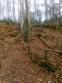
Return to Mont Rouge, passing through the Bois du Mont Noir. Enjoy a beautiful stroll through the woods, ending with a superb (and challenging) staircase.
Be careful, as soon as it gets a little wet, the paths become very difficult and you can sometimes find yourself with mud up to your mid-shoes. This was the case this morning (19 November 2021).
Mont Rouge from Loker
4.70 mi
+325 ft
-322 ft
2h 25
Easy
Departure from Heuvelland (Flandre-Occidentale)
A pleasant short hike near Loker and Le Mont Rouge, with easy-to-use numbered markings.
Mont Rouge, route courte
4.37 mi
+525 ft
-551 ft
2h 30
Easy
Departure from Heuvelland (Flandre-Occidentale)
This is a more family-friendly version of my two other hikes on Mont Rouge. It's short but with a good elevation gain. Half of the route is in the countryside and half in the woods, with a minimum of tarmac. Enough to keep you busy for half a day while getting plenty of fresh air!
Loker, Scherpenberg, Mont Rouge and Sulferberg starting from De Klijte
9.73 mi
+768 ft
-794 ft
5h 10
Average
Departure from Heuvelland (Flandre-Occidentale)
Departure from the car park of De Klijte church via Loker, Scherpenberg, Mont Rouge and Sulferberg.
De Klijte via Scherpenberg and Mont Rouge
9.42 mi
+610 ft
-604 ft
4h 50
Average
Departure from Heuvelland (Flandre-Occidentale)
Departure from the car park at De Klijte church. Crossing Scherpenberg and the Hellebeek nature reserve. Passing close to the vineyards of Mont Kemmel, Mont Rouge and Mont Noir.
From De Klijte via Lettenberg, Kemmelberg, Monteberg and Scherpenberg
9.68 mi
+577 ft
-574 ft
4h 55
Average
Departure from Heuvelland (Flandre-Occidentale)
Departure and arrival in De Klijte via Lettenberg, Kemmelberg, Monteberg and Scherpenberg. Crossing Scherpenberg and the Hellebeek nature reserve. Passing close to the vineyards of Mont Kemmel, Mont Rouge and Mont Noir.
Mont Rouge circular starting from De Klijte
9.48 mi
+797 ft
-794 ft
5h 05
Average
Departure from Heuvelland (Flandre-Occidentale)
Departure and arrival at the car parks either at De Klijte church or Loker via Scherpenberg, Sulferberg and the Mont Rouge nature reserve (Hellegatbos, or 'hole in the hill') with its De Kosmos recreation park.
De Klijte and the countryside around Reningelst and Dikkebus
9.58 mi
+141 ft
-138 ft
4h 30
Average
Departure from Heuvelland (Flandre-Occidentale)
A circular walking route starting at the church in the hamlet of De Klijte in Reningelst, through the countryside around Reningelst and Dikkebus, and past the Klein-Vierstraat British Military Cemetery
Around and on Mont Rouge
 10.03 mi
+787 ft
-814 ft
5h 20
Difficult
Departure from Heuvelland (Flandre-Occidentale)
10.03 mi
+787 ft
-814 ft
5h 20
Difficult
Departure from Heuvelland (Flandre-Occidentale)
A long, slightly winding route to enjoy the beautiful Belgian trails, which are well maintained and clearly marked.
Simple signposting: there are posts with numbers and an arrow indicating the number you want to go to (not easy to explain but obvious when you're there).
Difficult route, even very difficult in wet weather.
Roller coaster and maze on the Monts de Flandre
13.66 mi
+1,427 ft
-1,417 ft
7h 30
Difficult
Departure from Heuvelland (Flandre-Occidentale)
This is a route on which I had fun concentrating as many difficulties as possible (more than 400 m of elevation gain). This gives it a somewhat labyrinthine feel, but it allows you to avoid tarmac as much as possible. So you walk from peak to peak on well-marked, clean paths. The use ofthe Visorando app is highly recommended, even though the numbering system is very practical.
Scherpenberg and Rodeberg, mid-season route
 12.37 mi
+942 ft
-938 ft
6h 30
Difficult
Departure from Heuvelland (Flandre-Occidentale)
12.37 mi
+942 ft
-938 ft
6h 30
Difficult
Departure from Heuvelland (Flandre-Occidentale)
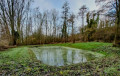
When the weather becomes a little wetter, you can still hike on Mont Rouge.
This route alternates between small roads (with little traffic), paths and forest trails, which makes it a little less strenuous.
It is a winding route, so the app is very useful.
There is quite a bit of elevation gain and, in wet weather, the trails are quite slippery. The walk is therefore quite tiring (equivalent to a 25 km route).
Loker via Saint Jans Cappel, Mont Noir, Douve valley and Mont Rouge
9.37 mi
+712 ft
-702 ft
4h 55
Average
Departure from Heuvelland (Flandre-Occidentale)
Departure and arrival at the car park of Loker Church via the countryside of Saint Jans Cappel and the Marguerite Yourcenar Nature Reserve at Mont Noir. Pass through the Douve Valley, which forms the border with France, and along Mont Rouge.
Loker, Mont Rouge, the Douve Valley and the Entre-deux-Monts vineyards
9.44 mi
+682 ft
-699 ft
4h 55
Average
Departure from Heuvelland (Flandre-Occidentale)
A circular walking route starting at Loker Church, via Mont Rouge, the Behaegel estate, the Douve Valley, the Entre-deux-Monts vineyards, the Hellegatbos, the Westouter countryside and the Scherpenberg.
Loker, Scherpenberg, Sulferberg, Westouter, Mont Noir and Mont Rouge
9.45 mi
+656 ft
-673 ft
4h 55
Average
Departure from Heuvelland (Flandre-Occidentale)
A circular walking route starting from Loker Church via Scherpenberg, Sulferberg, the Westouter countryside, Marguerite Yourcenar Park, Mont Noir, the Douve Valley and Mont Rouge.
Loker, Mont Rouge, the Monteberg vineyard and the Douve Valley
9.40 mi
+686 ft
-686 ft
4h 55
Average
Departure from Heuvelland (Flandre-Occidentale)
A circular walking route starting from Loker Church, passing through Mont Rouge, the Douve Valley, the Behaegel estate, the British Military Cemetery No. 10 at Locre, Dranouter Church and the Monteberg vineyard.
Loker, the Sulferberg, Westouter, Mont Noir and the Douve Valley
9.44 mi
+646 ft
-669 ft
4h 55
Average
Departure from Heuvelland (Flandre-Occidentale)
A circular walking route starting from Loker Church, passing through the Sulferberg, the Westouter vineyards, Marguerite Yourcenar Park, Mont Noir, the Douve Valley and the Behaegel Estate
Discovering the Lettenberg
 13.66 mi
+1,178 ft
-1,184 ft
7h 20
Difficult
Departure from Heuvelland (Flandre-Occidentale)
13.66 mi
+1,178 ft
-1,184 ft
7h 20
Difficult
Departure from Heuvelland (Flandre-Occidentale)
A long stretch along the slopes of Mont Kemmel to discover the Lettenberg, a small hill near Kemmel (perhaps the result of the union between Mont Rouge and Mont Kemmel?). The rest of the route is fairly standard, but passes through areas that are often very damp. And as always in this area, the elevation gain is quite significant. Avoid this walk in early August, during the Dranouter Festival.
The Mont Rouge and the Douve valley circular starting from Loker
9.42 mi
+673 ft
-673 ft
4h 55
Average
Departure from Heuvelland (Flandre-Occidentale)
Departure and arrival at the car park of Loker church via the Westouter countryside. Crossing the Hellegatbos woods with a passage through the Hell Hole of Mont Rouge. Passing near the Baneberg mill in Westouter. Crossing the Douve valley, which forms the border between France and Belgium. Passing into France through the Mont Noir countryside in Saint Jans Cappel and the vineyards of Dranouter.