Ponchapt from Fougueyrolles

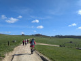
A very scenic, undulating route with magnificent views.

Details

n°28915275
Creation:
Last update:
Last review:
  • Walking
    Activity: Walking
  • ↔
    Distance: 7.56 mi
  • ◔
    Average duration: 3h 55 
  • ▲
    Difficulty: Moderate

  • ⚐
    Back to start: Yes
  • ↗
    Ascent: + 486 ft
  • ↘
    Descent: - 492 ft

  • ▲
    Highest point: 518 ft
  • ▼
    Lowest point: 256 ft

Photos

Description of the walk

Park in the car park next to the City Stade (school).

(S/E) From the car park, head left along the cemetery wall until you reach the junction just beyond.

(1) Take the first road on the left, cross the D708 and carry on straight ahead.

(2) Take the first road on the right and follow it to the end.

(3) Turn right onto the path behind the house. Join a road and follow it to the left as far as Ponchapt.

(4) At the village roundabout, turn right onto theGR®646until you reach a junction. At the Stop sign, head straight on along the path that climbs up through the vineyards.

(5) Turn left to pass beneath the mill mound, then take a path on the right which leads back towards the mill.

(6) Turn left after the mill and head back down towards the Pique-Sègue farm.

(7) At the farm, turn left onto the track and join theGR®6D. Follow it to the right until you reach the sign for ‘Le Fleix circular path of Ponchapt’.

(8) At the Haras Étoile d’Argent (Domaine de Cadefert), follow the road to the left.

(9) At the entrance to the woodland, take thefirst path on the right which passes under the mobile phone mast. At the vineyard, carry on straight ahead until you reach the road, which you then take on the left.

(10) At the Route de Calabre (D32E2), turn right and walk for about 400 m before turning left onto the path, the Way of St James.

(11) Go down a slope on the right before thefirst vineyard and follow it to the road, then follow the road to the right for about 150 m.

(12) Before the poplar grove and the stream, turn left, follow the path alongside the woods and poplar grove, then through the fields until you reach the T-junction, and turn right to join the D708.

(13) Cross the road, first turn right then left onto a track, then turn right onto the small road and continue straight on until you reach the crossroads by the cemetery.

(1) Turn left and head for the car park (S/E).

Waypoints

  1. S/E : mi 0 - alt. 341 ft - School car park
  2. 1 : mi 0.15 - alt. 348 ft - Cemetery junction
  3. 2 : mi 0.81 - alt. 312 ft - Road on the right
  4. 3 : mi 1.3 - alt. 397 ft - Path on the right behind the house.
  5. 4 : mi 2.38 - alt. 348 ft - Ponchapt
  6. 5 : mi 2.8 - alt. 466 ft - Junction, turn left
  7. 6 : mi 2.97 - alt. 518 ft - Mill
  8. 7 : mi 3.24 - alt. 427 ft - Pique-Sègue
  9. 8 : mi 4.36 - alt. 430 ft - Stud Farm
  10. 9 : mi 4.58 - alt. 390 ft - Path on the right
  11. 10 : mi 4.9 - alt. 449 ft - Route de Calabre
  12. 11 : mi 5.46 - alt. 404 ft - Embankment on the right
  13. 12 : mi 5.74 - alt. 367 ft - Poplar grove
  14. 13 : mi 6.84 - alt. 367 ft - D708
  15. S/E : mi 7.56 - alt. 341 ft - School car park

Always be cautious and plan ahead when you're outdoors. Visorando and the author of this route cannot be held responsible for any accidents occurring on this route.

The GR® and PR® markings are the intellectual property of the Fédération Française de Randonnée Pédestre.

Reviews and comments

3.5 / 5
Based on 2 reviews

Reliability of the description
3.5 / 5
Ease of following the route
3.5 / 5
Route interest
3.5 / 5
Tiwi33220
Tiwi33220

Overall rating : 3 / 5

Date of your route : Mar 09, 2026
Reliability of the description : ★★★☆☆ Average
Ease of following the route : ★★★☆☆ Average
Route interest : ★★★☆☆ Average
Very busy route : No

Far too much driving

Machine-translated

jsssc
jsssc

Overall rating : 4 / 5

Date of your route : Mar 01, 2026
Reliability of the description : ★★★★☆ Good
Ease of following the route : ★★★★☆ Good
Route interest : ★★★★☆ Good
Very busy route : No

Little or no signposting. You must follow the GPS.
The route from point 9 to 10 is impassable. We followed the road to find point 10.
Beautiful scenic hike.

Machine-translated

Other walks in the area

For more walks, use our search engine .

The GPS track and description are the property of this route's author. Please do not copy them without permission.