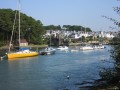
Pointe de Locmiquel as seen from Larmor-Baden

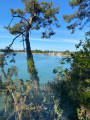
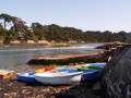
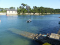
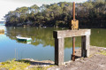
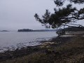
A lovely walk offering several views of the Seven Islands. A little corner of paradise, showcasing some of the finest scenery the Gulf of Morbihan has to offer. You’ll set off from the car park on Rue Gilles Rio, with a short stretch along the road at the start of the walk. Be patient – the best is yet to come. Once you’ve joined the GR®34, the magic begins. There are several vantage points overlooking some of the Gulf’s islands: Île aux Moines, Creizic, Berder, Gavrinis, Longue, Radenec, Grande and Petite Veïzit, and more. The highlight, Pointe de Locmiquel, offers an exceptional view of the Gulf, with the entrance to the Gulf of Morbihan visible in the distance.

Details

75497414
Creation:
Last update:
Last review:
  • Walking
    Activity: Walking
  • ↔
    Distance: 6.81 mi
  • ◔
    Average duration: 3h 15 
  • ▲
    Difficulty: Easy

  • ⚐
    Back to start: Yes
  • ↗
    Ascent: + 144 ft
  • ↘
    Descent: - 141 ft

  • ▲
    Highest point: 66 ft
  • ▼
    Lowest point: 3 ft

Photos

Description of the walk

 The starting point at the junction with Rue Gilles Rio.

(S/E) Take the D316 to the left as you leave the car park;be careful, as this section is quite busy.

(1) At the roundabout, turn right and follow Rue Impératrice Eugénie for a good hundred metres. 

2) Turn left onto Rue des Tennis, into a quieter area. Cross Rue du Moulin and continue straight ahead.

(3) Turn right to follow the GR®34, which runs along several streets before reaching the access road to Île de Berder: there’s a picnic spot here.

(4) Continue to follow the GR®, which soon leaves the road and heads towards the gulf. You’ll briefly return to the tarmac and reach the harbour master’s office at the Port Lagaden jetty.

(5) Follow the road opposite for about fifty metres, then turn left to walk around Port Lagaden.

(6) Continue along the GR® which runs as close as possible to the waters of the gulf, pass the Point du Berchis and carry on round the Anse de Locmiquel.

(7) Leave the path on your right – you’ll take this on the way back to reach the car park – and carry on along the shore. You’ll rejoin the tarmac road at Rue de Cadic; follow it straight on, temporarily leaving the GR®34, to reach the Chapelle Saint-Michel.

(8) Walk on for a few dozen metres, then turn left to rejoin the gulf’s shoreline and the GR®. Follow the path, which further on joins the Route de la Pointe; follow this to the left to reach the Pointe de Locmiquel.

(9) Continue along the GR®, which takes a detour to the right to go round some buildings before rejoining the shore.

(10) Leave the GR®34 by turning right onto the small road leading back to Locmiquel. At the first houses, turn right. Go past the first junction, then turn left at the second to return to the Chapelle Saint-Michel.

(8) Follow the outward route in the opposite direction to go round the cove again.

(7) Leave the shore and take the path on the left which joins the Route d’Auray (D316). Turn right onto it, then left to return to the car park on Rue Gilles Rio. (S/E). 

Waypoints

  1. S/E : mi 0 - alt. 10 ft - Crossroads, Rue Gilles Rio
  2. 1 : mi 0.2 - alt. 16 ft - Roundabout, turn right
  3. 2 : mi 0.27 - alt. 36 ft - Rue des Tennis
  4. 3 : mi 0.45 - alt. 56 ft - GR®@34
  5. 4 : mi 1.3 - alt. 7 ft - Chaussée de l’Île de Berder
  6. 5 : mi 1.56 - alt. 13 ft - Jetty
  7. 6 : mi 2.02 - alt. 10 ft - Port Lagaden
  8. 7 : mi 3.21 - alt. 10 ft - Junction of the Locmiquel circular loop
  9. 8 : mi 3.77 - alt. 49 ft - Saint-Michel Chapel
  10. 9 : mi 4.54 - alt. 10 ft - Pointe de Locmiquel
  11. 10 : mi 5.2 - alt. 10 ft - End of GR® route, turn right
  12. S/E : mi 6.81 - alt. 10 ft - Car park, Rue Gilles Rio

Worth a visit

Always be cautious and plan ahead when you're outdoors. Visorando and the author of this route cannot be held responsible for any accidents occurring on this route.

The GR® and PR® markings are the intellectual property of the Fédération Française de Randonnée Pédestre.

Reviews and comments

4.7 / 5
Based on 2 reviews

Reliability of the description
5 / 5
Ease of following the route
4 / 5
Route interest
5 / 5
Fabriceb
Fabriceb

Overall rating : 5 / 5

Date of your route : May 04, 2026
Reliability of the description : ★★★★★ Very good
Ease of following the route : ★★★★★ Very good
Route interest : ★★★★★ Very good
Very busy route : No

A lovely walk to explore Larmor Baden.

Machine-translated

User 10081180

Overall rating : 4.3 / 5

Date of your route : Apr 20, 2026
Reliability of the description : ★★★★★ Very good
Ease of following the route : ★★★☆☆ Average
Route interest : ★★★★★ Very good
Very busy route : No

A lovely walk, though the GR markings aren’t very clear in some places – but it’s still easy enough to follow

Machine-translated

Other walks in the area

For more walks, use our search engine .

The GPS track and description are the property of this route's author. Please do not copy them without permission.