


Refine your search for walks in Lac de la Sassière
Lac de la Sassière walks


 Col de la Bailletaz from the Saut Dam
 Visorando Member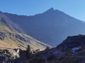
 8.16 mi
 +1,854 ft
 -1,854 ft
 5h 20
5h 20
 Moderate
 Departure from Tignes (Savoie)
This easy hike in the Grande Sassière Reserve will take you to a high mountain environment, between lakes and glaciers.
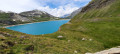
Walking along the Sassière to the lake
 4.31 mi
+610 ft
-614 ft
2h 30
4.31 mi
+610 ft
-614 ft
2h 30
 Easy
Departure from Tignes (Savoie)
Easy
Departure from Tignes (Savoie)
A family walk along a path following a small mountain river called the Sassière in the nature reserve of the same name. The walk ends at a small mountain dam that forms Lac de la Sassière. Keep your eyes peeled for marmots.
Lac de la Sassière, starting from Villaret
 10.38 mi
+2,270 ft
-2,260 ft
6h 45
10.38 mi
+2,270 ft
-2,260 ft
6h 45
 Difficult
Departure from Tignes (Savoie)
Difficult
Departure from Tignes (Savoie)
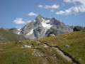
The aim of this hike is to climb across the fields, above the pretty hamlet of Villaret du Nial, with Lac du Chevril and the resort of Tignes in view, up to the wide, high-altitude valley of La Sassière and the lake of the same name, set against a backdrop of peaks still capped with snow.
Route via Picheru and Col de la Bailletaz from Val-d'Isère
 10.53 mi
+4,731 ft
-4,738 ft
9h 00
Difficult
Departure from Val-d'Isère (Savoie)
10.53 mi
+4,731 ft
-4,738 ft
9h 00
Difficult
Departure from Val-d'Isère (Savoie)
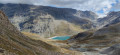
A fairly strenuous hike offering the chance to enjoy the Grande Sassière Nature Reserve, as well as the Bailletaz Nature Reserve, via two passes. The route offers stunning views of the Aiguille de la Grande Sassière and La Tsanteleina to the north.
As the route passes through two nature reserves, please respect the wildlife.
Yellow markings and signposts.
Rhêmes-Golette Glacier and Lake
 15.72 mi
+6,293 ft
-6,276 ft
5 hrs
15.72 mi
+6,293 ft
-6,276 ft
5 hrs
 Very difficult
Departure from Val-d'Isère (Savoie)
Very difficult
Departure from Val-d'Isère (Savoie)
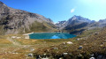
Situated in the Haute Tarentaise massif, this small lake nestles at the foot of the Rhêmes-Golette glacier.
Dominated by the peaks of Grande Sassière (3,747m) and Tsanteleina (3,602m) on the Italian border, this route takes you through a high-mountain landscape, between lakes and glaciers.
This hike is reserved for experienced and fit mountain walkers.
Pointe de la Bailletaz via the Col de la Bailletaz
9.20 mi
+2,575 ft
-2,575 ft
6h 30
Difficult
Departure from Tignes (Savoie)
This hike, which is not particularly difficult apart from its final section, is an extension of the Col de la Bailletaz hike starting from the Saut Dam. It will take you up to a 3,000-metre peak, accessible via the Grande Sassière Nature Reserve, before you reach a more high-mountain environment from the Col de la Bailletaz (2,852 m). I have therefore included the description of the first four points up to the Col de la Bailletaz. My addition concerns the route to the summit of the Pointe de la Bailletaz (3,071 m) via a more rugged path.
Walks near Lac de la Sassière
The Balcons des Barmettes trail
 Tourist office3.05 mi
+899 ft
-436 ft
2h 10
Easy
Departure from Val-d'Isère (Savoie)
Tourist office3.05 mi
+899 ft
-436 ft
2h 10
Easy
Departure from Val-d'Isère (Savoie)
Balcony trail from La Daille to Le Fornet with several possible entry points. The Balcony Trail is a must-do walk in Val d’Isère. It requires a bit of physical effort, but you’ll soon be rewarded with breathtaking views of the village, Solaise and Bellevarde.
From the Mario Bezzi refuge to the Chenal car park via the Col du Rocher Blanc
 7.92 mi
+2,031 ft
-3,937 ft
5h 25
Difficult
Departure from Valgrisenche (Aosta Valley)
7.92 mi
+2,031 ft
-3,937 ft
5h 25
Difficult
Departure from Valgrisenche (Aosta Valley)
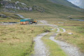
The final day of the Tour de l’Archeboc features a long, beautiful climb to the Col du Rocher Blanc, followed by a descent on the French side back to our starting point at Chenal. Views of the Italian and then French glaciers throughout today’s route.
Mario Bezzi – Benevolo
 7.31 mi
+3,648 ft
-3,629 ft
6h 30
Difficult
Departure from Valgrisenche (Aosta Valley)
7.31 mi
+3,648 ft
-3,629 ft
6h 30
Difficult
Departure from Valgrisenche (Aosta Valley)
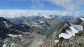
Hike up the magnificent glacial valley, which marks the end of the Val Grisenche, overlooking the imposing Glariettez Glacier. Access to the Val de Rhême via the Col de Bassac-Déré (3,082 m), then a descent through a high-mountain landscape to Lac de Golettaz, where the seracs are reflected in the water. The route then descends through the mountain pastures to the Refuge Benevolo (2,285 m).
Bénévolo – Chivasso
 6.47 mi
+3,005 ft
-1,975 ft
5h 35
Difficult
Departure from Rhêmes-Notre-Dame (Aosta Valley)
6.47 mi
+3,005 ft
-1,975 ft
5h 35
Difficult
Departure from Rhêmes-Notre-Dame (Aosta Valley)
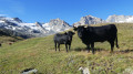
The ascent takes you through very wild, virtually off-trail terrain up to the Nivoletta Alpine Pass (3,152 m), followed by a descent via the gullies overlooking the magnificent Leitz and Rosset Lakes in the Valsavarenche. You then make your way towards the Chivasso Refuge through splendid flower-filled mountain pastures, renowned for their delicious fontina cheese.
The Col de la Leisse from the arrival point of the Aéroski cable car
6.01 mi
+856 ft
-2,785 ft
3h 30
Moderate
Departure from Tignes (Savoie)
A beautiful hike to admire the mountains around Tignes, with views as far as Mont Blanc. Lovely view of the Grande Motte glacier. Little elevation gain when taking the cable car.
Fond des Fours – La Leisse
 10.52 mi
+3,061 ft
-3,215 ft
7h 30
Difficult
Departure from Val-d'Isère (Savoie)
10.52 mi
+3,061 ft
-3,215 ft
7h 30
Difficult
Departure from Val-d'Isère (Savoie)
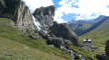
A little-used path leading to the Col de la Rocheure (2,911 m) runs alongside a myriad of small high-altitude lakes, before descending to the Refuge de la Femma. The ascent to the Col de Pierre-Blanche (2,842 m) is steady and not very well marked, even veering off the beaten track. The view is magnificent over the rocky Leisse valley, nestled between the giant peaks of the Grande Motte and the Grande Casse. Descend through these deserted landscapes towards the eagle’s nest that is the Refuge de la Leisse (2,487 m).
From the Fond des Fours Refuge to the Col de la Vanoise Refuge
 14.55 mi
+3,097 ft
-3,156 ft
9h 25
Difficult
Departure from Val-d'Isère (Savoie)
14.55 mi
+3,097 ft
-3,156 ft
9h 25
Difficult
Departure from Val-d'Isère (Savoie)
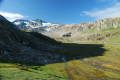
A long stage for this third day with very varied landscapes and terrain.It’s a shame that the road section after the Refuge de la Femma can’t be avoided, as it’s rather uninteresting. You’ll have to wait until the Refuge d’Entre Deux Eaux to finally get back on a trail.The difficulty is mainly due to the distance, as the elevation gains aren’t too steep and the trails are in good condition.
Circular route in the Vanoise around Tignes / Val d'Isère
22.77 mi
+8,281 ft
-6,831 ft
2 days
Difficult
Departure from Tignes (Savoie)
A challenging two-day mini-trek in the heart of the Vanoise National Park between the resorts of Tignes and Val d’Isère, with several possible routes. Ideal for seasonal workers or for those who want to experience a night in a mountain refuge.
Refuge de la Femma from Tignes / Val Claret
10.79 mi
+3,337 ft
-2,546 ft
7h 50
Difficult
Departure from Tignes (Savoie)
Day1 of this mini trek around Tignes – Val d’Isère, a magnificent hike in the heart of the Vanoise National Park starting from Tignes. This hike allows you to discover the wild valleys of the Leisse and the Femma. The GPX track may prove useful after the (5).
From the Refuge de la Martin to the Refuge de Turia via La Gurraz
 6.47 mi
+3,615 ft
-2,828 ft
6h 05
Difficult
Departure from Villaroger (Savoie)
6.47 mi
+3,615 ft
-2,828 ft
6h 05
Difficult
Departure from Villaroger (Savoie)
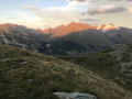
The third stage of a 4-day hiking tour around Mont Pourri. In the heart of the Vanoise National Park, this stage sets off from the La Martin Refuge and ends at the foot of Mont Turia and the refuge of the same name. The route takes you past glaciers and small lakes, and passes close to the very picturesque village of La Gurraz.
Breathtaking views of Mont Blanc and all the mountains stretching towards the Italian border.