Gunstett Plain and Surbourg Forest (short route)

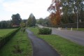
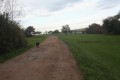
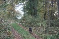
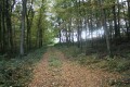
A pleasant walk through the Plaine de la Sauer near Gunstett and in the Surbourg Forest. This walk passes close to a former oil mine. Beautiful Alsatian landscapes and, in autumn, stunning colours.

Details

n°663710
Creation:
Last update:
Last review:
  • Walking
    Activity: Walking
  • ↔
    Distance: 7.73 mi
  • ◔
    Average duration: 3h 40 
  • ▲
    Difficulty: Moderate

  • ⚐
    Back to start: Yes
  • ↗
    Ascent: + 148 ft
  • ↘
    Descent: - 177 ft

  • ▲
    Highest point: 715 ft
  • ▼
    Lowest point: 522 ft

Photos

Description of the walk

The car park is situated next to the spa and functional rehabilitation centre. Alternatively, there is another car park at the Maison des Associations, next to the roundabout where the D27 and D250 roads meet.

(S/E) Leave the car park and head for the D27, known as the Route de Haguenau. Cross the road with great care (at the pedestrian crossing) and follow it, turning left.
Walk past the spa centre. Continue towards the exit for Morsbronn-les-Bains.
Cross the D86 road leading to Durrenbach and take the footpath (cycle path) which descends towards the car park at the Maison des Associations.

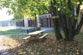
Go under the archway between the Maison des Associations and the Syndicat des Eaux to join the cycle path that runs along the rear of these buildings. Here, there are two picnic tables and a drinking fountain.
Turn left onto the cycle path. Cross the Route de Gunstett with care (at the pedestrian crossing).

(1) Turn right onto the cycle path that runs alongside Route de Gunstett.
Opposite the entrance to the leisure park, cross the road via the cycle path (protected crossing) and follow the road on the right-hand side. Cross the Sauer via a small bridge built for the cycle path. Continue to the entrance to Gunstett.

(2) Turn right onto a small dead-end road serving the houses. The road continues as a farm track which turns at a right angle and runs behind the gardens of the houses on Rue des Iris.
The farm track runs along the edge of a small wood before winding its way through fields and joining Impasse de la Rivière. Carry on straight ahead and, at the end of this cul-de-sac, turn right into a street leading towards the Sauer.
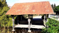
On the banks of the Sauer, you’ll see the pretty wooden wash house.

(3) Return to the road and turn right into a large open space. When you reach the mill buildings, turn right onto a farm track and cross the River Sauer.
Go round the mill along a farm track which soon crosses the River Sauer again, leading you to a large sawmill.

(4) Turn left and walk up Rue du Maréchal de Lattre de Tassigny until about twenty metres past Rue du Général Koenig on the left.

(5) Turn right onto a forest track known as Neuweg.
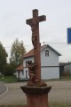
This track is lined with two wayside crosses in its first section and another further on, after passing under the high-voltage power line.
Carry on straight ahead until you reach a road leading from the D250 to the village of Biblisheim.
Cross the road carefully and continue straight ahead onto a path that leads into the woods, close to the edge.

(6) At the first crossroads, about three hundred metres on, turn left (at a right angle) onto the track heading north.
Carry on straight ahead until you reach the D250 road. Cross with great care and carry on straight ahead through the forest (a path that is more or less marked out in a relatively open area) until you come out onto a forest lane running perpendicular to the direction you are travelling in.

Turn right onto this lovely forest lane. Continue straight on until you reach a T-junction.
Turn left onto a forest track which gradually becomes narrower.
Pass the first path on the left and continue to where the path crosses a forest lane (at an angle).
Turn left onto the forest track and continue until you reach a forest road. The path comes to a crossroads where the road coming from the north gives way to a stony track, but where several other paths, some more clearly marked than others, also join.

(7) Turn right onto the road heading north. This crosses a vast open area before reaching the edge of a wood (Heidenbusch).
Turn left onto a path which starts on the right-hand edge of the woodland and then enters the woodland, running almost level.
When you reach almost the opposite edge of the woodland, turn right at a right angle onto a forest track which quickly begins a steep descent.
At the junction with a forest track, turn left onto this level track before heading uphill to the edge of the woodland.
It leads onto a small road heading west. Turn right onto it.

(8) At a right-hand bend in the road, take the forest track on the left which runs alongside the fence of a plot of land. Follow this overgrown forest track until you reach a road.

N.B. Those who do not wish to take this overgrown farm track can continue along the small road that goes round the area, turning left twice onto other roads.

At the end of the farm track, carry on straight ahead onto the farm track which takes the place of the road at this point. This farm track runs almost along the ridge as far as Gunstett.
Carry on straight ahead to Rue des Seigneurs, which overlooks the village of Gunstett and is lined with newer houses.

(9) Carry on straight ahead, along the hillside, into Rue des Romains. Follow it to the D250 road (which descends after a right-angled left-hand bend).
Turn right onto the Route de Gunstett (D250). Cross it carefully to rejoin the cycle path as you leave the village.

(2) Take the cycle path, cross the Sauer and cross the Route de Gunstett carefully (at the pedestrian crossing) near the entrance to the leisure park.
Continue along the cycle path until you reach the junction with the D27 Route de Haguenau.

(1) Turn left to cross Route de Gunstett with care (at the pedestrian crossing) and take the cycle path leading towards the Maison des Associations.
About a hundred metres further on, turn right to go under the archway between the Maison des Associations and the Syndicat des Eaux.
Cross the car park of the Maison des Associations heading south and take the path (cycle path) which leads to the junction with the D86 road heading towards Durrenbach.

Cross this road with care (at the pedestrian crossing) and continue straight on until you reach the front of the Beau Séjour hotel.
Cross the D27 road with great care (at the pedestrian crossing) and turn right into the spa centre grounds via a pedestrian entrance (three steps).
Take the path that goes round the spa centre buildings to the north and west.

When you reach the rear corner of the southernmost building, turn right to reach the car park via a narrow pedestrian passageway next to a small building (S/E).


Waypoints

  1. S/E : mi 0 - alt. 587 ft - Car park next to the spa centre
  2. 1 : mi 0.45 - alt. 545 ft - Junction of the cycle path and the Gunstett road - Sauer (rivière)
  3. 2 : mi 0.79 - alt. 535 ft - Junction of the road and the forest track
  4. 3 : mi 1.37 - alt. 525 ft - Gunstett wash house on the River Sauer
  5. 4 : mi 1.6 - alt. 522 ft - Junction of forest track and road
  6. 5 : mi 1.78 - alt. 538 ft - Junction of the street and the Neuweg track
  7. 6 : mi 3.25 - alt. 551 ft - Junction of forest tracks
  8. 7 : mi 4.3 - alt. 682 ft - Junction of forest tracks and road
  9. 8 : mi 5.37 - alt. 682 ft - Junction of road and forest track
  10. 9 : mi 6.35 - alt. 650 ft - Rue des Romains
  11. S/E : mi 7.73 - alt. 587 ft - Car park next to the spa centre

Notes

This walk takes place over varied terrain, which may be damp or even slightly muddy, so suitable footwear is essential.

As this route is not fully signposted, you will need to follow the directions in the description and on the map, whilst also reading the landscape.

Alternative route:
For walkers who do not wish to walk approximately five hundred metres off the path, upon reaching the road at the corner of Gunstett Wood, just before the ‘6 ’ (elevation 165 on the map), take the road to the left which runs alongside the wood on your right. As you approach the D250 road, take the right-hand branch at the T-junction, cross the D250 road with care and continue along the forest track heading north-east. At the next crossroads, elevation 190 on the map, take the track on the right heading east. Shortly afterwards, you will rejoin the route described in the guide.

Hike completed by the author of this guide on 20 October 2017.

Worth a visit

Morsbronn-les-Bains

History

6 August 1870, Battle of Frœschwiller-Wœrth.

In the spring of 1904, a borehole drilled by the Gewerkschaft Gute Hoffnung, whilst searching for oil, discovered a hot spring at a depth of 450 metres, to the north-west, on the edge of the Frœschwiller road leading to the village of Eberbach-Wœrth and the hamlet of Lausberg. Georges Urban, a restaurant owner from Morsbronn, bought the spring and, following analyses, this hot water source at 42°C was found to have beneficial properties for rheumatism as it is rich in sodium chloride and calcium.

Monuments

All Saints’ Church: Morsbronn is one of around 50 towns in Alsace with a ‘simultaneous’ church.
There are several monuments commemorating those who died in the Franco-Prussian War of 1870, including the impressive ‘Adler’ (‘Eagle’), not far from the Bouygues telephone relay station on the hills above the village.

Thermal spas in Morsbronn-les-Bains

The thermal water at Morsbronn-les-Bains comes from two natural springs discovered in 1904 during drilling carried out to locate oil deposits in the region: the ‘Les Cuirassiers’ spring at 38.9°C, drawn from a depth of 400 metres, and the ‘Saint Arbogast’ spring at 41.9°C, drawn from a depth of 670 metres.

These two extraction points provide the spa with an abundant flow of naturally warm water rich in sodium chloride, calcium, magnesium and sulphur.

With their sedative, analgesic and relaxing properties, these waters are recommended for the treatment of:
- chronic and debilitating inflammatory rheumatism,
- spinal, cervical or lumbar osteoarthritis, and osteoarthritis of the hip or knee
- fibromyalgia,
- progressive polyarthritis,
- the after-effects of osteoarticular trauma.

Reviews and comments

3.2 / 5
Based on 4 reviews

Reliability of the description
3 / 5
Ease of following the route
3.8 / 5
Route interest
2.8 / 5
phihal
phihal

Overall rating : 4.3 / 5

Date of your route : Feb 16, 2021
Reliability of the description : ★★★★★ Very good
Ease of following the route : ★★★★★ Very good
Route interest : ★★★☆☆ Average
Very busy route : No

An easy walk; the section between points 6 and 7 requires a GPS or a compass as the path is barely visible, if at all. Alternatively, you can follow the sun on clear days! It was 1 o’clock, so it was easy – the sun was at your back.
Another option, if you’re not equipped, is to choose the alternative route suggested by the author of the walk.

Machine-translated

pgetrochon
pgetrochon

Hello to all hikers who wish to tackle this route,

For those who do not wish to take the short off-track section, I have just included an alternative route in the hike description on Visorando which turns left, just before the point (6), onto the road that runs alongside Gunstett Forest on the right-hand side. After crossing the D250 road, simply follow the forest track north-east until you reach the next junction, where you should take the track on the right to quickly rejoin the route described in the guide. This route means the walker has to walk about five hundred metres along a road (something I try to avoid as much as possible in the routes I suggest), but it has the advantage of keeping you on footpaths and small roads the whole time.
Kind regards

Machine-translated

pgetrochon
pgetrochon

Hello,
The route was completed in its entirety by the author of this guide on 20 October 2017 (further details can be found in the practical information section of the description). The short section off the beaten track was manageable without any real difficulty.
I am not from this region, which is very dear to my heart.
Furthermore, having validated over two hundred routes across France, it is impossible to repeat them all every year. Nor are we expected to do so.
Kind regards

Machine-translated

sylviadaniel
sylviadaniel

Overall rating : 3 / 5

Date of your route : Sep 11, 2020
Reliability of the description : ★★★☆☆ Average
Ease of following the route : ★★★☆☆ Average
Route interest : ★★★☆☆ Average
Very busy route : No

A week on, my legs are still feeling the effects of that route! Thank you, and I’m sorry, Dominique, for not paying more attention to your advice. In future, I’ll be more careful about the advice I take.
One final question regarding the route planning: how long has it been since you last travelled this route?

Machine-translated

pgetrochon
pgetrochon

I replied to you earlier.
I can confirm that everything was stated in the description (unmarked path, off the ‘track’, etc.). I think, as you yourself admit, that this type of hike isn’t for you until you’re better at finding your way when there’s no path. You need to develop a feel for the natural environment, and then you’ll start to spot the paths where you currently see none. That takes time. This route goes off-track for less than five hundred metres in two separate sections, separated by a road, which allows you to get back on course if you’ve strayed. Off-trail walking may also require additional equipment such as a GPS (smartphone or similar) or the Visorando app on your phone. This is very helpful in ensuring you don’t stray too far from the suggested route. As for nature, it remains in control of its own development, and you have to learn to work with it.
This type of route is enjoyed by some (myself included) but requires a bit of experience to ensure you continue to enjoy the hike.
Happy hiking.

Machine-translated

pgetrochon
pgetrochon

Thank you for your message.
I can well believe that nature has reclaimed the area in certain places, given the unusual year we’ve had.
However, the only section off the forest track is the south-north stretch starting from the point (6). It isn’t very long, and you cross it in the middle via a road that’s bound to be clear. This can help you reorient yourself if necessary. The forest is denser to the south of the road but was very passable when I walked through it. North of the road, the route joins a west-east track, so everyone is free to choose the route they find easiest. I admit that it takes a bit of practice to find the right paths. The woodland in this area had no brambles, and progress was only hindered by branches.
Enjoy your walks.

Machine-translated

Dominique Arcade
Dominique Arcade

Thank you for confirming my feelings.
I took the liberty of warning any potential walkers.
But Floch hadn’t approved it.
I do enjoy walking and a bit of an adventure, but I’m not skilled enough to find my way when there’s no path left.
And that day, I was really glad I wasn’t out with the children…
Kind regards
Dominique

Machine-translated

sylviadaniel
sylviadaniel

Overall rating : 3.3 / 5

Date of your route : Sep 04, 2020
Reliability of the description : ★★★☆☆ Average
Ease of following the route : ★★★☆☆ Average
Route interest : ★★★★☆ Good
Very busy route : No

Hello,
We did part of the walk in the opposite direction; between points 6 and 7, the forest became too dense and we found ourselves trudging through it, thinking we’d be able to rejoin the path further on… but we gave up because the forest was so inhospitable. The small ditch you mentioned is currently impassable!
I think it would be best to remove this route.
Kind regards,
Sylvia

Machine-translated

pgetrochon
pgetrochon

Thank you for your message.
I’m not sure whether the terms used are accurate.
Very disappointing description: you don’t say why in your comment. It would be helpful if we were to improve it.
Inadequate signposting: however, in the practical information it states, ‘As this route is not signposted in its entirety, you must follow the directions in the description and on the map, whilst also reading the landscape.’ It cannot therefore be described as faulty, but as stated, part of it is unmarked. If starting from the point (6), you need to use the route description and head straight north, following a small ditch through the woods, cross the road and continue straight on until you reach a forest track running at right angles. This is fairly straightforward and leaves the choice of route up to the walker, offering a very natural section of the walk.
Non-existent path: after crossing the road, the route description states: ‘carry on straight ahead through the woods (a more or less marked path in a relatively open area) until you come out onto a forest track running at right angles to the direction of travel.’ There is no misleading information here, and the area is open enough to allow everyone to make their own way through the undergrowth as they please, whilst maintaining a general northerly direction. Indeed, using a GPS with the Visorando app can make things easier for those who find it harder to find their bearings.
Your lack of interest is a matter of personal perception – no doubt heightened by the fact that you lost your way – but as the writer of this review, I thoroughly enjoyed this very natural route deep in the forest, with a section off any marked trails. This was, after all, stated in the description.
Perhaps next time you might choose a fully signposted route. I’ve suggested some, and they’re very convenient for those who prefer them.
Happy hiking.

Machine-translated

Dominique Arcade
Dominique Arcade

Overall rating : 2 / 5

Date of your route : Jun 21, 2020
Reliability of the description : ★☆☆☆☆ Very disappointing
Ease of following the route : ★★★★☆ Good
Route interest : ★☆☆☆☆ Very disappointing
Very busy route : No

Poor signposting. No paths.
We got lost in the forest.
A real nightmare.
Thanks for the GPS feature on Visorando.

Machine-translated

Other walks in the area

For more walks, use our search engine .

The GPS track and description are the property of this route's author. Please do not copy them without permission.