The Petite Camargue between Vauvert and Gallician

This cycle route, taking in quiet country lanes and greenways, invites you to explore the Costières, the Petite Camargue and the canals of the Bas-Rhône Languedoc and the Rhône to Sète between Vauvert and Gallician, passing in particular by the Pont des Tourradons and the small marina at Gallician.

Details

n°668307
Creation:
Last update:
Last review:
  • Touring/Gravel
    Activity: Touring/Gravel
  • ↔
    Distance: 12.57 mi
  • ◔
    Duration according to the author: 1.5 hrs 
  • ▲
    Difficulty: Easy

  • ⚐
    Back to start: Yes
  • ↗
    Ascent: + 66 ft
  • ↘
    Descent: - 66 ft

  • ▲
    Highest point: 75 ft
  • ▼
    Lowest point: 3 ft
  • ⚐ Country: France
  • ⚐ City: Vauvert (30600)
  • ⚑
    Start/End: N 43.687435° / E 4.269332°
  • ❏
    IGN map(s): Ref. 2943OT

  • ◶
    Type of surface:
  •  
     
    ■ 50% Road ■ 50% Byway
  • Hour-by-hour weather

Photos

Description of the route

The route starts at La Vallée Verte secondary school in Vauvert; there are several parking spaces on the corner of Rue Fanfonne Guillerme.

(S/E) Join the cycle path alongside the Canal du Bas-Rhône Languedoc, also known as the Philippe Lamour Canal. Follow the cycle path to the left, keeping the canal on your right.
After about 1 km, the cycle path joins a road, the RD352.
Turn right to cross the canal and continue along this road. You’ll soon reach the cycle path car park.

(1) Carry on to the left along the road. Just over 1 km further on, at a sharp right-hand bend, pass under a railway bridge before reaching a junction a few metres past the houses at Jasse de Barry.

(2) At this junction, turn left onto the RD104 towards the Pont des Tourradons.
You’ll pass several meadows where you can see bulls and vineyards before a short climb near the Mas du Bourry. Shortly afterwards, you’ll pass close to a water tower. 100 metres further on, turn right onto a small track to climb up to the orientation table.

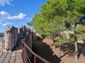
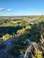
(3) A stunning view over the meadows of Vauvert and the Petite Camargue (in the Gard). In the distance, you can make out the town of Aigues-Mortes and the Tour de Constance.
Return to the road and continue downhill to the right.

(4) At the end of the straight stretch, turn left, still on the RD104. Pass a junction and arrive at the Rhône-Sète Canal at the Pont des Tourradons, amongst the ponds.

(5) Take the cycle path on the left which runs alongside the canal. Follow it to the Gallician marina.

(6) At the marina, turn left before the bridge to join the RD179. Enter the village of Gallician.

(7) At the end of the street, turn left, then immediately right, and continue along the RD179. Leave the village 500 metres further on, just after crossing an old railway line, and arrive at the Canal du Bas-Rhône Languedoc.

(8) Turn left onto the cycle path that runs alongside the canal beneath the pine trees. Continue along the left bank for 5 km until you reach the end of this cycle path at the car park.

(1) Follow the route you took on the way out, along the canal, and immediately after the bridge, turn left onto the cycle path to return to the starting point (S/E).

Waypoints

  1. S/E : mi 0 - alt. 62 ft - Rue Fanfonne Guillerme. Towards the greenway at the - canal du Bas-Rhône Languedoc ou canal Philippe-Lamour
  2. 1 : mi 0.86 - alt. 59 ft - Cycle path car park
  3. 2 : mi 1.54 - alt. 26 ft - Junction of the RD352 and RD104
  4. 3 : mi 3.96 - alt. 62 ft - Orientation map
  5. 4 : mi 4.58 - alt. 33 ft - Turn left onto the RD104 - Vistre (fleuve)
  6. 5 : mi 5.32 - alt. 20 ft - Pont des Tourradons
  7. 6 : mi 7.7 - alt. 10 ft - Gallician Marina - Canal du Rhône à Sète
  8. 7 : mi 7.97 - alt. 10 ft - Gallician
  9. 8 : mi 8.58 - alt. 62 ft - BRL Canal
  10. S/E : mi 12.57 - alt. 62 ft - Rue Fanfonne Guillerme

Notes

This route is suitable for mountain bikes, hybrid bikes or road bikes.

Please take care with children, as part of the route is on roads open to motor traffic.

Reviews and comments

4.7 / 5
Based on 1 review

Reliability of the description
5 / 5
Ease of following the route
5 / 5
Route interest
4 / 5
MARTIDUME
MARTIDUME

Overall rating : 4.7 / 5

Date of your route : Jun 06, 2022
Reliability of the description : ★★★★★ Very good
Ease of following the route : ★★★★★ Very good
Route interest : ★★★★☆ Good
Very busy route : Yes

An easy, flat and very pleasant route along the canals. This is the wine-growing region of the Camargue. You’ll see bulls here, but don’t expect to see the lagoons or the sea.

Machine-translated

pillerijean@orange.fr
• Edited:

This walk hasn’t been done yet.
Kind regards
Jean

Machine-translated

For more walks, use our search engine .

The GPS track and description are the property of this route's author. Please do not copy them without permission.