From Beaucaire to Uzès via the Pont-du-Gard

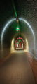
A lovely cycle ride along the new greenway linking Beaucaire to Uzès. You’ll pass through a magnificent cycle tunnel with light displays, then cross the Pont du Gard aqueduct twice. This route is considered the most scenic in the Gard. On arrival in Uzès, take an alternative route back to complete a half-circular route. This takes you through three lovely villages: Sagriès, Sanilhac and Collias.

Details

55158931
Creation:
Last update:
Last review:
  • Touring/Gravel
    Activity: Touring/Gravel
  • ↔
    Distance: 42.69 mi
  • ◔
    Duration according to the author: 6 hrs 
  • ▲
    Difficulty: Difficult

  • ⚐
    Back to start: Yes
  • ↗
    Ascent: + 1,175 ft
  • ↘
    Descent: - 1,184 ft

  • ▲
    Highest point: 502 ft
  • ▼
    Lowest point: 39 ft
  • ⚐ Country: France
  • ⚐ City: Beaucaire (30300)
  • ⚑
    Start/End: N 43.815196° / E 4.619602°
  • ❏
    IGN map(s): Ref. 2941OT, 2942OT

  • ◶
    Type of surface:
  •  
     
     40% Road  60% Byway
  • Hour-by-hour weather

Photos

Description of the route

You can park your car in the supermarket car park on Chemin Clapas de Cornut in Beaucaire.

(S/E) Cross the road at the car park exit and take the cycle path just below (V66, Martinet greenway).

(1) Go through the tunnel to pass under the road and carry on until you reach a roundabout.

(2) Turn left, towards Avignon.

(3) At the four-way junction, head towards the tunnel to go through it and carry on until you reach a railway line.

(4) Carry on straight ahead to pass under the railway line and follow the track marked by the blue sign and green markings. Carry on straight for 9 km until you reach a junction with a wall opposite and a railway bridge on your left.

(5) Take the track to the left of the road, remembering to dismount under the railway bridge. At the next junction, turn right, crossing the departmental road at the pedestrian crossing to end up on the right-hand side of the road, and continue along the D6086.

(6) At the roundabout, take the second exit, the D981, towards Pont-du-Gard, on the right bank. After a few metres, take the cycle path indicated by the sign on the right.

(7) Keep to the cycle path on the right, go round the car park and arrive at the entrance to the Pont du Gard site.

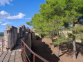
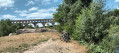
(8) Turn left, join the lovely concrete path and head towards the aqueduct to cross it on foot.

(9) At the esplanade ahead, head straight on towards the shops and walk your bike through. Then cross the car park on the right and join the Route du Pont du Gard. Cross at the pedestrian crossing to get behind the wall, to the left of the road. Take the next pedestrian crossing, then turn left to reach a roundabout.

(10) Take the3rd exit, the D981, towards Alès, then take the cycle path on the right and continue to the next roundabout.

(11) Turn right onto the D227 towards Vers, then cross the road to take the cycle path to the left of the road. Then move back to the right by taking the pedestrian crossing a few metres further on. From here, follow the greenway to Uzès, its terminus.

(12) Turn right and, at the roundabout, turn right onto the D981 towards Avignon. Continue for a few metres and turn right onto Chemin de la Californie. At the next junction, carry on straight ahead onto Chemin Lou Sauté. Please note that this track is not tarmac-surfaced throughout and some sections are a little tricky.

(13) Start the right-hand bend at No. 10 and enter the village of Sagriès (Chemin de Perret). Then turn right at the sign for the Uzège – Pond-du-Gard circular loop, cross the village via the narrow streets and head down to the D212.

(14) Turn left towards Sanilhac and stay on the D212 until you reach the village. Ride through the village and you’ll come to the D112.

(15) Turn left towards Collias and follow the D-road until you reach a roundabout in the village.

(16) Take the cycle path on the left which runs alongside the D3 towards Pont du Gard, then turn right at the War Memorial.

(17) At the picnic area, turn right onto Chemin du Grès, then onto Chemin de Coste Garoute, and continue to the next junction.

(18) Turn right onto Drovers' Road, then left onto Chemin du Garrege. Ignore Chemin de la Marquise on the left and continue to La Bégude Saint-Pierre (hotel and restaurant).

(19) Take the dead-end track on the right (Chemin des Bégudes), carry straight on and reach the car park at the end of the track.

(20) Head left, cross a large open space and join the path leading to the Allée du Pont du Gard.

(9) Turn right and follow the route back the way you came to reach the supermarket car park on Chemin Clapas (S/E).

Waypoints

  1. S/E : mi 0 - alt. 75 ft - Supermarket car park, Chemin Clapas
  2. 1 : mi 0.14 - alt. 72 ft - Tunnel
  3. 2 : mi 0.78 - alt. 52 ft - Roundabout, follow signs for Avignon
  4. 3 : mi 2.28 - alt. 66 ft - Tunnel – River Rhône
  5. 4 : mi 4.49 - alt. 62 ft - Pass under the railway line
  6. 5 : mi 10.03 - alt. 82 ft - Junction
  7. 6 : mi 10.43 - alt. 89 ft - Roundabout – Gardon (river) – a tributary of the Rhône
  8. 7 : mi 11.49 - alt. 92 ft - Cycle path
  9. 8 : mi 11.88 - alt. 79 ft - Pont du Gard site
  10. 9 : mi 12.43 - alt. 128 ft - A/R junction – Pont du Gard
  11. 10 : mi 13.04 - alt. 108 ft - D981, towards Alès
  12. 11 : mi 13.54 - alt. 151 ft - D227, towards Vers
  13. 12 : mi 19.82 - alt. 223 ft - Uzés – Alzon (river) – Tributary of the Gardon
  14. 13 : mi 20.92 - alt. 230 ft - Right-hand bend, no. 10
  15. 14 : mi 21.3 - alt. 249 ft - D212, towards Sanilhac
  16. 15 : mi 23.24 - alt. 400 ft - D112, towards Collias
  17. 16 : mi 26.08 - alt. 164 ft - D3, towards Pont du Gard
  18. 17 : mi 26.52 - alt. 125 ft - Chemin du Grès – Alzon (river) – Tributary of the Gardon
  19. 18 : mi 27.65 - alt. 190 ft - Chemin de la Drovers' Road
  20. 19 : mi 29.31 - alt. 108 ft - Dead end on the right (Chemin des Bégudes)
  21. 20 : mi 30.24 - alt. 148 ft - End of the road
  22. S/E : mi 42.69 - alt. 75 ft - Supermarket car park, Chemin Clapas

Notes

(8) You can leave the track and head down to the river to have a bite to eat and go for a swim.

Reviews and comments

4.8 / 5
Based on 2 reviews

Reliability of the description
5 / 5
Ease of following the route
5 / 5
Route interest
4.5 / 5
nathbou24
nathbou24

Overall rating : 5 / 5

Date of your route : Apr 27, 2025
Reliability of the description : ★★★★★ Very good
Ease of following the route : ★★★★★ Very good
Route interest : ★★★★★ Very good
Very busy route : No

A lovely drive, with the Pont du Gard as the icing on the cake.
Coming from Avignon, we set off from the car park at the Meyne swimming pool (there was a market in Sernhac so there were no spaces, and in Remoulins all car parks are now pay-and-display seven days a week).
The circular route through the villages is really lovely and breaks up the ‘slight monotony’ of the cycle route; and the route is very well marked and helpful. Same time and same distance as the description – everything was perfect!
Thanks to the contributor and to Visorando for enabling us to enjoy these lovely moments.

Machine-translated

CAROLE DU 13
CAROLE DU 13

Overall rating : 4.7 / 5

Date of your route : Apr 28, 2025
Reliability of the description : ★★★★★ Very good
Ease of following the route : ★★★★★ Very good
Route interest : ★★★★☆ Good
Very busy route : No

A brilliant route – just download the app and let it guide you. A great cycle ride to enjoy with family or friends. It’s worth noting that the route starts from the Aldi car park, as there are several supermarkets in this shopping area.

Machine-translated

For more walks, use our search engine .

The GPS track and description are the property of this route's author. Please do not copy them without permission.