A short, invigorating walk on Mont Caume

Mont Caume is a classic hike in the Var. For those wishing to minimise the elevation gain and avoid the climb up the path from the Col du Corps de Garde, we’ve put together this more modest route featuring a gentle ascent along the road and a descent via a pleasant footpath. The main thing is to have fun and enjoy the bright, panoramic surroundings of the highest peak in the Toulon hinterland.

Details

73545410
Creation:
Last update:
Last review:
  • Walking
    Activity: Walking
  • ↔
    Distance: 3.88 mi
  • ◔
    Average duration: 2h 30 
  • ▲
    Difficulty: Moderate

  • ⚐
    Back to start: Yes
  • ↗
    Ascent: + 833 ft
  • ↘
    Descent: - 814 ft

  • ▲
    Highest point: 2,612 ft
  • ▼
    Lowest point: 1,873 ft

Photos

Description of the walk

Head to the Col du Corps de Garde, either via Le Broussan or from Toulon, and take the small road that provides access by car to Mont Caume via its south-eastern slope. Just over two kilometres past the pass, at a large hairpin bend to the left, turn off to the right and park on a lay-by below the road’s retaining wall.
A little further down from this car park, in the middle of the heath, there is an apiary monitored by CCTV. Opposite, to the north, you can see the two peaks of Mont Caume.

(S/E) Head back up to the road and begin the climb, which has a very gentle gradient.

(1) As you pass, note a path marked with a green signpost on the embankment to the right: this is where the descent on the return journey will end.
Continue to the left, climbing very gently, first taking a wide bend to the right, then a wide bend to the left.

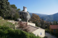
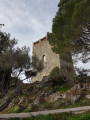
(2) Look out for the return path on the right. Continue to the left, climbing very gently, passing the ruins of the barracks (on the embankment to the right) and reaching the next bend on the right at the pass between the two summits of Mont Caume.

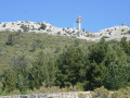
(3) Leave the road and continue towards the military fortifications of Mont Caume Ouest.

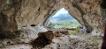
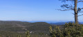
(4) Walk past the buildings to reach the western esplanade, from where there is a superb panoramic view of Le Broussan, La Barre des Aiguiers, the Bassin du Beausset and, in the distance, the Sainte-Baume mountain range. Note the location of the Trou des Fées in the rocks on the summit, heading south.

(5) Turn back.

(4) Just after the last building, look for the path on the left which heads back eastwards, passing over the northern ramparts. You’ll come to a series of batteries (circular structures) and ammunition depots (rectangular structures) before reaching the pass you crossed earlier.

(3) Turn left onto the road leading up to the military fortifications on the eastern summit.

(6) At the second left-hand bend, turn right up a flight of steps leading up to the summit plateau, near a hut covered in graffiti, and head left towards the towers (semaphore and aerials) of Mont Caume East.

(7) Turn back, head towards the northern ramparts and return to the graffiti-covered hut via the rampart walk.Superb views of Le Revest, La Touravelle and Le Coudon.

(6) Head back down the road in the opposite direction to your outward journey and, shortly after the ruins of the barracks (on the left-hand embankment), look out for the start of the downhill path in the wide right-hand bend.

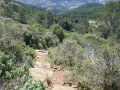
(2) To the left of the road, just before the parapet at the bend, head down the very rocky path. This crosses a scrubby heath on a very steep slope, with frequent rocky outcrops, before crossing more easily through a pine forest and rejoining the road just above the starting point.

(1) Continue straight ahead in the opposite direction to your outward journey and return to the car park below the road (S/E).


Waypoints

  1. S/E : mi 0 - alt. 1,873 ft - Parking below the bend
  2. 1 : mi 0.09 - alt. 1,903 ft - Crossroads at the end of the circular loop
  3. 2 : mi 0.83 - alt. 2,224 ft - Common junction for out-and-back route
  4. 3 : mi 1.11 - alt. 2,320 ft - Common junction (out and back)
  5. 4 : mi 1.36 - alt. 2,379 ft - Junction. Return walk to Mont Caume Ouest
  6. 5 : mi 1.43 - alt. 2,405 ft - Mont Caume Ouest (753 m)
  7. 6 : mi 2.37 - alt. 2,575 ft - Graffiti-covered hut
  8. 7 : mi 2.51 - alt. 2,579 ft - Tour of the Antennas - Mont Caume (804m)
  9. S/E : mi 3.88 - alt. 1,873 ft - Parking is available below the bend

Notes

The route was completed in late April 2025, in superb weather with rockroses in full bloom.

This walk presents no difficulty, apart from the final descent, which is somewhat uneven. Those concerned about their knees may, in fact, start by walking up the path from point (1) to (2) and then walk all the way back down via the road.

Worth a visit

The highlight of this walk is, of course, the magnificent panoramic views it offers in all directions. It’s a great opportunity to brush up on your local geography and pick out places for your next walks.

In particular, there are stunning views of the majestic Toulon harbour.

Reviews and comments

4.1 / 5
Based on 4 reviews

Reliability of the description
3.8 / 5
Ease of following the route
3.5 / 5
Route interest
5 / 5
stjo
stjo

@User 10865200 It's true that you need a good pair of walking sticks to descend the trail. However, there is enough shrubbery to hold onto the branches in the slipperiest places.

Machine-translated

User 10865200

Overall rating : 4.7 / 5

Date of your route : Oct 23, 2025
Reliability of the description : ★★★★★ Very good
Ease of following the route : ★★★★☆ Good
Route interest : ★★★★★ Very good
Very busy route : No

We didn't complete the entire route as indicated, preferring to continue along the road instead, as we didn't have walking sticks for the section through the heath, which looked quite slippery.
However, it is a magnificent walk, which was not very busy when we did it, and the view from the top is simply sublime.

Machine-translated

User 27623886

Overall rating : 5 / 5

Date of your route : Sep 15, 2025
Reliability of the description : ★★★★★ Very good
Ease of following the route : ★★★★★ Very good
Route interest : ★★★★★ Very good
Very busy route : No

Great loop
Enough. Simple and not very long
Good with children
Magnificent view
Easy to park

Machine-translated

User 26741273

Overall rating : 4.3 / 5

Date of your route : Jul 28, 2025
Reliability of the description : ★★★★☆ Good
Ease of following the route : ★★★★☆ Good
Route interest : ★★★★★ Very good
Very busy route : No

the road to access the start of the walk was closed
we had to walk 2 km along the road to reach the starting point and to leave.
it's a shame there was so much road and so few trails, but it was a very beautiful hike with magnificent scenery.

Machine-translated

stjo
stjo

@User 4731752, please let me know where you encountered a lack of information about the itinerary.
And who are you referring to when you say "you ask for a lot of personal information without giving any explanation"?

Machine-translated

User 4731752

Overall rating : 2.3 / 5

Date of your route : Jun 09, 2025
Reliability of the description : ★☆☆☆☆ Very disappointing
Ease of following the route : ★☆☆☆☆ Very disappointing
Route interest : ★★★★★ Very good
Very busy route : No

Unclear interface and lack of information, you ask for a lot of personal information without giving any explanations. I'm deactivating the application.

Machine-translated

Other walks in the area

For more walks, use our search engine .

The GPS track and description are the property of this route's author. Please do not copy them without permission.