Circular route to the east of Bengy-sur-Craon

A short, easy walk through wooded countryside and arable fields in the Champagne-Berrichonne region.
Bengy-sur-Craon is situated between Bourges and Nevers on the D976.

Details

138875
Creation:
Last update:
Last review:
  • Walking
    Activity: Walking
  • ↔
    Distance: 5.49 mi
  • ◔
    Average duration: 2h 40 
  • ▲
    Difficulty: Easy

  • ⚐
    Back to start: Yes
  • ↗
    Ascent: + 131 ft
  • ↘
    Descent: - 138 ft

  • ▲
    Highest point: 715 ft
  • ▼
    Lowest point: 607 ft

Description of the walk

Park in the church square in Bengy-sur-Craon.

(S/E) Walk south towards Cornusse along the D102. After about 2 km, you’ll reach a Y-junction.

(1) Leave the D102 and turn left, towards Saligny-le-Mort, onto the tarmac path that runs alongside military land (do not enter the military land). Then turn left to cross through Saligny-le-Mort. Walk slightly downhill through the woodland until you reach a small pond.

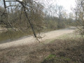
(2) Turn 90° to the right (behind a tree), continue downhill and reach the edge of a woodland.

(3) Enter the woodland and continue until you reach the D10E.

(4) Turn left onto it, then quickly turn right onto the tarmac road and head towards the houses at Cul-de-Sac.

(5) Cross the road and head straight ahead, continuing until you reach the railway level crossing.

(6) Cross the tracks with great care; see the ‘Practical Information’ section below. Carry on to the Bourges–Nevers road, the D976.

(7) Turn left onto it and walk for about a hundred metres along the hard shoulder. Take great care as this is a very busy road. Take great care when crossing, then continue straight ahead to reach Les Loges d’en bas. At the corner of house no. 5, turn left onto the path that climbs between the house and the metal shed. This leads onto the road serving Les Loges d’en haut.

(8) Turn left onto this road to head back towards the village of Bengy. At the Stop sign, cross the road, turn right and follow the pavement, which then turns left, to return to the church car park (S/E) after crossing another level crossing – again, take great care here.

Waypoints

  1. S/E : mi 0 - alt. 627 ft - Church car park - Gare de Bengy
  2. 1 : mi 1.19 - alt. 686 ft - Y-junction
  3. 2 : mi 2.14 - alt. 686 ft - Small pond
  4. 3 : mi 2.53 - alt. 636 ft - Edge of the woodland
  5. 4 : mi 3.09 - alt. 623 ft - D10E
  6. 5 : mi 3.43 - alt. 623 ft - Cul-de-Sac
  7. 6 : mi 3.92 - alt. 614 ft - Level crossing, danger
  8. 7 : mi 4.18 - alt. 623 ft - D976
  9. 8 : mi 4.65 - alt. 699 ft - Route des Loges d’en haut
  10. S/E : mi 5.49 - alt. 627 ft - Church car park

Notes

There are no signposts along this route. IGN map 2424 East.
Important note: Avoid this route on hunting days. The local path is always open to the public but there is a risk of conflict with hunters on private hunting grounds.
At (3), the passage is tricky, if not almost impossible, in winter or in wet weather.
(6) Level crossing: take extreme care as trains travel at around 140 km/h here; ensure you wait for the barriers to close.
In conclusion: a walk best undertaken in dry weather and outside the hunting season.
The walk can easily be completed in two hours or less, excluding breaks.

Worth a visit

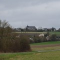
(8) Bourges Cathedral in the distance
With a bit of luck, you might spot a roe deer, a species quite common in this region.

Reviews and comments

4.5 / 5
Based on 2 reviews

Reliability of the description
5 / 5
Ease of following the route
4.5 / 5
Route interest
4 / 5
User 24738239

Overall rating : 4.3 / 5

Date of your route : Jun 02, 2025
Reliability of the description : ★★★★★ Very good
Ease of following the route : ★★★★☆ Good
Route interest : ★★★★☆ Good
Very busy route : No

A family hike. The path was not maintained and we passed through tall grass. This walk should be done in good weather, as some sections were greasy. The paths through the fields are pleasant because they are shaded, as if we were passing through small forests. The end of the walk is uphill. However, it avoids walking too long on the end of the main road. A nice moment.

Machine-translated

Marc Yves
Marc Yves

Overall rating : 4.7 / 5

Date of your route : Feb 12, 2024
Reliability of the description : ★★★★★ Very good
Ease of following the route : ★★★★★ Very good
Route interest : ★★★★☆ Good
Very busy route : No

Machine-translated

Marc Yves
Marc Yves

An easy hike that I did in winter in rainy weather. Pretty, typical landscapes, sometimes a little sad
The directions are precise. Be careful when approaching the level crossing if you are with small children. Nothing will stop them from stepping onto the railway tracks

Machine-translated

Other walks in the area

For more walks, use our search engine .

The GPS track and description are the property of this route's author. Please do not copy them without permission.