Walk around Parassy and Les Aix-d’Angillon

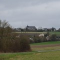
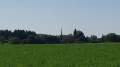
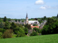
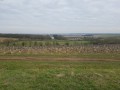
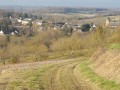
The suggested route, at the foot of the Sancerre foothills, is not particularly difficult. This circular route, which crosses the fields, will take you to the edge of the vineyards on the slopes of Parassy. You may also have the chance to spot some roe deer.

This route can also be tackled by mountain bike.

Details

918648
Creation:
Last update:
Last review:
  • Walking
    Activity: Walking
  • ↔
    Distance: 9.70 mi
  • ◔
    Average duration: 4h 40 
  • ▲
    Difficulty: Moderate

  • ⚐
    Back to start: Yes
  • ↗
    Ascent: + 262 ft
  • ↘
    Descent: - 262 ft

  • ▲
    Highest point: 801 ft
  • ▼
    Lowest point: 545 ft
  • ⚐ Country: France
  • ⚐ City: Soulangis (18220)
  • ⚑
    Start/End: N 47.185638° / E 2.519494°
  • ❏
    IGN map(s): Ref. 2323SB, 2423SB
  • Hour-by-hour weather

Photos

Description of the walk

Start from the car park at the Soulangis village hall.

(S/E) Leave the car park and head towards the D56 (Route des Aix), then turn right towards the football stadium.

(1) At the football ground, turn left towards the car park, then carry on straight ahead.

(2) Turn right at the first junction after passing a field with beehives (no danger) and continue towards the hamlet of Le Roulier.

(3) At the junction with the Route du Roulier, turn left towards Les Aix-d’Angillon.

(4) At the junction before the quarry, turn left onto the dirt track.

(5) At the end of the track, turn right towards the hamlet of La Limaye.

(6) After the hamlet, turn right onto the road towards Les Aix-d’Angillon and join the D25.

(7) Turn left onto this road, continue for about 150 metres and turn right onto the track through the fields.

(8) At the junction with the Route de Chaumoux, turn right towards the hamlet.

(9) At the first junction, turn left. Go straight on at the crossroads, then turn right and continue towards Parassy. Follow the vineyards until you reach the junction halfway up the hill.

(10) Turn left.

(11) Turn left when you reach Rue Creuse and head towards the Parassy football ground.

(12) At the junction with the road leading to the stadium, turn left towards the hamlet of Beauvais. Join the D25.

(13) Turn right, follow the D25 for 100m, then turn left and continue, keeping the houses on your left.

(14) At the junction with the Voie Communale, turn left towards Les Aix-d’Angillon and continue for about 300m on the tarmac.

(15) Turn right onto the track that takes you back to Soulangis.

(2) Carry on straight ahead towards the stadium until you reach the D56.

(1) Turn right and carry on to the car park at the village hall (S/E).

Waypoints

  1. S/E : mi 0 - alt. 551 ft - Village hall car park
  2. 1 : mi 0.25 - alt. 581 ft - Football stadium, on the left
  3. 2 : mi 0.64 - alt. 617 ft - Junction after the beehives
  4. 3 : mi 0.9 - alt. 594 ft - Le Roulier, on the left
  5. 4 : mi 1.5 - alt. 584 ft - The quarry, on the left
  6. 5 : mi 2.08 - alt. 607 ft - At the crossroads, turn right towards La Limaye
  7. 6 : mi 3.02 - alt. 630 ft - At the junction, turn right towards Les Aix
  8. 7 : mi 3.54 - alt. 630 ft - D25, on the left
  9. 8 : mi 4.47 - alt. 696 ft - At the junction, turn right towards Chaumoux
  10. 9 : mi 4.7 - alt. 722 ft - At the junction, turn left towards Parassy
  11. 10 : mi 5.63 - alt. 791 ft - At the junction in the vineyards, turn left
  12. 11 : mi 5.79 - alt. 797 ft - Rue Creuse, on the left
  13. 12 : mi 5.97 - alt. 738 ft - Route to Parassy football ground, on the left
  14. 13 : mi 6.58 - alt. 676 ft - D25, on the right
  15. 14 : mi 7.31 - alt. 663 ft - At the junction, turn left
  16. 15 : mi 7.51 - alt. 689 ft - To the right, head back towards Soulangis
  17. S/E : mi 9.7 - alt. 551 ft - Village hall car park

Notes

Good walking boots and walking poles are recommended.
Don’t forget to bring a drink to keep you hydrated. There are no water points along the route. You should also take a few cereal bars or other snacks to stave off hunger pangs...

Note:

This circular route (13.5 km) can start:

  • from Parassy, starting at (11) or (12) (the football ground).
  • or from Aix-d’Angillon, starting from the point (7).

After the point (15), turn left at the point (2) towards the hamlet of Le Roulier.

Reviews and comments

4.8 / 5
Based on 2 reviews

Reliability of the description
5 / 5
Ease of following the route
4.5 / 5
Route interest
5 / 5
maryv
maryv

Overall rating : 5 / 5

Date of your route : Jan 06, 2019
Reliability of the description : ★★★★★ Very good
Ease of following the route : ★★★★★ Very good
Route interest : ★★★★★ Very good

A lovely walk with views almost the whole time, and we saw loads of deer
Thanks

Machine-translated

Calixte1
Calixte1

Overall rating : 4.7 / 5

Date of your route : May 06, 2018
Reliability of the description : ★★★★★ Very good
Ease of following the route : ★★★★☆ Good
Route interest : ★★★★★ Very good

Just a quick note: when you reach the entrance to Parassy Cemetery, you need to turn right into Rue Creuse (not left, as stated in the description). Finally, please don’t forget to specify the distance when a change of direction is due. ‘In 400 m’ or ‘800 m’, for example – this prevents you from turning too early or too late.
A lovely walk, with marvellous weather. Many thanks to everyone.

Machine-translated

Other walks in the area

For more walks, use our search engine .

The GPS track and description are the property of this route's author. Please do not copy them without permission.