A short walk towards Arpajon-sur-Cère

Here’s a short walk to stretch your legs, right next to Aurillac.

Details

n°43542
Creation:
Last update:
Last review:
  • Walking
    Activity: Walking
  • ↔
    Distance: 3.74 mi
  • ◔
    Average duration: 2h 00 
  • ▲
    Difficulty: Easy

  • ⚐
    Back to start: Yes
  • ↗
    Ascent: + 335 ft
  • ↘
    Descent: - 364 ft

  • ▲
    Highest point: 2,356 ft
  • ▼
    Lowest point: 1,988 ft

Description of the walk

Start from the car park on Rue du Commandant Le Pourcelet in Carbonnat.

(S/E) Head south, following the road until you reach the junction with the D990. Take care – there are no pedestrian crossings, and despite the 70 km/h speed limit, traffic moves quite fast. Cross the road and take the path directly opposite.
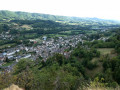
You’ll start to climb gently; look back – Arpajon-sur-Cère is beginning to come into view. You’ll reach a junction where two paths meet.

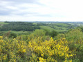
(1) Turn right (south-west). You’ll pass through small woods bordering the meadows. You’ll reach the highest point of this walk.

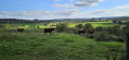
(2) Take the path on the right (north-west). You’ll no doubt come across herds of Salers cattle. Carry on straight ahead until you reach the housing estates via Chemin Douarat and then Route d’Esmolès.

(3) Turn right onto Rue Jean Rostand, then Rue Marie Curie. Follow the D990 on your right along this small path reserved for walkers.

(4) At the pedestrian crossing, turn left and cross the road carefully. Opposite, take the path that leads through the fields and takes you to the small green bridge over the Cère. You’re back in Carbonnat.

(5) Follow the road, turning right until you reach the junction, then left to return to the car park (S/E).

Waypoints

  1. S/E : mi 0 - alt. 2,047 ft - Car park on Rue du Commandant Le Pourcelet
  2. 1 : mi 0.93 - alt. 2,221 ft - On the right
  3. 2 : mi 1.23 - alt. 2,356 ft - On the right
  4. 3 : mi 2.19 - alt. 2,018 ft - On the right, Rue Jean Rostand
  5. 4 : mi 2.9 - alt. 2,018 ft - Pedestrian crossing on the left
  6. 5 : mi 3.31 - alt. 2,005 ft - On the right – Bridge over the - Cère (rivière)
  7. S/E : mi 3.74 - alt. 2,047 ft - Car park on Rue du Commandant Le Pourcelet

Notes

There are no drinking water points, so please remember to bring something to drink.
A good pair of trainers or walking boots is essential on some of the dirt tracks, which have been damaged by water and tractors.

Worth a visit

You’re about ten minutes’ drive from Aurillac town centre (museum, shops, entertainment) and about twenty minutes from Lake Saint-Étienne-de-Cantalès (water sports in summer, lovely walks).
For lovers of scenic landscapes, the Gorges de la Jordanne lead to one of the peaks of the Auvergne volcanoes: Le Puy Mary (1-hour drive).
You’re also a 20-minute drive from the Lioran winter sports resort.

Reviews and comments

3.6 / 5
Based on 3 reviews

Reliability of the description
3.7 / 5
Ease of following the route
4 / 5
Route interest
3 / 5
mick15
mick15

Overall rating : 4.7 / 5

Date of your route : Feb 29, 2024
Reliability of the description : ★★★★★ Very good
Ease of following the route : ★★★★★ Very good
Route interest : ★★★★☆ Good
Very busy route : No

A lovely walk with beautiful views

Machine-translated

Pascale1515
Pascale1515

Overall rating : 3.3 / 5

Date of your route : May 01, 2020
Reliability of the description : ★★★☆☆ Average
Ease of following the route : ★★★★☆ Good
Route interest : ★★★☆☆ Average
Very busy route : No

Lack of signposting and too much traffic on the road

Machine-translated

Pascale1515
Pascale1515

Overall rating : 2.7 / 5

Date of your route : Jun 01, 2020
Reliability of the description : ★★★☆☆ Average
Ease of following the route : ★★★☆☆ Average
Route interest : ★★☆☆☆ Disappointing
Very busy route : No

Lack of signposting; too much traffic on the road

Machine-translated

Other walks in the area

For more walks, use our search engine .

The GPS track and description are the property of this route's author. Please do not copy them without permission.