Between town and countryside in Aurillac

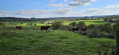
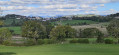
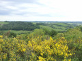
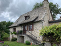
A short walk starting from Aurillac, offering a chance to get close to nature with some interesting viewpoints.

Details

n°65033867
Creation:
Last update:
Last review:
  • Walking
    Activity: Walking
  • ↔
    Distance: 3.55 mi
  • ◔
    Average duration: 1h 55 
  • ▲
    Difficulty: Easy

  • ⚐
    Back to start: Yes
  • ↗
    Ascent: + 354 ft
  • ↘
    Descent: - 348 ft

  • ▲
    Highest point: 2,211 ft
  • ▼
    Lowest point: 1,919 ft

Photos

Description of the walk

Park in the car park at the end of Avenue Charles de Gaulle, on the right.

(S/E) As you leave the car park, turn right to cross the Pont Julien, which spans the railway line, and continue along Avenue de Conthe until the next junction.

(1) Turn left towards Belbex, via Route du Collet, and follow this road along the path running alongside it until you reach the sports ground.

(2) Cross the road again, taking care, then take the steps leading down into the housing estate (path through the grass) and join Rue du Val.

(3) Head to the right, then left to take the steps leading to Chemin des Remparts.

(4) At the top of the steps, take the Chemin des Remparts to the left and, at the first junction, turn left onto the street, which is a cul-de-sac.

(5) At the end of the street, take the path slightly to the right, a wide, stony path in places. A footbridge allows you to cross the Ruisseau d’Antuéjoul. Join the Route de Fontette and cross Poudrière.

(6) Continue in the same direction until the next junction.

(7) Do not cross the railway line, but take the path to the left which runs alongside the tracks, then veers off to the left. This path can be muddy in places after rain. Continue in the same direction to reach Bourdieu.

(8) Turn right to cross the railway line, then take the Route de Toulouse (N2122) on the left: please note this is a busy road. Head to the car park (S/E).

Waypoints

  1. S/E : mi 0 - alt. 2,093 ft - Car park at the roundabout on Avenue Charles de Gaulle
  2. 1 : mi 0.19 - alt. 2,129 ft - Multiple junctions
  3. 2 : mi 0.75 - alt. 2,201 ft - Belbex Stadium
  4. 3 : mi 0.82 - alt. 2,159 ft - Rue du Val
  5. 4 : mi 0.94 - alt. 2,208 ft - Chemin des Remparts
  6. 5 : mi 1.09 - alt. 2,142 ft - End of the street
  7. 6 : mi 2.13 - alt. 2,014 ft - Junction of Route de Fontette and Chemin de Lescudiller
  8. 7 : mi 2.31 - alt. 2,031 ft - Junction with the Chemin d’Esban
  9. 8 : mi 3.27 - alt. 2,080 ft - Boudieu
  10. S/E : mi 3.55 - alt. 2,093 ft - Car park at the roundabout on Avenue Charles de Gaulle

Notes

Some sections may be muddy after periods of rain.

Worth a visit

In Belbex, you can take a stroll along Rue des Remparts and have a look at the orientation table!

Reviews and comments

4.3 / 5
Based on 2 reviews

Reliability of the description
5 / 5
Ease of following the route
4 / 5
Route interest
4 / 5
User 29728352

Overall rating : 4.3 / 5

Date of your route : Sep 21, 2026
Reliability of the description : ★★★★★ Very good
Ease of following the route : ★★★★☆ Good
Route interest : ★★★★☆ Good
Very busy route : Yes

A easy and enjoyable route

Machine-translated

User 5831026

Overall rating : 4.3 / 5

Date of your route : Nov 10, 2025
Reliability of the description : ★★★★★ Very good
Ease of following the route : ★★★★☆ Good
Route interest : ★★★★☆ Good
Very busy route : No

Well done and thank you.

DG

Machine-translated

Other walks in the area

For more walks, use our search engine .

The GPS track and description are the property of this route's author. Please do not copy them without permission.