A short walk between Graix and Thélis-la-Combe

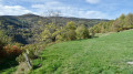
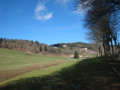
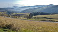
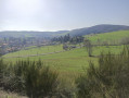
A very easy short walk with magnificent views over Thélis-la-Combe.

Details

28393728
Creation:
Last update:
Last review:
  • Walking
    Activity: Walking
  • ↔
    Distance: 2.59 mi
  • ◔
    Average duration: 1h 40 
  • ▲
    Difficulty: Easy

  • ⚐
    Back to start: Yes
  • ↗
    Ascent: + 548 ft
  • ↘
    Descent: - 571 ft

  • ▲
    Highest point: 3,248 ft
  • ▼
    Lowest point: 2,661 ft

Photos

Description of the walk

Park on the small access road to the hamlet of La Célarie.

(S/E) Walk back up towards the junction with the D8. Turn right onto the small tarmac road towards Puits de Lusinas. It goes uphill and then back downhill.

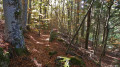
(1) At the bend leading to the hamlet of Puits de Lusinas, leave the tarmac and take the path straight ahead, signposted for cyclists, which descends through a small deciduous woodland.

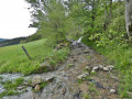
(2) At the junction with the dirt track, cross it and take the path opposite which continues to descend.

(3) At the junction signposted by the Pilat Regional Nature Park (PNR du Pilat), turn right and follow the main track down, ignoring all other tracks. View of the village and church of Thélis-la-Combe.

(4) When you come within sight of the tarmac road, do not continue down towards it but turn right onto the path that leads uphill.

(5) When you reach the hamlet of La Combe, follow the road on the left for a few metres, then turn right between the houses onto the path leading up towards Pierre Morte. Stay on the main path until you rejoin the small access road to La Célarie. Take the road on the right back to your car (S/E).

Waypoints

  1. S/E : mi 0 - alt. 3,173 ft - Parking along the road
  2. 1 : mi 0.36 - alt. 3,248 ft - Leave the tarmac road
  3. 2 : mi 0.57 - alt. 3,150 ft - Crossroads of dirt tracks
  4. 3 : mi 0.79 - alt. 3,015 ft - Signposted junction for Parc Pilat
  5. 4 : mi 1.38 - alt. 2,667 ft - End of the descent
  6. 5 : mi 1.74 - alt. 2,871 ft - La Combe
  7. S/E : mi 2.59 - alt. 3,173 ft - Parking is available along the road

Reviews and comments

4.8 / 5
Based on 2 reviews

Reliability of the description
5 / 5
Ease of following the route
5 / 5
Route interest
4.5 / 5
visorandonneuses
visorandonneuses

We couldn't find the starting point, so we chose a marked trail (on site)!

Machine-translated

Kélig07
Kélig07

Overall rating : 5 / 5

Date of your route : May 06, 2025
Reliability of the description : Not used / Not applicable
Ease of following the route : ★★★★★ Very good
Route interest : ★★★★★ Very good
Very busy route : No

A lovely little walk with no difficulty at all.
We enjoyed the varied scenery, with some lovely views.

Machine-translated

F.J
F.J

Overall rating : 4.7 / 5

Date of your route : May 06, 2024
Reliability of the description : ★★★★★ Very good
Ease of following the route : ★★★★★ Very good
Route interest : ★★★★☆ Good
Very busy route : No

I only came across a few sheep!

Machine-translated

Other walks in the area

For more walks, use our search engine .

The GPS track and description are the property of this route's author. Please do not copy them without permission.