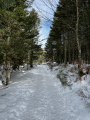
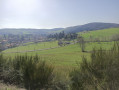
Thélis-la-Combe double circular loop

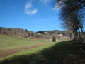
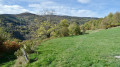
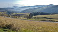
This walk will take you up the slope of Thélis-la-Combe and, if you continue on the additional circular loop, you’ll be treated to a beautiful view of Colombier and Saint-Julien-Molin-Molette.

Details

4552047
Creation:
Last update:
Last review:
  • Walking
    Activity: Walking
  • ↔
    Distance: 6.84 mi
  • ◔
    Average duration: 3h 55 
  • ▲
    Difficulty: Moderate

  • ⚐
    Back to start: Yes
  • ↗
    Ascent: + 889 ft
  • ↘
    Descent: - 915 ft

  • ▲
    Highest point: 3,274 ft
  • ▼
    Lowest point: 2,736 ft

Photos

Description of the walk

Park in the car park of the ‘L’Instant’ wellness centre in the hamlet of La Fargère.

(S/E) Head south towards Bourg Argental. Walk past the house at La Fargère and you’ll soon come to a crossroads with several directions, including the one towards Le Mont.

(1) Turn right, ignoring the sign for Le Mont on the left, and immediately afterwards take the path on the left. Continue until you come to a narrow path.

(2) Take this narrow path on the right, zigzagging between the trees, until you reach a wider path.
Turn left onto it to reach the junction with the path leading to the hamlet of La Ciovette.

(3) Turn left towards the south and stay on this path as it descends.

(4) Carry straight on along the path, which is circular and curves widely to the right before heading north-west.

(5) Keep to the left and you’ll then reach the lowest point.

(6) Keep to the main track on the right and begin a long climb to reach the junction with the Chemin de la Guillotière.

(7) Take care not to miss the single track branching off to the right, which quickly leads to the junction with the road to Puits de Lusinas.

(8) Turn right onto the downhill path that leads back to the original junction.

(1) Continue along the road opposite, pass the hamlet of Le Mont and, a little further on, you’ll come to a Y-junction with two tracks.

(9) Head off to the right, turn left at the next junction, and pass through the hamlet of Pécoutioux. Walk along a clearing opposite the houses at Bel-Air. Continue north through the woods until you reach a track. Take it to the left to return to the Y-junction you passed earlier.

(9) Follow the same route as on the way out until you reach the original junction.

(1) Turn right to make your way back at a leisurely pace to the car park at the Espace Bien-Être (S/E).

Waypoints

  1. S/E : mi 0 - alt. 2,986 ft - Car park at the Espace Bien Être L’Instant
  2. 1 : mi 0.2 - alt. 2,999 ft - Mont Crossroads
  3. 2 : mi 0.69 - alt. 3,232 ft - Short path
  4. 3 : mi 0.99 - alt. 3,084 ft - Chemin de la Ciovette
  5. 4 : mi 1.47 - alt. 2,969 ft - Ciovette crossroads
  6. 5 : mi 2.04 - alt. 2,927 ft - Fork in the road, turn left
  7. 6 : mi 2.38 - alt. 2,736 ft - Thélis la Combe side
  8. 7 : mi 3.56 - alt. 3,146 ft - 2nd single track
  9. 8 : mi 3.77 - alt. 3,248 ft - The Lusinas Well
  10. 9 : mi 4.95 - alt. 2,907 ft - Junction 2nd circular loop
  11. S/E : mi 6.84 - alt. 2,966 ft - Car park at the Espace Bien Être L’Instant

Reviews and comments

3.8 / 5
Based on 4 reviews

Reliability of the description
3.3 / 5
Ease of following the route
3.5 / 5
Route interest
4.5 / 5
patm69
patm69

Overall rating : 4 / 5

Date of your route : Mar 11, 2025
Reliability of the description : ★★★☆☆ Average
Ease of following the route : ★★★★☆ Good
Route interest : ★★★★★ Very good
Very busy route : No

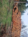
A lovely walk, mainly through woodland, with a beautiful path lined with low stone walls in places. There are also some lovely views over the valley. It’s a shame there isn’t more information and detail about the route, as I think it would be difficult to find your way without a GPS or compass. We couldn’t find marker no. 3; when we reached marker no. 2, instead of turning right onto the narrow path – which we couldn’t find – we carried on straight ahead, following a small, well-marked trail on the ground that wound its way through the trees and led us back onto the wider path between markers no. 3 and no. 4. Also, be careful when you reach marker no. 4: it’s advisable to head straight on, but at this point the loggers have stacked a lot of timber and you can no longer see the path, so go round the pile for now. It’s a walk I’d definitely do again in the summer.
Thank you to the author for helping us discover these beautiful spots and landscapes.

Machine-translated

christal42
christal42

At point 2, we couldn’t find the narrow path, but otherwise it was a lovely walk – we adjusted the route using the GPS

Machine-translated

TREVYHYNAD
TREVYHYNAD

Overall rating : 3 / 5

Date of your route : Oct 05, 2023
Reliability of the description : ★★★☆☆ Average
Ease of following the route : ★★☆☆☆ Disappointing
Route interest : ★★★★☆ Good
Very busy route : No

Without the sat-nav, we would have got lost… the waypoints are hard to spot, and the route description needs revising…
A very wooded route best tackled in hot weather...

Machine-translated

cathyferrer
cathyferrer

Overall rating : 4 / 5

Date of your route : Jun 15, 2023
Reliability of the description : Not used / Not applicable
Ease of following the route : ★★★★☆ Good
Route interest : ★★★★☆ Good
Very busy route : No

To keep myself busy all day, I combined it with the “Circular Route des Roches and Crêt de la Garde” route.
A real breath of fresh air in the heart of the woods.
However, a word of thanks to my GPS: between points 2 and 3, the route is made difficult by pruned fir trees with branches on the ground and brambles. The path off to the left is a vague track, partially blocked for 100 metres, before you come to a better-defined path. If I were to do it again, I’d look for an alternative to this section starting from point 1.
Thanks for the description.

Machine-translated

michele07
michele07

Overall rating : 4.3 / 5

Date of your route : Jul 19, 2021
Reliability of the description : ★★★★☆ Good
Ease of following the route : ★★★★☆ Good
Route interest : ★★★★★ Very good
Very busy route : No

It’s a lovely walk that avoids the ‘crowds’ at Pilat. I got lost right from the start because I was distracted by the mushrooms, and once you stray off the path, you can’t find it again because there are so many paths – but they all lead to roughly the same spot. You just need to take a map and a compass (or rely on your sense of direction) with you.
Thank you for this discovery.

Machine-translated

Other walks in the area

For more walks, use our search engine .

The GPS track and description are the property of this route's author. Please do not copy them without permission.