


 Country:

 City:


Start from the car park at the Magnien football ground, Stade du Vernoy, 21230 Rue de Saint-Agnan (D17F).
(S/E) To begin with, walk alongside the football pitch on your right until you reach a three-way junction.
(1) Turn right onto Rue du Bois Derrière and continue along the path that leads into the forest. Carry on until you reach the junction known as ‘des Quatre Chemins’.
(2) Carry on straight ahead, then turn slightly left at the next junction. On the gentle descent that follows, leave the main path and turn left. The path climbs steeply for a few dozen metres. Then continue along this forest track until you reach a crossroads.
(3) Turn left and then rejoin a wider track; continue down the slope to the right along this track until you reach a small tarmac road, the Route de Villeneuve.
(4) Turn left onto it for about 100 metres until you reach the Route de Magnien in Dracy. Follow it to the left for about 150 metres, then turn onto the hedgerow path on the right, which winds its way through the meadows.
(5) Cross the D17Fwith care and continue to the next junction.
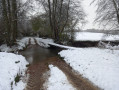
(6) Turn right to see the charming little bridge over the Ruisseau Le Villeneuve.
(7) Turn round and head back to the junction.
(6) Head up the wide path on the right until you reach a road (D17F). Follow it straight ahead until you reach a junction; turn left and rejoin the (S/E).

 Tourist office

 Visorando Member

 Association / Club / Walk leader
 Moderate

