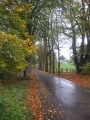
A short walk through the Chestrolaise countryside

Consisting mainly of farm tracks and forest paths, as well as little-used country lanes, this short walk through the Neufchâteau countryside also takes you past a few signs on the Sentier des Artisans.

Details

n°3002411
Creation:
Last update:
Last review:
  • Walking
    Activity: Walking
  • ↔
    Distance: 4.76 mi
  • ◔
    Average duration: 2h 35 
  • ▲
    Difficulty: Easy

  • ⚐
    Back to start: Yes
  • ↗
    Ascent: + 463 ft
  • ↘
    Descent: - 433 ft

  • ▲
    Highest point: 1,519 ft
  • ▼
    Lowest point: 1,247 ft

Photos

Description of the walk

No dedicated car park; you can park at the entrance to the farm track where it crosses Rue La Chehée, on the way out of Grandvoir towards Rossart.

(S/E) Head north-east towards the Grandvoir manor farm. Ignore the road on the left and carry on straight ahead. Walk past the manor farm, which has been converted into a brewery and a hotel-restaurant. Cross over the River La Rosière. Keep to the right at thefirst junction and turn left at the next Fork in the road.

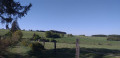
(1) When you reach the Ferme du Grand Enclos, turn left onto the uphill farm track. Follow the track and enjoy the unobstructed view of the countryside. Cross the road carefully and carry on straight ahead.

Signposting: Red Triangle and Red Rectangle

(2) At the crossroads by another farm, at a place called Lôhièpré with a sign for the Sentier des Artisans, turn left. Walk alongside the woodland. At the next crossroads, head left and then walk alongside the meadows.

(3) At the road, in the hamlet of Fineuse, where there is a sign for the Sentier des Artisans, turn right onto the road. Keep to the left at the Fork in the road and head downhill. Ignore the path on the right running alongside the river in the hamlet of Moulin de Gué Lahérie. There is also a sign for the Sentier des Artisans here. Cross over the River Rosière. Walk back up the road and past the hotel-restaurant. Continue to follow the road, ignoring any paths branching off to your right.

(4) At the fork in the road with a dirt track, turn right – not onto the forest track leading into the woods, but onto the dirt track between the meadows and woodland. At the end of the track, at a place called Forêt de Huqueni, turn left. Walk carefully alongside the busy road for approximately 200 metres, leaving thefirst trackleading into the woods on your right.

(5) Take the next path on your right. You’ll come to another path; continue straight on until you reach a track. The signposting ends here.

No signposting

(6) At the junction with the Route des Forges, at a place called Chemin de Fer with a sign for the Sentier des Artisans, turn right. Walk downhill to a stream.

(7) Do not cross the stream but turn left onto the path running alongside it. The path becomes a track and runs some distance alongside the Pré du Foi stream until it reaches the road.

(8) At the road, turn left and head uphill to the hamlet of La Holière. The signposting resumes.

Red Rectangle Triangle Markings

Carry on straight ahead to the start (S/E).

Waypoints

  1. S/E : mi 0 - alt. 1,302 ft - Crossroads on leaving the village, heading towards Rossart
  2. 1 : mi 0.38 - alt. 1,276 ft - Dirt track, on the left
  3. 2 : mi 1.36 - alt. 1,470 ft - At the farm, turn left
  4. 3 : mi 2 - alt. 1,319 ft - At the road, turn right
  5. 4 : mi 2.51 - alt. 1,391 ft - Dirt track on the right
  6. 5 : mi 2.98 - alt. 1,509 ft - Path on the right
  7. 6 : mi 3.26 - alt. 1,424 ft - At a place called Chemin de Fer, turn right
  8. 7 : mi 3.59 - alt. 1,381 ft - Turn left before the stream
  9. 8 : mi 4.27 - alt. 1,306 ft - At the road, turn left
  10. S/E : mi 4.76 - alt. 1,302 ft - Crossroads on leaving the village, heading towards Rossart

Notes

The route is often in open country.
Muddy in places.
A total of 2.5 km of tarmac: mainly at the start, between (3) and (4), and at the end.
From October to December, please note the hunting season dates.
The signs for local craftspeople that you’ll see along the route are part of the TARPAN walks, which are themed walks.

Worth a visit

During:
Calvaire.
Grandvoir Castle: a 17th-century square-shaped castle-farm. Over the years, this building has been the residence of the master blacksmiths of the Province of Luxembourg. It is now a hotel-restaurant and a brasserie.
The Old Ironworks Route.

Reviews and comments

4.7 / 5
Based on 1 review

Reliability of the description
5 / 5
Ease of following the route
5 / 5
Route interest
4 / 5
claude M
claude M

Hello Carla,
The path between numbers 7 and 8.
The start, where the pallets are, and further on, near the meadow.
Have a nice day.

Machine-translated

lazzerini
lazzerini
• Edited:

Hello Claude M,

Just to clarify your information, is this indeed the route between (6) and (7), and not the route once you’ve turned onto (7)? Or is it actually the route after (7)?

Thank you for your feedback

Machine-translated

claude M
claude M

Overall rating : 4.7 / 5

Date of your route : Sep 20, 2020
Reliability of the description : ★★★★★ Very good
Ease of following the route : ★★★★★ Very good
Route interest : ★★★★☆ Good
Very busy route : No

A lovely walk, but just before the stream, the path is barely visible and there are lots of branches blocking the way.

Machine-translated

Other walks in the area

For more walks, use our search engine .

The GPS track and description are the property of this route's author. Please do not copy them without permission.