A walk through the peaceful forest of Montplainchamps

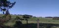
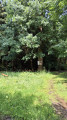
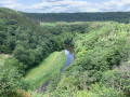
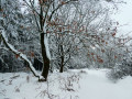
Enjoy this walk in and around the Montplainchamps Forest – a peaceful getaway in a quiet spot.

Details

n°36772854
Creation:
Last update:
Last review:
  • Walking
    Activity: Walking
  • ↔
    Distance: 6.46 mi
  • ◔
    Average duration: 3h 20 
  • ▲
    Difficulty: Moderate

  • ⚐
    Back to start: Yes
  • ↗
    Ascent: + 440 ft
  • ↘
    Descent: - 449 ft

  • ▲
    Highest point: 1,470 ft
  • ▼
    Lowest point: 1,283 ft

Photos

Description of the walk

The walk starts at the church in Montplainchamps, at No. 7 Rue le Sclapé.
Free parking is available around the church and the cemetery.

(S/E) Walk alongside the cemetery, turn left onto the path behind the church and continue straight on to the hamlet of Hosseuse. Follow the Yellow Triangle signposts.

(1) In the village, turn left and follow the tarmac road to the next junction.

(2) At the Nolinfaing crossroads, turn right onto the path until you reach the junction with a large white stone. At the Fork in the road, follow the path on the left marked with a Red Triangle until you reach the sign for Bourzi.

(3) Continue to the left until you reach the stone path. Keep to your right, carry on straight ahead and you’ll pass a viewing point. Continue along the main path until you reach a fork.

(4) Leave the main path, turn right and carry on straight ahead until you reach the Suxy road.

(5) Cross it, veering slightly to the left for about twenty metres, and carry on straight ahead.

(6) Turn right at the dead tree marked with a Red Triangle. Follow the dirt track until you reach the stone road. Turn left and follow it for about a hundred metres.

(7) Turn right and you’ll come to a Fork in the road. Follow the dirt track on the right and carry on until you reach the Ruisseau de la Scierie. You’ll then join the Chaussée de Florenville (N85).

(8) Cross it carefully at the purple tourist sign for “Pays de Bouillon en Ardenne”. Follow the path that climbs to the left. At the end of this path, head left for about a hundred metres, then right until you reach a crossroads.

(9) Follow the Yellow Rectangle signpost to the right and carry on to the crossroads.

(10) Turn right towards the astronomical observatory. Once you reach it, continue along the tarmac road towards the village of Grapfontaine. The Yellow Rectangle signposting remains in place. Walk through the hamlet, passing by the fountain.

(11) Turn right at the Bpost letterbox. Carry on straight ahead along Rue de la Tachette. Cross the N85 with care. Montplainchamps Church is directly in front of you (S/E).

Waypoints

  1. S/E : mi 0 - alt. 1,470 ft - Montplainchamps Church
  2. 1 : mi 0.39 - alt. 1,437 ft - The hamlet of Hosseuse
  3. 2 : mi 0.85 - alt. 1,362 ft - Nolinfaing crossroads
  4. 3 : mi 1.44 - alt. 1,312 ft - Signpost for Bourzi
  5. 4 : mi 2.12 - alt. 1,302 ft - Junction after the viewing tower
  6. 5 : mi 2.58 - alt. 1,385 ft - Route de Suxy
  7. 6 : mi 2.8 - alt. 1,381 ft - Dead tree – Red Triangle
  8. 7 : mi 3.08 - alt. 1,398 ft - Junction
  9. 8 : mi 3.58 - alt. 1,316 ft - Chaussée de Florenville (N85)
  10. 9 : mi 4.09 - alt. 1,371 ft - Straimont crossroads
  11. 10 : mi 4.55 - alt. 1,414 ft - Crossroads leading to the astronomical observatory
  12. 11 : mi 5.94 - alt. 1,394 ft - Bpost letterbox in Grapfontaine
  13. S/E : mi 6.46 - alt. 1,470 ft - Montplainchamps Church

Notes

No special equipment is required for this walk; a good pair of trainers will suffice.

Worth a visit

Reviews and comments

3.8 / 5
Based on 2 reviews

Reliability of the description
3 / 5
Ease of following the route
3.5 / 5
Route interest
5 / 5
didz
didz

Overall rating : 5 / 5

Date of your route : Apr 06, 2025
Reliability of the description : Not used / Not applicable
Ease of following the route : ★★★★★ Very good
Route interest : ★★★★★ Very good
Very busy route : No

A peaceful walk – we came across fewer than 10 people. The scenery is varied and very beautiful. We had no trouble finding our way using the Visorando app in GPS mode. The cemetery is a great place to park.

Machine-translated

VéroMi1
VéroMi1

Overall rating : 3.3 / 5

Date of your route : Aug 21, 2023
Reliability of the description : ★★★☆☆ Average
Ease of following the route : ★★☆☆☆ Disappointing
Route interest : ★★★★★ Very good
Very busy route : No

The walk is very pleasant; the scenery is superb and varied, and it’s a peaceful experience. Unfortunately, the route description is rather vague, and the start in particular is described incorrectly (please correct to: coming from the cemetery, take the path on the left before the church OR, starting from the church towards the cemetery, take the path on the right after the church). The signposts mentioned are often missing or pointing in the wrong direction, which makes them useless. At point 4, it’s difficult to be sure you’re taking the right path, as it’s barely visible in summer due to the vegetation.
All in all, with the map, Google Maps and a few short detours, we still had a good time.

Machine-translated

Other walks in the area

For more walks, use our search engine .

The GPS track and description are the property of this route's author. Please do not copy them without permission.