A rural walk around Bessay, a small village in southern Vendée

A pleasant route through the Vendée countryside around a small village, offering the chance to discover a washhouse, a castle, a lovely lodge, a beautiful river and an episode from the War in the Vendée (1793).

Details

31611638
Creation:
Last update:
Last review:
  • Walking
    Activity: Walking
  • ↔
    Distance: 7.42 mi
  • ◔
    Average duration: 3h 35 
  • ▲
    Difficulty: Moderate

  • ⚐
    Back to start: Yes
  • ↗
    Ascent: + 167 ft
  • ↘
    Descent: - 164 ft

  • ▲
    Highest point: 161 ft
  • ▼
    Lowest point: 30 ft

Photos

Description of the walk

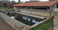
Parking: car park and starting point below the church, near a beautiful washhouse.
Yellow markings.

(S/E) Walk up Rue de l’Église Saint-Jean-Baptiste, go round the church and continue to the main street of the village of Bessay. Turn left onto Rue Principale and walk to the town hall.
Opposite the town hall, turn right onto the small road. After 100 m, looking to the right, you’ll see Bessay Castle and its beautiful Renaissance tower. Continue to the fork in the road.

(1) Turn left and follow a grassy path bordered on the left by a hedge and on the right by a field. You’ll come to a road.

(2) : Turn left onto this road. Cross the D7, then follow a land consolidation track straight ahead until you reach the busier D88 at a place called La Croix Gâté. Cross it carefully and follow a small, sloping road straight ahead through large fields without hedges. You’ll come to a crossroads just before the hamlet of Châtelard.

(3) Turn left and follow a footpath to a small road running alongside the River Smagne. Continue in this direction. At the junction, take the road on the right. Continue to follow the river to the village of Mainclaye. Cross the D7 again.

(4) Just after crossing, on the right, you’ll come across a historic site from the Wars of the Vendée: the ruins of the Mainclaye bridge (commemorative plaque). Continue on your way until you reach a crossroads. Carry on for about 200 m.

(5) Turn right onto a small road leading downhill and follow the very pleasant Chemin de la Smagne, which runs alongside the river. You’ll arrive at Le Coteau, where you can admire the magnificent manor house on your right.

(6) Carry on straight ahead along a small road leading downhill; ignore the road on the left which leads back to Bessay, and you’ll reach a junction.

(7) At the bottom of the descent, turn left then right towards the football ground. Climb a steep hill and turn left to walk alongside the ground behind one of the goals.

(8) Turn left to cross the hedge (note that the ‘turn left’ sign may be obscured by vegetation). Follow the path to the D88, turn right and follow the road for 100 m.

(9) Then turn left onto the first path until you reach another path crossing it.

(10) There are two options at this T-junction:
- take a shortcut by turning left then right to rejoin the route shown here.
- Alternatively, turn right and follow the yellow arrows through the Bois de Bessay. In the middle of the woods, the path turns sharply left, heading due north. Leave the woods and follow the path bordered on the left by a hedge and on the right by a field. At the first junction, turn left onto the road until you reach a crossroads (marker 37).

(11) Turn left onto the path running through the middle of the fields.

(12) Still following the yellow signposts, leave the land consolidation track and turn right onto a grassy, uphill path. At the next junction, turn left; you will see Bessay Castle again. When you reach a small road, turn right and then, a little further on (marker 46), turn left onto the road and continue to the fork you passed on the way out.

(1) Turn slightly left and reach the village of Bessay by following the route in the opposite direction to the outward journey, returning to the cemetery car park (DA).
Take some time to explore the village and visit the beautifully restored wash house.


Waypoints

  1. S/E : mi 0 - alt. 118 ft - Cemetery car park
  2. 1 : mi 0.38 - alt. 157 ft - Common junction (out and back)
  3. 2 : mi 0.72 - alt. 98 ft - Road, on the left
  4. 3 : mi 2.04 - alt. 56 ft - Châtelard. At the junction, turn left. Follow the - Smagne (rivière) - Affluent du Lay
  5. 4 : mi 2.96 - alt. 39 ft - The old Mainclaye Bridge
  6. 5 : mi 3.06 - alt. 49 ft - Three-way fork, turn right
  7. 6 : mi 4.3 - alt. 75 ft - Hillside, head down to the right
  8. 7 : mi 4.51 - alt. 43 ft - At the crossroads, head towards the sports ground
  9. 8 : mi 4.64 - alt. 79 ft - Football pitch, on the left
  10. 9 : mi 4.8 - alt. 102 ft - Leave the road, turning left
  11. 10 : mi 4.98 - alt. 121 ft - T-junction, turn right
  12. 11 : mi 5.93 - alt. 115 ft - Junction, turn left
  13. 12 : mi 6.36 - alt. 89 ft - Junction, turn right
  14. S/E : mi 7.42 - alt. 118 ft - Cemetery car park

Notes

Shelter is available at the washhouse or the sports ground.
In wet weather, sturdy footwear is essential, particularly in the woods or on grassy paths.

Worth a visit

Bessay Castle: a listed historic monument and private residence open to the public (see online information). It comprises two Renaissance towers linked by a main building dating from the 17th century. It features a large dovecote, extensive grounds with ancient trees and flowerbeds.
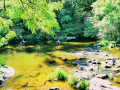
The river: The 50 km-long Smagne flows into the River Lay and has numerous meanders. Two mills can be seen along the walk.
The Mainclaye Bridge: a commemorative plaque recounts a bloody episode from the Wars of the Vendée (the Third Battle of Luçon on 14 August 1793).
Nearby, in the church at Dissay, there is a memorial to the three Battles of Luçon and the fortified camp at Le Châtelard. There is a route that traces this episode of the Wars of the Vendée.

Reviews and comments

4.7 / 5
Based on 3 reviews

Reliability of the description
4.7 / 5
Ease of following the route
4.7 / 5
Route interest
4.7 / 5
Cécile LG1
Cécile LG1

Overall rating : 4.3 / 5

Date of your route : May 10, 2024
Reliability of the description : ★★★★☆ Good
Ease of following the route : ★★★★☆ Good
Route interest : ★★★★★ Very good
Very busy route : No

A lovely little, peaceful spot in the Vendée....

Machine-translated

Jacky Dalançon
Jacky Dalançon

Hello,
I’m glad you enjoyed this walk; it’s lovely and varied. You can shorten it if you like.
To visit the castle, you’ll need to book an appointment with the owner (see the website).
Another walk to try in warm weather is the one to the sources of the Yon at St Martin des Noyers, which I suggested a few months ago. Enjoy your walks.
Another lovely walk too, on the other side towards Sainte-Pexine and Moutiers-sur-le-Lay, which takes you past the River Lay, to the Chapel of Saint Brice, the Motte Orson and some beautiful paths...

Machine-translated

SYL8559
SYL8559

Overall rating : 4.7 / 5

Date of your route : Nov 26, 2023
Reliability of the description : ★★★★★ Very good
Ease of following the route : ★★★★★ Very good
Route interest : ★★★★☆ Good
Very busy route : No

Hello
We made the most of a sunny late morning for this walk, and it’s a lovely hike! I’d definitely recommend it! The route isn’t monotonous, with a bit of road and, above all, grassy paths just as we like them. Lovely scenery as you walk alongside the River Smagne! I also really enjoyed the section through the little Bessay wood!
Thank you, Visorando!
Kind regards!

Machine-translated

Jacky Dalançon
Jacky Dalançon

Hello,
I’m glad you enjoyed this walk; it’s lovely and varied. You can shorten it if you like.
To visit the castle, you’ll need to book an appointment with the owner (see the website).
Another walk to try in warm weather is the one to the sources of the Yon in St Martin des Noyers, which I suggested a few months ago. Enjoy your walks.

Machine-translated

rando_pyramide
rando_pyramide

Overall rating : 5 / 5

Date of your route : Jun 21, 2023
Reliability of the description : ★★★★★ Very good
Ease of following the route : ★★★★★ Very good
Route interest : ★★★★★ Very good
Very busy route : No

I was familiar with Bessay as I used to live in Dissais about fifty years ago. The village has been greatly enhanced by its floral displays and its beautifully restored houses. A lovely walk taking in the Smagne Valley and the Mainclaye site.
It’s a shame we didn’t get a full view of the houses on the hillside.
There were 26 of us and we were all delighted by this walk, despite the muggy, stormy weather.

Machine-translated

Other walks in the area

For more walks, use our search engine .

The GPS track and description are the property of this route's author. Please do not copy them without permission.