Country:
 City:


Park in the Rue du Chêne car park in Noirchain.
(S/E) Head towards the nearby junction and turn left onto Rue d’Asquillies, which leads towards the stud farm.
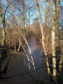
(1) At the junction, cross the small bridge on the left over the By and follow the path up towards the cemetery. Turn right and follow the path downhill.
(2) Keep straight on at the junction and go under the motorway.
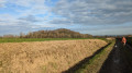
(3) Turn right onto Rue de Goispienne and follow the path alongside the slag heap.
(4) Turn left onto Rue des Robiniers.
(5) Enter the Ciply slag heap site and walk around it at your leisure (you can walk around it without climbing it, but that would be a shame), then return to Rue des Robiniers.
(5) Carry on to the left until you reach Rue de Brunehaut, where you turn right.
(6) When you reach the bench, head off to the right, cross the By again and continue to the row of houses (no. 220) where the Sentier de la Garenne begins.
(7) Take the path between the two houses, follow it down and, after the stream, turn right and then immediately left onto Rue des Robiniers. Walk up this street, pass the small square with the children’s playground and continue to the new blocks of flats.
(8) After the flats, turn right onto the Sentier des Gailles, then further on turn right onto Rue Brunehaut and you’ll come back to the junction you passed on the way there.
(3) Go back under the motorway.
(2) At the fork in the road, turn left and then carry straight on to the car park on Rue du Chêne (S/E).
 Visorando Member



 Difficult