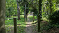
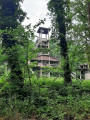
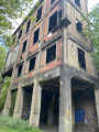
Around the Genly slag heap

Circular route around the Genly slag heap, through meadows dotted with horses and offering a lovely view of the region.

Details

n°28372896
Creation:
Last update:
Last review:
  • Walking
    Activity: Walking
  • ↔
    Distance: 4.19 mi
  • ◔
    Average duration: 2h 05 
  • ▲
    Difficulty: Easy

  • ⚐
    Back to start: Yes
  • ↗
    Ascent: + 187 ft
  • ↘
    Descent: - 187 ft

  • ▲
    Highest point: 440 ft
  • ▼
    Lowest point: 285 ft
  • ⚐ Country: Belgium
  • ⚐ City: Frameries 
  • ⚑
    Start/End: N 50.403485° / E 3.898545°
  • ❏
    IGN map(s): Ref. 2706OT, 2806O
  • Hour-by-hour weather

Photos

Description of the walk

Park on Avenue Joseph Wauters in Frameries. See alternative parking in the ‘Practical Information’ section.

(S/E) Follow the path leading towards the copse until you reach Chemin Vert.

(1) Turn right towards the housing estate and continue straight on along the path that climbs towards Eugies.

(2) When you reach the ‘Mons Borinage Eugies’ sign, follow cycle route 43 to the left, which leads towards the telecoms pylon.

(3) Near the mast, turn slightly left onto the path leading down towards the spoil heaps.

(4) When you reach the road, turn left, cross the level crossing and follow the path on the left until you reach the Chemin Vert.

(5) Turn left, cross the level crossing and you’ll come to the fork in the road from the outward journey.

(1) Take the path on the right to return to your starting point, Avenue Joseph Wauters (S/E).

Waypoints

  1. S/E : mi 0 - alt. 358 ft - Avenue Joseph Wauters
  2. 1 : mi 0.55 - alt. 322 ft - Chemin Vert
  3. 2 : mi 1.43 - alt. 427 ft - Eugies town sign
  4. 3 : mi 1.79 - alt. 440 ft - Telecommunications mast
  5. 4 : mi 2.94 - alt. 328 ft - Main road
  6. 5 : mi 3.53 - alt. 295 ft - Chemin Vert
  7. S/E : mi 4.19 - alt. 358 ft - Avenue Joseph Wauters

Notes

You can also start from Place d’Eugies by parking near the church at point (2) on Chemin de l’Étang.

Reviews and comments

4.7 / 5
Based on 1 review

Reliability of the description
5 / 5
Ease of following the route
5 / 5
Route interest
4 / 5
SylLaVie
SylLaVie
• Edited:

Overall rating : 4.7 / 5

Date of your route : Dec 23, 2024
Reliability of the description : ★★★★★ Very good
Ease of following the route : ★★★★★ Very good
Route interest : ★★★★☆ Good
Very busy route : No

Tested in December, the walk proved to be perfectly manageable. Very well signposted, it offers lovely views across the fields of a region that undoubtedly suffers from preconceptions. The chosen route is well-maintained and clean. A lovely breath of fresh air and plenty of light.

Machine-translated

Other walks in the area

For more walks, use our search engine .

The GPS track and description are the property of this route's author. Please do not copy them without permission.