Via the Bois des Moines to Campremy

Circular route from Campremy to Grand-Mesnil via Farivillers.

Details

n°8650664
Creation:
Last update:
Last review:
  • Walking
    Activity: Walking
  • ↔
    Distance: 7.49 mi
  • ◔
    Average duration: 3h 40 
  • ▲
    Difficulty: Moderate

  • ⚐
    Back to start: Yes
  • ↗
    Ascent: + 223 ft
  • ↘
    Descent: - 236 ft

  • ▲
    Highest point: 512 ft
  • ▼
    Lowest point: 397 ft
  • ⚐ Country: France
  • ⚐ City: Campremy (60480)
  • ⚑
    Start/End: N 49.570961° / E 2.31127°
  • ❏
    IGN map(s): Ref. 2310E, 2310O
  • Hour-by-hour weather

Photos

Description of the walk

Park in the square in Campremy.

(S/E) Cross the square, take Rue de l’École opposite until you reach the town hall, then follow the path on the left which runs alongside the school. Walk downhill and take the first path on the right.

(1) Take the path on the right which goes uphill and goes round the Bois du Parc. Continue along the path on the right, then turn left and join the D112.

(2) Stay on the left-hand side of the road, turn onto the first path on the left and head downhill. Continue straight on until you reach the entrance to Farivillers.

(3) Enter Farivillers and turn right. Continue along the main road to the junction, then turn left towards the D916. At the agricultural co-operative, take the road on the right until you reach the D916.

(4) Cross with care and carry on straight ahead to the end of the road, then turn left until you reach the first road on the right.

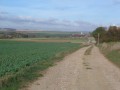
(5) Take this track; at the end, turn right and head downhill. Walk alongside the Bois des Moines on your left. After the woodland, carry on straight ahead until you reach a cross-track.

(6) At the end of the path, turn right and continue towards the wind turbines. Cross the D916 with care, heading towards Grand Mesnil. Continue straight on and leave Grand Mesnil.

(7) Turn onto the path on the right and carry on until you reach a road (D61).

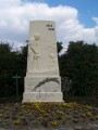
(8) Just before this, take the track on the right and follow it to a road. Turn left to enter Campremy. At the end, turn left onto the main road (D112), pass the war memorial on your right and head for the square on the right (S/E).


Waypoints

  1. S/E : mi 0 - alt. 479 ft - Campremy Square
  2. 1 : mi 0.54 - alt. 397 ft - Junction
  3. 2 : mi 1.08 - alt. 482 ft - Road junction
  4. 3 : mi 1.78 - alt. 492 ft - Entrance to Farivillers
  5. 4 : mi 2.7 - alt. 509 ft - Road D916
  6. 5 : mi 3.24 - alt. 472 ft - Junction
  7. 6 : mi 4.44 - alt. 489 ft - Towards the wind turbines
  8. 7 : mi 5.91 - alt. 446 ft - Leaving Grand Mesnil
  9. 8 : mi 6.89 - alt. 486 ft - Fork in the path
  10. S/E : mi 7.49 - alt. 479 ft - Campremy Square

Reviews and comments

3.8 / 5
Based on 2 reviews

Reliability of the description
4 / 5
Ease of following the route
4 / 5
Route interest
3.5 / 5
fredbes
fredbes

Overall rating : 3.7 / 5

Date of your route : Oct 18, 2026
Reliability of the description : ★★★★☆ Good
Ease of following the route : ★★★★☆ Good
Route interest : ★★★☆☆ Average
Very busy route : No

A walk in the sunshine and cool weather.
The route and the scenery were nothing out of the ordinary, but we had a good breath of fresh air.
After the walk, we discovered, right nearby in the village of NOYERS-St-Martin, a Soviet military cemetery where soldiers and civilians who were victims of the Second World War are buried. It is certainly one of the very few of its kind in the country.

Machine-translated

User 27873804

Overall rating : 4 / 5

Date of your route : Jun 08, 2026
Reliability of the description : ★★★★☆ Good
Ease of following the route : ★★★★☆ Good
Route interest : ★★★★☆ Good
Very busy route : No

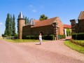
A easy route with little elevation gain, winding through fields, offering a glimpse of the old Cistercian barn at Grand Mesnil

Machine-translated

Other walks in the area

For more walks, use our search engine .

The GPS track and description are the property of this route's author. Please do not copy them without permission.