


Refine your search for walks in Obélisque de Saint-Vrain
Obélisque de Saint-Vrain walks


 Following the River Juine and its tributaries
 Visorando Member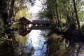
 152.32 mi
 +5,879 ft
 -6,490 ft
 20 days
 Moderate
 Departure from Angerville (Essonne) (Essonne)
The River Juine rises on the Beauce plateau, flows through the town of Étampes and joins the River Essonne further on. This series of walks follows the course of this river. Several of the stages are linear routes running from station to station, whilst others are circular loops on the hillsides flanking the river.
Walks near Obélisque de Saint-Vrain
From Ballancourt to La Ferté-Alais, the Itteville marshes and the Sanglier rock
 8.20 mi
+381 ft
-354 ft
4h 05
Moderate
Departure from Ballancourt-sur-Essonne (Essonne)
8.20 mi
+381 ft
-354 ft
4h 05
Moderate
Departure from Ballancourt-sur-Essonne (Essonne)
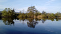
A walk from station to station that starts gently along the Essonne. Further on, the crossing of the Itteville marshes allows you to discover ponds and reed beds and admire the birds from the observation points provided. After passing an imposing menhir, you climb the Butte d’Itteville. You then reach the rocky outcrops of Le Sanglier. The walk ends with a stroll through the narrow streets of La Ferté-Alais.
From Ballancourt-sur-Essonne to La Ferté-Alais via Mondeville
 12.27 mi
+663 ft
-630 ft
6h 15
12.27 mi
+663 ft
-630 ft
6h 15
 Difficult
Departure from Ballancourt-sur-Essonne (Essonne)
Difficult
Departure from Ballancourt-sur-Essonne (Essonne)
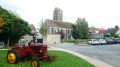
Twenty-ninth stage of the Grand Tour of Île-de-France via the GR®11, linking Ballancourt-sur-Essonne to La Ferté-Alais. Although both towns are located in the Essonne valley, the proposed route passes through the plateau overlooking the valley on the east side, in the Gâtinais Français Regional Nature Park, to the charming village of Mondeville. The GR® then winds its way between valleys, forests dotted with sandstone boulders and agricultural plateaus. This stage is shorter than the previous ones but is not without its difficulties as it still covers steep sections of terrain similar to the Fontainebleau forest, particularly around Mondeville. The route also allows you to discover some unusual sights, such as the Roches du Père La Musique in Ballancourt.
From Lardy to Dourdan
20.31 mi
+1,322 ft
-1,260 ft
10h 30
 Very difficult
Departure from Lardy (Essonne)
Very difficult
Departure from Lardy (Essonne)
This stage of the GR®1 is one of the most difficult on this GR®. It is 32 km long and has an elevation gain of over 400 m. It is also one of the most beautiful. Starting from Lardy, this hike takes you past magnificent monuments such as the Church of Saint-Sulpice, the Church of Saint-Yon, the Church of Sermaise and the Château de Dourdan. There are other monuments to visit in this town. Most of the route is in the countryside, with several ascents and descents into the valleys. The route passes through numerous villages of varying sizes.
From Lardy to Ballancourt via the Marais d’Itteville
 8.92 mi
+33 ft
-135 ft
4h 10
Moderate
Departure from Lardy (Essonne)
8.92 mi
+33 ft
-135 ft
4h 10
Moderate
Departure from Lardy (Essonne)
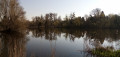
The final stretch follows the River Juine to its confluence with the River Essonne, which is, however, not accessible. The route alternates between built-up areas and paths through fields and woods. The Marais d’Itteville, with its ponds, reed beds and birdwatching hides, is the highlight of this walk.
Following the Orge from Arpajon to Sainte-Geneviève-des-Bois.
 8.47 mi
+69 ft
-102 ft
3h 55
Moderate
Departure from Arpajon (Essonne)
8.47 mi
+69 ft
-102 ft
3h 55
Moderate
Departure from Arpajon (Essonne)
A hike from station to station, mostly following the Orge river or its secondary branch, the Grande Boële, and along a few large reservoirs. There is a rich heritage to discover, in Arpajon at the start of the hike and, as a highlight, at the Basilica of Longpont.
From La Ferté-Alais to Chamarande
 9.27 mi
+679 ft
-597 ft
4h 50
Moderate
Departure from La Ferté-Alais (Essonne)
9.27 mi
+679 ft
-597 ft
4h 50
Moderate
Departure from La Ferté-Alais (Essonne)
From the Essonne Valley to the Juine Valley through woods and fields, passing by the Pierre Levée in Janville-sur-Juine and the Chamarande viewpoint.
A route almost entirely on paths with beautiful views in the Gâtinais Français Regional Nature Park.
From Arpajon to Saint-Chéron via the Bassin de Trêvois and the Château de Baville
 8.45 mi
+272 ft
-246 ft
4h 05
Moderate
Departure from Arpajon (Essonne)
8.45 mi
+272 ft
-246 ft
4h 05
Moderate
Departure from Arpajon (Essonne)
A hike from station to station, along the Orge and its tributary, the Rémarde, as well as the Bassin de Trêvois. A small menhir and a Louis XIII-style castle add a nice touch of heritage.
From La Ferté-Alais to Mennecy via the ponds
 10.80 mi
+66 ft
-135 ft
5h 00
Moderate
Departure from La Ferté-Alais (Essonne)
10.80 mi
+66 ft
-135 ft
5h 00
Moderate
Departure from La Ferté-Alais (Essonne)
This hike is certainly the most "aquatic" of those that can be undertaken along the Essonne. Indeed, numerous ponds punctuate the route: ponds for fishing or other forms of leisure; ponds and marshes that make up a protected natural area, a source of biodiversity and a place to observe wildlife.
From La Ferté-Alais to Boutigny via the Charron and Miséry woods
 8.73 mi
+328 ft
-341 ft
4h 20
Moderate
Departure from La Ferté-Alais (Essonne)
8.73 mi
+328 ft
-341 ft
4h 20
Moderate
Departure from La Ferté-Alais (Essonne)
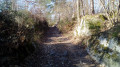
A varied walk, from station to station. After the footpaths and the church at Cerny, the route becomes predominantly woodland. It winds through the Bois Charron and climbs up the hill of La Roche Cornue, dotted with boulders. After a pleasant walk through the Bois de Miséry, you return to the Essonne valley and its villages.
From La Ferté-Alais to Étréchy, from Essonne to Juine
 12.26 mi
+827 ft
-791 ft
6h 20
Difficult
Departure from La Ferté-Alais (Essonne)
12.26 mi
+827 ft
-791 ft
6h 20
Difficult
Departure from La Ferté-Alais (Essonne)
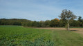
Thirtieth stage of the Grand Tour of Île-de-France via the GR®11, linking La Ferté-Alais, in the Essonne valley, to Étréchy, in the Juine valley, through the western part of the Gâtinais Français Regional Nature Park. It consists of continuing the crossing of the Essonne, between agricultural landscapes, small forest ranges and more imposing valleys. A relatively short stage without any major difficulties, before the next two, which will be a little longer.