Country:
 City:
City:


Starting point and access: La Ferté-Alais railway station.
- RER – Line D, on the section between Paris and Malesherbes.
Take the Rue Heren exit via the footbridge at the front of the train when arriving from Paris at Malesherbes (at the rear of the train when travelling in the opposite direction).
Red and white markings
(S) As you leave the footbridge, turn right and follow a tarmac path overlooking the railway line. At the end, turn right and cross the bridge over the railway line. At the next junction, turn left onto Boulevard d’Angot following theGR®111A(let theGR®11continue straight ahead). At the Stop sign, turn left towards Melun. At the Fork in the road that appears shortly afterwards (marked by a stone marker), veer to the right. At the next junction, when the street becomes a dead end, turn right onto Rue Maxime Lisbonne.
Blue + Red and White markings
At the end, first turn left then right and take a one-way street (Rue Jean Moulin on the map). Pass a chicane and continue along a path.
(1) Cross the Essonne via a footbridge and go straight on along the tarmac path bordered by a wall on the right-hand side. Continue along a street, keeping the sports grounds on your left. At the traffic lights, cross the D449 at the pedestrian crossing on the left. Opposite, take the cycle path running parallel, a short distance away, to the D145 heading towards Cerny.
(2) When the cycle path joins the D145, turn right to cross this road (take care) and follow Rue de la Ferme towards Cerny town centre (caution: narrow verge). When you reach a metal gate on the right-hand side, turn left onto a wide track and follow the river on your right. At thefirst junction, carry on straight ahead along the river, which is now bordered by woodland on the opposite bank.
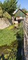
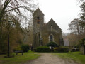
(3) At thesecond junction, turn right. Cross the woodland, cross the river via a wooden bridge, then walk alongside some gardens. At the end of the path, turn right and walk alongside another river. After a few dozen metres, turn left and cross the river. Follow a path flanked by walls (Rue de l’Abreuvoir). At the end, turn right then left to reach the church.
(4) Continue along the street and, at the corner by the war memorial, turn left onto Rue de Longueville.
Blue signposting
Take thesecond street on the left, Chemin Sollier (let theGR® continue straight ahead). The tarmac soon gives way to a track. Turn right between two walls and, at the next junction, continue straight ahead. You’ll come out onto a street; follow it to the right. At the end, turn right onto Rue de Longueville.
Blue + Red and White markings
(5) Turn into thefirst street on the left, Rue aux Moines. At the crossroads (statue of Christ with outstretched arms, not the Virgin Mary as shown on the map), take thesecond left onto Chemin des Amoureux. At the Fork in the road, veer to the right. At the end of the tarmac road, go straight on, pass through a metal gate and follow a path through the woods.
(6) At the T-junction, follow a sandy path to the left. At the crossroads (signpost), go straight on. Walk south-south-west, passing a gate on the right and then a path branching off to the right. After a left-hand bend, you’ll come out onto a small road; follow it to the right.
No signposting
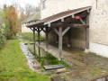
(7) At the junction, turn left into Rue de Boissy. At the Stop sign, carry on straight ahead along the same street, with a wall on your right. At the next Stop sign, cross Rue du Château, pass a washhouse on your right and follow Rue de la Grange Larchée.
(8) At the corner of No. 8, turn right onto a grassy path. Walk alongside a meadow on your right and, at the far end of it, veer left and take a very narrow track bordered by a wire fence on your left. Note a pond on your right. Follow the track as it winds its way between fences and garden walls.
(9) You’ll eventually come out onto a street; follow it to the left. At the traffic lights, carry on straight ahead into Rue de l’Égalité. At the Stop sign, go straight on. Just before a set of traffic lights, near the media library, turn right onto a gravel track heading towards the sports ground. After about 200m, you’ll come to an information sign for the Bois Charron footpaths.
Wooden posts + blue/red signposting
The path is marked by numerous wooden posts; coloured arrows are only present at major junctions.
(10) Turn left here, pass through a forest gate, join the path and wind your way through the woodland dotted with small rocks. At a fork in the road, take the left-hand path. Note the old sandstone boundary markers at the edge of the path. Ignore any vague offshoots to the sides; follow the wooden markers closely and, at a junction that is more clearly marked than the others (shown on the map), go straight on. You will eventually reach Rue de l’Égalité (a memorial stone in honour of a former mayor).
Unmarked
Follow the road to the right, passing some tennis courts. After about 200m, at a Fork in the road, turn right onto Rue de la Roche Cornue. Just past No. 7, look out for an inconspicuous path starting on the right.
N.B. The following out-and-back section is on private property. Access is tolerated, particularly for rock climbers. Please respect the area and follow any signs you may encounter.
(11) Set off along the path, enter the woods and continue along a wider but poorly marked track. Climb up through the woods and look out for large boulders perched on a hillock to your right. Climb the hillock, navigating between rocks and ferns, until you reach the Roche Cornue site (the climbing routes are marked on the rocks with numbers and coloured arrows indicating their difficulty). Descend, keeping a north-north-easterly then north-easterly bearing.
(11) Return to the road and follow it to the right for about 350 metres.
Blue markings
At the junction, turn right onto the path closed to motor vehicles (forest barrier). Pass a large gate on your left and begin the ascent. The path becomes enclosed between small rocks. Ignore a path on the left that is clearly blocked; continue along a gently rising path with a birch copse on your right, until you reach a crossroads.
Blue + Red and White markings
(12) Then turn sharply left and follow theGR®1along a sandy path through a pine forest. At a junction, go straight on and climb gently. After a sort of pass, descend just as gently.
Blue markings
On the section that follows, not all the paths are shown on the IGN base map, but the markings are clearly visible at every junction.
(13) At a fork in the road, veer left (let theGR® head off to the right). At the next junction, continue straight on. Ignore a path coming from the right and, at the fork that appears immediately, turn left. Then ignore a path branching off to the left and veer right. At a crossroads, take thesecond path on the left and follow a fence on your left-hand side.
(14) Cross (with care) the D449 and follow the lane opposite downhill. At the end, turn right. You’ll come out onto Place de l’Église; note the church on your left. Continue right along Rue de l’Église and pass the gate to Château de la Sablière.
Blue + Red and White signposting
At the Stop sign, cross the D449 at the pedestrian crossing on the left and follow the road to the left along a separate pavement.
(15) At the traffic lights, cross the D449 one last time at the pedestrian crossing and take Rue du Sourdet, where the speed limit is 30 km/h. Turn right with the road and you’ll come to a junction (with a memorial stone). Then turn left and, at the Stop sign immediately ahead, go straight on. You’ll see a wash house on the left; follow the Route de la Duchère as it winds through a residential area. Ignore all side paths and cross the Chemin de l’Abreuvoir.
Shortly after a narrow section, leave the road and cross a lawn diagonally to the left. Cross three branches of the Essonne in succession – the main one being thesecond – and continue along the road. At the level crossing, you’ll find a direct access point to the platforms at Boutigny station (E) on the right.
To return home:
- RER – Line D, towards Paris (access before the level crossing) or Malesherbes (access after).




 Visorando Member
 Difficult
 Easy
Easy