


 Country:
 City:
City:


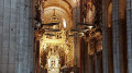

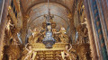
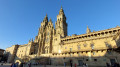
(S) With your back to the campsite, head right (south-west). At the junction, go straight ahead (slightly to the right) and continue through meadows and woods until you reach the next junction.
(1) Ignoring the crossroads, carry on straight ahead until you reach the Stop sign at the junction with the N-547.
(2) Cross this road carefully, then, after a left/right bend, turn onto the stony path that starts behind the ‘O Burgo’ sign. Walk through the woods until you reach the village of Pedrouzo on Rúa Peregrino. Turn right to walk past a bus depot, then at the Stop sign, turn right onto the Concello. Continue until you reach the football pitch sheltered behind a stone wall.
(3) Turn left onto the tree-lined path to reach the hamlet of San Antón.
(4) Turn right, then at the fork in the road, veer left. At the next fork in the road, keep right. Carry on to another fork in the road and turn left towards the south-west, onto a narrow path through the woodland. Keeping an eye out for the boundary markers along the way, continue to the T-junction at the edge of the woods.
(5) Carry on to the left, then immediately to the right (north-west). After a 90° bend, you’ll reach a junction. Turn right at a right angle and continue on to enter the hamlet of O Amenal. Carry on until you reach a junction opposite two small sheds.
(6) Turn right to continue through the hamlet. At the Fork in the road, head slightly left. Carry on north-west, cross a small stream before passing the Pensión Bar Kilómetro 15, where you can top up your supplies. Carry on to the underpass on the left just before the ‘Stop’ sign at the junction with the N-547.
(7) Go under the N-547, then carry on straight ahead along the tree-lined path to reach a tarmac road at a hairpin bend. Cross this road and head left along the meadow (on your right), then continue through the woods. Pass through the hamlet of Cimadevila before heading uphill into the woods. Keep heading north-west, ignoring any side paths, and carry on until you reach the T-junction.
(8) Turn right towards the north and carry on until you come to a road bridge.
(9) Turn left, walk a few metres until you pass a granite cairn on the path. Continue along the path, initially following the fence of Santiago de Compostela Airport. Walk past the airport’s communications tower. After crossing the road, you’ll reach the junction at the entrance to the hamlet of San Paio.
(10) Turn right to enter the hamlet. Walk past the Chapel of Saint Lucy and follow the signs for the Camino de Santiago. At the Fork in the road, take the left-hand path up the gently sloping road and continue to the signpost.
(11) Turn right onto the path that heads into the woods, towards the Camino de Santiago. Pass under the A-54 motorway and continue straight on (south-west) along the small, uphill road leading towards the woods. Pass under a high-voltage power line before reaching a Fork in the road.
(12) Head slightly to the left and continue south-west to leave the woods and reach the junction with Calle Lugar Esquipa. Turn right to enter the hamlet of Esquipa and carry on to the crossroads at the edge of the hamlet.
(13) Carry on straight ahead to enter the village of Lavacolla. Stay on this road, which, after a wide left-hand bend, takes you to a large flight of steps. Climb the steps, turning left as you go, to arrive in front of the Church of San Paio.
(14) Turn right in front of the church and carry on to the ‘Stop’ sign at the junction with the N-634. Cross this road carefully, then, straight ahead and slightly to the left, follow the signs for Vilamaior. Carry on to the grain silo.
(15) Turn right, cross the Rio de Sionlla and continue to the right along the tarmac road. Stay on this tarmac road, ignoring any side paths or roads leading off it. Walk through the woods until you reach the hamlet of Vilamior, where you’ll find yourself in front of a farm shed.
(16) Walk through the hamlet. At the fork in the road, turn left, then turn right at the next junction. Walk alongside a wall until you reach a large crossroads.
(17) Turn slightly left and carry on along this road. Walk through the woods, then past the Galicia TV Station before arriving at the San Marcos campsite.
(18) Turn left, then take the first street on the right heading west. After a long straight stretch, you’ll come to a Stop sign at the junction with Rúa do Coto dos Olmos.
(19) Turn right to enter and pass through the hamlet of Coto dos Olmos. At the Fork in the road, veer left onto Rúa de San Marcos, which is closed to vehicles over 5.5 tonnes. Keep heading south-west until you reach the San Marcos Chapel.
(20) Continue on your way, passing the Monte do Gozo private hostel. Carry on along Rúa do Gozo until you reach a right-hand bend, next to a three-storey building painted pink and yellow.
(21) Leave the tarmac road and turn left onto a path that leads to a concrete footbridge. You’ll arrive at the edge of the N-634.
(22) Continue left towards the south-west, keeping this road on your right. Pass over the E-1 motorway and a railway line, then carry on until you reach a roundabout lined with flowers and trees. Cross this roundabout to reach a park where the Porta Itineris Sancti Iacobi (the gateway to the city of Santiago de Compostela) stands. Don’t forget to take some photos to mark the occasion of passing through this gate.
(23) Carry on along the N-634, go through the next roundabout and continue straight ahead along Rúa de San Lázaro to enter the city of Santiago de Compostela: you can stock up on supplies from here onwards. Go through the next two roundabouts, pass the Church of San Lázaro and carry on to the roundabout with a monument in the centre.
(24) Go through this roundabout and head along Rúa do Valiño, which curves slightly to the left as it runs alongside some sports grounds. Stay on this street until the next roundabout.
(25) Carry on straight ahead onto Rúa da Fonte dos Concheiros as the road curves to the left; keep to the right to take the ramp back onto Avenida de Rodríguez de Viguri. Cross this avenue carefully and turn left to reach a junction with traffic lights.
(26) Keep heading south-south-west to continue along Rúa dos Concheiros. Follow this street until you reach the Fork in the road.
(27) Turn slightly right onto Rúa de San Pedro. Carry on to the end of this short cobbled street to reach a large junction.
(28) Cross the junction and continue along Rúa das Casas Reais opposite, slightly to the left and against the flow of traffic. Follow this street in this direction as far as the Church of Ánimas before reaching a Fork in the road.
(29) Turn left to reach Cervantes Square. Walk to the right of the statue perched on a column and follow the arcades on your right, continuing along Rúa da Acibechería. Continue along this street until you reach Inmaculada Square, between the Monument to San Martiño Pinario on your right and the Episcopal Coat of Arms of Monsignor Julián Barrio.
(30) Head south-west from Acibecharía Square to pass under the vault. You will arrive at the Obradoiro Square, an extraordinary World Heritage Site. Head towards the centre of the square, to ‘Kilometre 0’, marked by a commemorative granite plaque on the ground, opposite Santiago de Compostela Cathedral. This is the end point of your journey (E).
 Association / Club / Walk leader
 Visorando Member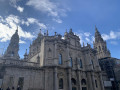
 Easy
Easy  Tourist office
 Difficult
