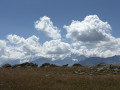
Munt La Schera (2,586 m) is one of the few accessible peaks in the Swiss National Park. Stocky and somewhat isolated, it offers a sublime view of the many neighbouring 3,000-metre peaks in Switzerland and Italy. The National Park has set up an educational geological trail; enquire at the Park House in Zernez.
See the note in the ‘Practical Information’ section regarding this hike The start and finish point is at Punt la Drossa, at the entrance to the international tunnel.
(S/A) Opposite the tunnel entrance, the start of the path is on the right. Like all the Park’s paths, it is clearly visible, signposted and well-maintained. Continue to the Charbunera junction.
(1) Turn left towards Alp la Schera. Walk past the chalets to reach, further on, the first junction leading to the summit.
(2) Continue straight ahead to reach the second junction leading to the summit a little further on.
(3) Turn left to reach the summit of Munt la Schera.
(4) Start the descent on the left to return to thefirst junction leading to the summit.
(2) Turn right back onto the path you took on the way up until you reach the Charbunera junction.
(1) Continue to the right along the route you took on the way up to return to the starting point at Punt la Drossa (S/E).
Waypoints
S/E : mi 0 - alt. 5,617 ft - Punt la Drossa
1 : mi 0.63 - alt. 6,027 ft - Charbunera junction
2 : mi 2.63 - alt. 7,667 ft - First junction below the summit
3 : mi 3.22 - alt. 7,776 ft - Second fork below the summit
4 : mi 4.12 - alt. 8,461 ft - Summit of Munt la Schera – 2,586 m
S/E : mi 7.41 - alt. 5,614 ft - Punt la Drossa
Notes
Important note regarding this hike: From Zernez, take the Pass dal Fuorn road, either by car or coach. The PostBus service runs very reliably. If you choose to drive, you run the risk of the small car park at the start being full. Park regulations restrict parking to prevent the trails from becoming too crowded. This is Switzerland, and illegal parking is not taken lightly, so… It’s also worth noting that it’s strictly forbidden to leave the paths, as the park’s policy is to prohibit all human activity outside the designated access routes. There are no water points.
Please note: only walking is permitted. The park regulations are extremely strict and there really are park rangers, although they are discreet. You must therefore be just as respectful as you would be in any mountain area, whilst also bearing in mind the ban on parking your car haphazardly and straying from the paths.
It is extremely useful, if not essential, to visit the Park visitor centre in Zernez before setting off on any walk. You’ll also find itineraries for other hikes there.
Due to the altitude and climate, part of the route may be closed late in the season because of snow.
Worth a visit
(4) Munt la Schera: enjoy an extraordinary panorama from the summit, featuring numerous Swiss and Italian 3,000-metre peaks. Geological trail – ask for information at the Park Visitor Centre.
To open this route on your smartphone, you must have the Visorando app installed. If not, got to the Apple Store (iPhone) or Google Play Store (Android) to download the app.



 Country:

 City:


 Visorando Member
 Easy