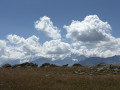
Route du Val Trupchun in the Swiss National Park

A classic walk in the Swiss National Park, this route leads to the bottom of the remarkably picturesque Trupchun Valley, where you’re very likely to spot ibex, chamois, deer and, of course, the ever-present marmots, as well as various species of birds.

The elevation gain is relatively low, the path is easy, the scenery is superb – a real family walk.

Details

n°2186163
Creation:
Last update:
Last review:
–
  • Walking
    Activity: Walking
  • ↔
    Distance: 8.38 mi
  • ◔
    Average duration: 5h 20 
  • ▲
    Difficulty: Moderate

  • ⚐
    Back to start: Yes
  • ↗
    Ascent: + 1,719 ft
  • ↘
    Descent: - 1,726 ft

  • ▲
    Highest point: 6,781 ft
  • ▼
    Lowest point: 5,525 ft

Description of the walk

See the note in the Practical Information section regarding parking.
From Zernez, the national park’s central town, head to S-chanf via the St Moritz road and park at the Spinatsch car park.

(S/E) Set off on the path that climbs to the south of the car park.
There are trailheads at either end of the car park; the circular route can be walked in either direction.
The description provided here is for the anti-clockwise route.
Head towards Punt da Val da Scrigns.

(1) Do not cross it; continue to the right and quickly gain altitude on this wild slope of the Val Trupchun. Reach the level of Alp Purcher.

(2) Continue almost level to reach the Ova da Trupchun stream.

(3) Cross the stream and continue south-east to climb up to Alp Trupchun.

(4) Return to the previous junction via the same route.

(3) Follow the right bank of the Ova da Trupchun stream to reach the confluence with the stream flowing down from the Val Muschauns.

(5) Please take care here: the crossing can sometimes be tricky in spring, as floodwaters may dislodge the footbridges – see §Practical Information.
Continue along the right bank to return to the original junction.

(1) Leave the Punt da Val da Scrigns on your left. Do not cross. Continue along the right bank of the torrent. Reach the hamlet of Varusch.

(6) Cross the Varusch bridge and head to the Spinatsch car park (S/E).

Waypoints

  1. S/E : mi 0 - alt. 5,574 ft - Spinatsch car park
  2. 1 : mi 1.15 - alt. 5,705 ft - Punt da Val da Scrigns
  3. 2 : mi 2.68 - alt. 6,352 ft - Alp Purcher
  4. 3 : mi 4.05 - alt. 6,555 ft - Common junction (out and return)
  5. 4 : mi 4.4 - alt. 6,677 ft - Alp Trupchun
  6. 5 : mi 5.74 - alt. 6,214 ft - Val Muschauns
  7. 6 : mi 8.03 - alt. 5,525 ft - Varusch Bridge
  8. S/E : mi 8.38 - alt. 5,574 ft - Spinatsch car park

Notes

Note on parking: Please be aware that parking is strictly regulated within the park and strictly prohibited outside designated areas; this is a strategy designed to limit the number of visitors to the park. The PostBus, a remarkable Swiss institution, also serves the starting points for walks and avoids the hassle of finding a parking space. Enquire at the Park House in Zernez. You can also reach S-chanf by train.
Swiss National Park.
(For the section leading to 5): Please check carefully at the park visitor centre that the route is fully open.

Reviews and comments

Other walks in the area

For more walks, use our search engine .

The GPS track and description are the property of this route's author. Please do not copy them without permission.