


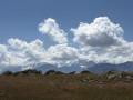
Set off from the car park at the Katholische Herz Jesu Kirche. Head gently towards the forest (1). At the first fork, turn right and follow the sign for Alp Muntatsch. You’ll reach the Alp Muntatsch mountain hut (2) after walking through pleasant woodland, which is shaded in the morning. Do not walk past the building; take the path that climbs up to its right. All you need to do is climb gently to reach the Cho’d Valletta ridge, where a superb 360-degree view awaits hikers. The view over the valley stretches from Samedan to Pontresina, where you can admire the blue of the numerous bodies of water. Higher up, the view takes in the Bernina, Morteratsch and Palü glaciers. The descent follows an easy alpine path, which is steeper than the ascent was. On the way down, you’ll come across an unlikely swing that’s a real hit with the children (6). It’s about a ten-minute walk back to the car park. A family hike suitable for children aged 8 to 12. On the way back, take a quick look at the little church and San Peters cemetery overlooking Samedan.
Circular Chod’Valletta starting from Samedan


A family hike along a ridge above Samedan, with magnificent views of the Graubünden glaciers. The route winds through the forest and across the mountain pastures of Chod’Valletta. The network of paths offers a choice of routes of varying lengths and elevation gains. A significant advantage of this route is that it is far less crowded than the region’s more popular tourist trails!
Details
Creation:
Last update:
Last review:
–
–
-
 Activity: Walking
 -
 Distance: 5.80 mi
 -
 Average duration: 4h 55
 -
 Difficulty: Easy
 -
-
 Back to start: Yes
 -
 Ascent: + 2,543 ft
 -
 Descent: - 2,536 ft
 -
-
 Highest point: 8,136 ft
 -
 Lowest point: 5,748 ft
-
 Country:
Switzerland
Country:
Switzerland
-
 Area: Alps
 -
 City:
Samedan
City:
Samedan -
 Start/End: N 46.534077° / E 9.866825°
 -


 Hour-by-hour weather
Photos
Description of the walk
Waypoints
- S/E : mi 0 - alt. 5,748 ft - Paid car park at the Katholische Herz Jesu Kirche
- 1 : mi 0.38 - alt. 5,919 ft - Start of the ascent through the forest
- 2 : mi 1.61 - alt. 7,188 ft - Alp Muntatsch
- 3 : mi 3.06 - alt. 8,127 ft - Chod'Valletta
- 4 : mi 3.73 - alt. 7,966 ft - Crossroads
- 5 : mi 4.36 - alt. 7,323 ft - Fork in the road
- 6 : mi 5 - alt. 6,401 ft - Pedra Grossa
- S/E : mi 5.8 - alt. 5,774 ft - Paid car park at the Katholische Herz Jesu Kirche
Other walks in the area
Champlönch and Grimmels circular loop in the Swiss National Park
 Visorando Member5.36 mi
+1,614 ft
-1,637 ft
3h 50
Easy
Visorando Member5.36 mi
+1,614 ft
-1,637 ft
3h 50
Easy
 Departure from Zernez (Grisons)
A lovely and very easy walk in the exceptional setting of the Swiss National Park, home to marmots, ibex, chamois and the park’s iconic bird, the spotted nutcracker. The atmosphere is quite wooded, with alpine pastures and clearings, dead trees… In the national park, nature is allowed to evolve with as little human intervention as possible, resulting in often stunning landscapes.
For more walks, use our search engine .
The GPS track and description are the property of this route's author. Please do not copy them without permission.

