Lignac Mill

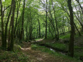
A lovely walk that takes the walker into the heart of the Meyjade Forest and offers a glimpse of a rich historical heritage.

Details

n°1055857
Creation:
Last update:
Last review:
  • Walking
    Activity: Walking
  • ↔
    Distance: 4.31 mi
  • ◔
    Average duration: 2h 20 
  • ▲
    Difficulty: Easy

  • ⚐
    Back to start: Yes
  • ↗
    Ascent: + 449 ft
  • ↘
    Descent: - 443 ft

  • ▲
    Highest point: 1,273 ft
  • ▼
    Lowest point: 1,014 ft
  • ⚐ Country: France
  • ⚐ City: Beyssac (19230)
  • ⚑
    Start/End: N 45.37053° / E 1.403358°
  • ❏
    IGN map(s): Ref. 2033E, 2034E
  • Hour-by-hour weather

Photos

Description of the walk

(S/E) From the car park in front of the church, head left along the Grande Rue and turn left towards the town hall.
Take the small sunken path opposite the buildings until you reach the D7E.

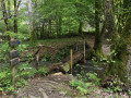
(1) Take the road on the right for 50 metres, then the path on the left to the Lignac mill. Cross the small bridge and head up the path (steep incline).

(2) Turn left at the junction and carry on to the next path.

(3) Turn right along the edge of the woods and head downhill to the ford, which you cross via a small bridge on the left.

(4) After the ford, turn left. Watch out for ruts. A slightly tricky section: if the path is muddy, there is a footpath to the right of the backwater. Continue to the D7E3.

(5) Turn left, pass the Moulin de la Rivière and continue carefully along the road to the Domaine de la Rivière. The road goes round this estate.

(6) At the three-way junction, turn right. Follow the signs for La Villatte and go past the turn-off for this hamlet.

(7) Take the path on the left. Walk up a lovely avenue lined with tall fir trees. When you reach a meadow, turn left, following the fence along the edge of the meadow until you reach the road and Beyssac.
At the Grande Rue, turn left to return to the church (S/E).

Waypoints

  1. S/E : mi 0 - alt. 1,234 ft - Beyssac Church
  2. 1 : mi 0.46 - alt. 1,243 ft - D7E on the right
  3. 2 : mi 1.17 - alt. 1,171 ft - Turn left at the crossroads
  4. 3 : mi 1.68 - alt. 1,129 ft - On the right, along the woodland
  5. 4 : mi 2 - alt. 1,017 ft - On the left after the ford
  6. 5 : mi 2.43 - alt. 1,024 ft - Turn left onto the D7E3
  7. 6 : mi 3.04 - alt. 1,145 ft - Three-way junction
  8. 7 : mi 3.52 - alt. 1,093 ft - Road past La Villate
  9. S/E : mi 4.31 - alt. 1,234 ft - Beyssac Church

Worth a visit

In the heart of the village, the church commemorates Pope Innocent VI, who was born in Les Monts at the end of the 13th century. He commissioned its construction between 1352 and 1362, the final years of his pontificate. This relatively rustic-style building features gable buttresses, radiating window grilles and decorative masonry carvings in the vaults…
Innocent VI, born Étienne Aubert in Beyssac, Limousin, in 1282 and died on 12 September 1362, was Bishop of Noyon and Bishop of Clermont, before becoming the 199th Pope of the Catholic Church in Avignon from 1352 to 1362, succeeding Pope Clement VI (1342–1352). His memorial stone stands in Les Monts.

The Glandier (or du Glandier) Charterhouse is a former Carthusian monastery that has been converted into a care centre for people with disabilities. This former Charterhouse was known as the focal point of the Lafarge affair, concerning a young woman of aristocratic origin accused of poisoning her husband, a master blacksmith.

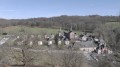
The Domaine de la Rivière, formerly a mare stud belonging to the National Stud Farm, is home to the Château de la Rivière, one of whose towers is thatched.

Reviews and comments

4.3 / 5
Based on 2 reviews

Reliability of the description
4.5 / 5
Ease of following the route
4.5 / 5
Route interest
4 / 5
Marychaplin
Marychaplin

Overall rating : 4.7 / 5

Date of your route : Aug 25, 2025
Reliability of the description : ★★★★★ Very good
Ease of following the route : ★★★★★ Very good
Route interest : ★★★★☆ Good
Very busy route : No

A lovely walk with no particular difficulties. The path is very well signposted with green signposts marked '7'. Much of the route is sheltered by trees, which is ideal on sunny days.

Machine-translated

JF Gourseyrol
JF Gourseyrol
• Edited:

A rural and picturesque route in the first half; far too many fairly busy roads afterwards. We couldn’t find the end of the route despite several attempts (had the signposts been removed or hidden by vegetation?). It’s a shame, as this trail is well worth a visit!

Machine-translated

Celineetfrederic
Celineetfrederic

Overall rating : 4 / 5

Date of your route : Dec 25, 2023
Reliability of the description : ★★★★☆ Good
Ease of following the route : ★★★★☆ Good
Route interest : ★★★★☆ Good
Very busy route : No

A pleasant walk. You need to follow the signposts, as the route description is sometimes a bit vague and the route has changed since then (the GPS route is more accurate).

Machine-translated

Other walks in the area

For more walks, use our search engine .

The GPS track and description are the property of this route's author. Please do not copy them without permission.