Montpon – Saint-Martial-d’Artenset: Circular route from the stream to the river

A lovely circular walk exploring the Isle, a river winding through two communes in the Montpon area. Wooded and rural landscapes will allow you to enjoy the peaceful surroundings. Picnic tables are available along the route.

Details

4659287
Creation:
Last update:
Last review:
  • Walking
    Activity: Walking
  • ↔
    Distance: 9.76 mi
  • ◔
    Average duration: 4h 35 
  • ▲
    Difficulty: Moderate

  • ⚐
    Back to start: Yes
  • ↗
    Ascent: + 148 ft
  • ↘
    Descent: - 141 ft

  • ▲
    Highest point: 236 ft
  • ▼
    Lowest point: 98 ft

Photos

Description of the walk

Park at the car park on Place Clémenceau, next to the Tourist Office.

(S/E) From the information sign near the Tourist Office, cross Avenue Jean Moulin (D6089) at the pedestrian crossing, then head down Rue de Chandos, on the corner opposite Atoll Opticians.

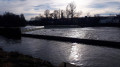
(1) Leave Rue des Barthes on your right and carry on straight ahead. Cross the bridge over the Ruisseau des Barthes. Further on, ignore the turn-off to Les Barthes on your left and carry on straight ahead. When you reach a small, winding pond, keep left to reach the banks of the Isle and turn right to follow the river.

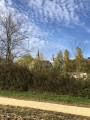
(2) At the junction, where you can enjoy a lovely view of the Chartreuse de Vauclaire, turn right up the field and carry on straight on until you reach the crossroads situated a good hundred metres before the farm buildings.

(3) Turn left and carry on straight ahead, keeping in the same direction, until you reach the D6089 in Saint-Martial-d’Artenset.

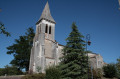
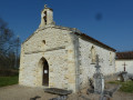
(4) Cross the departmental road again at the pedestrian crossing and take the D13 opposite. Walk past the church on your right, then the cemetery, and cross the level crossing.

(5) Immediately afterwards, turn right onto the small road which takes a 90° left-hand bend and then leads straight on to a T-junction with another, larger road. Follow this road to the right, pass the hamlet of Larmane and continue for about a hundred metres.

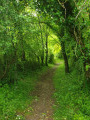
(6) Leave the road and take a path on the left which enters the Bois de Larmane, running alongside the Ruisseau de Boubouyre at a distance. You will then pass under the A89 motorway bridge and over two small bridges. This area has three picnic tables.

(7) Turn right and keep to the right at the next junction. Once you reach the small road, turn right and cross the bridge over the motorway

(8) Once you reach the edge of the woods, leave the road and take a path on the left which first runs alongside the woods before entering them by turning sharply to the right. You’ll come to a road at a bend.

(9) Follow the road to the right, then continue left onto Rue Léonard de Vinci until you reach the T-junction.

(10) Turn left, then left again onto Rue Paul Gauguin at the Jardins du Cœur. At the junction, turn right onto Rue Jean Monnet and carry straight on at the crossroads to come out onto Allée Jean Ferrat.

(11) Turn right and pass the police station. Cross the railway line and carry straight on along Rue Georges Clemenceau to return to the car park (S/E).

Waypoints

  1. S/E : mi 0 - alt. 141 ft - Place Clémenceau car park
  2. 1 : mi 0.39 - alt. 105 ft - Junction, go straight on
  3. 2 : mi 2.41 - alt. 102 ft - Viewpoint over the Chartreuse, on the right - Isle (rivière)
  4. 3 : mi 2.87 - alt. 105 ft - Junction, turn left
  5. 4 : mi 4.04 - alt. 144 ft - Crossing the D6089
  6. 5 : mi 4.59 - alt. 157 ft - Level crossing
  7. 6 : mi 5.83 - alt. 157 ft - Larmane, path on the left
  8. 7 : mi 6.68 - alt. 171 ft - White path, on the right
  9. 8 : mi 7.46 - alt. 210 ft - Edge of the woods, on the left
  10. 9 : mi 7.89 - alt. 207 ft - Road, on the right
  11. 10 : mi 8.63 - alt. 148 ft - T-junction, turn left
  12. 11 : mi 9.31 - alt. 154 ft - Allée Jean Ferrat, on the right
  13. S/E : mi 9.76 - alt. 141 ft - Place Clémenceau car park

Notes

Long route; make sure you wear sturdy shoes.

Worth a visit

(2) L’Isle, viewpoint over the Chartreuse de Vauclaire.

(4) Saint-Martial Church.

Reviews and comments

3.8 / 5
Based on 3 reviews

Reliability of the description
4.3 / 5
Ease of following the route
3.7 / 5
Route interest
3.3 / 5
User 25885652

Overall rating : 3 / 5

Date of your route : May 26, 2025
Reliability of the description : ★★★★☆ Good
Ease of following the route : ★★☆☆☆ Disappointing
Route interest : ★★★☆☆ Average
Very busy route : No

I can confirm that the signposting isn’t good enough. The walk was lovely, but thank goodness we had our GPS on our phones! We were lucky enough to find some mushrooms🍄‍🟫😁

Machine-translated

OT Montpon
OT Montpon

Thank you for your feedback; we’ll take it on board.
Kind regards

Machine-translated

isèrevercors
isèrevercors

Overall rating : 4.7 / 5

Date of your route : Aug 19, 2023
Reliability of the description : ★★★★★ Very good
Ease of following the route : ★★★★★ Very good
Route interest : ★★★★☆ Good
Very busy route : Yes

It’s fine at the start of the walk along the path and riverside, but after a short while there’s a lot of road. Fortunately, there’s a bit of woodland afterwards and the famous picnic area once you’ve passed under the motorway
but it’s not well-maintained, so you don’t really fancy having lunch there. Then back onto the road again, followed by more woodland, and the end of the route to reach the gendarmerie and Place Clémenceau. A shame there’s so much road to avoid, as
yesterday – it was far too hot. Fortunately, we finished early. (Avoid going on Monpton’s public holiday – access to the square is prohibited, just like yesterday; you’ll have to park in the side streets to find a space.)

Machine-translated

cocoden
cocoden
• Edited:

Overall rating : 3.7 / 5

Date of your route : Jul 01, 2023
Reliability of the description : ★★★★☆ Good
Ease of following the route : ★★★★☆ Good
Route interest : ★★★☆☆ Average
Very busy route : Yes

The start of the circular path (around 3 km) is very pleasant, following a path that winds its way through the fields and runs close to the river.
From this point (4), things take a turn for the worse. The section along the D13 is very dangerous as there is virtually no hard shoulder and there is heavy traffic.
From the point (5), the route continues along a road that is, thankfully, less busy, but it is still a tarmac road.
At point (6), we took a shortcut to reach Montpon via the road.

Machine-translated

Other walks in the area

For more walks, use our search engine .

The GPS track and description are the property of this route's author. Please do not copy them without permission.