Marquinaux Circular in Saint-Martial-d’Artenset

(Moderator’s warning) A walk where some difficult sections have been reported. A detour is currently being sought.

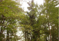
A lovely walk through the heart of the Landais forest, featuring pines, oaks and hornbeams, as well as ferns and rushes. As you pass a pleasant stream, you’ll cross two small wooden bridges. Picnic tables are available for you to have a bite to eat or take a rest.

Details

4661480
Creation:
Last update:
Last review:
  • Walking
    Activity: Walking
  • ↔
    Distance: 9.02 mi
  • ◔
    Average duration: 4h 15 
  • ▲
    Difficulty: Moderate

  • ⚐
    Back to start: Yes
  • ↗
    Ascent: + 157 ft
  • ↘
    Descent: - 157 ft

  • ▲
    Highest point: 305 ft
  • ▼
    Lowest point: 148 ft

Photos

Description of the walk

Park in the car park on the church square.

(S/E) Follow the D13 towards Saint-Sauveur-Lalande. Pass the cemetery and then cross the railway line.

(1) Immediately afterwards, turn right. Then, at the T-junction, turn right again towards Larmane, and pass through this hamlet.

(2) At the junction, take the small path on the left which crosses the Bois de Larmane and runs alongside the Ruisseau de Boutouyre before passing under the A89. This part of the walk is very pleasant as it is well shaded. You’ll find the little stream and two small wooden bridges here.

(3) Turn left to walk alongside the motorway, pass a picnic table and reach a small road at a bend.

(4) Turn left to follow this road, continuing alongside the motorway until you reach the junction with the D13. Turn left, go under the motorway again and walk for about a hundred metres.

(5) Take the unpaved track on the right. At the bottom of the descent, take the small road on the right, pass through the hamlet of Eybrard, then turn right.

(6) Cross the motorway bridge, then turn left onto the Chemin des Diligences. When you reach the Route des Chevaux, turn left and cross the motorway bridge again.

(7) Turn left onto the path through the woodland, which first turns right then left before reaching a T-junction. Turn right and, on emerging from the woodland, follow the road to the left for about a hundred metres.

(8) Turn right and follow the straight path until you reach the railway line. Turn left to walk alongside it at first, then move away from it as you head south. Further on, turn right onto the path and join a small tarmac track.

(9) Cross the road and take the path opposite, which eventually leads onto the D13. Turn right.

(1) Cross the railway line and carry on straight ahead to reach the church, your starting point (S/E).


Waypoints

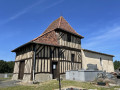
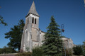
  1. S/E : mi 0 - alt. 148 ft - Église Saint-Martial (Église Saint-Martial-d'Artenset)
  2. 1 : mi 0.5 - alt. 157 ft - Junction of the circular loop
  3. 2 : mi 1.72 - alt. 157 ft - Crossroads
  4. 3 : mi 2.55 - alt. 167 ft - Junction
  5. 4 : mi 3.26 - alt. 292 ft - Road junction
  6. 5 : mi 3.83 - alt. 249 ft - White path
  7. 6 : mi 4.69 - alt. 210 ft - Path on the left
  8. 7 : mi 5.41 - alt. 174 ft - Turn left into the woods
  9. 8 : mi 6.1 - alt. 167 ft - Path on the right
  10. 9 : mi 7.64 - alt. 164 ft - Tarmacked track
  11. S/E : mi 9.02 - alt. 148 ft - Église Saint-Martial (Église Saint-Martial-d'Artenset)

Notes

Make sure you wear good walking shoes as the route is long.

Worth a visit

Marquinaux Wood

Reviews and comments

4.7 / 5
Based on 2 reviews

Reliability of the description
5 / 5
Ease of following the route
5 / 5
Route interest
4 / 5
BERNARDLAB
BERNARDLAB

Overall rating : 4.7 / 5

Date of your route : Aug 06, 2023
Reliability of the description : ★★★★★ Very good
Ease of following the route : ★★★★★ Very good
Route interest : ★★★★☆ Good
Very busy route : No

A pleasant walk, mainly through woodland with a few meadows, signposted along the CD 24. Indeed, between points 3 and 7, the path runs alongside the motorway (which was very noisy this busy weekend!) for almost 5 km, and the vegetation there is rather overgrown; there were clearly no other walkers about. Perhaps it would be possible to take the small roads south of the A89 instead, which are very quiet, although this would of course extend the route by a few kilometres.

Machine-translated

Marjo-Ludo
Marjo-Ludo

Overall rating : 4.7 / 5

Date of your route : Jul 16, 2021
Reliability of the description : ★★★★★ Very good
Ease of following the route : ★★★★★ Very good
Route interest : ★★★★☆ Good
Very busy route : No

A lovely walk, but it’s been a long time since the route was last walked; some sections are a bit tricky due to the vegetation. PLEASE NOTE: I wouldn’t recommend it if you’re doing it with young children.

Otherwise, it’s a walk in the sunshine, and it’s mostly in the shade.

Machine-translated

Other walks in the area

For more walks, use our search engine .

The GPS track and description are the property of this route's author. Please do not copy them without permission.