


 Following a fire on 5 April 2023 on the hills above Saint-Guilhem-le-Désert and Saint-Jean-de-Fos, the route remains passable but the PR® des Fenestrettes is affected, as is the Arles trail (GR®653). Please check with the Saint-Guilhem – Vallée de l’Hérault Tourist Office to find out whether the route is open.


 Country:

 City:
City:


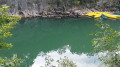
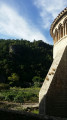
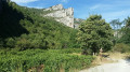
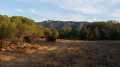
To reach the Barry car park, the starting point for our walk: from Montpeyroux town centre (Place de l’Horloge), follow Avenue des Platanes (to the right of the covered market) for approximately 600 metres.
(S) From the Barry car park, walk up the main street (closed to vehicles), pass by the Church of Saint-Martin (12th century) and then follow the signs for ‘Castellas’ (signs and yellow markings). The village well (15th century) marks the start of the wide path leading to the castle.
(1) At Castellas, ignore the wide, rocky, steep path that starts straight ahead and instead take the narrow, inconspicuous path, marked with red-and-whiteGR® signs, the entrance to which is hidden near the north-eastern ridge of the castle, just to the right of the Castellas rampart walk. During the gentle, steady climb through the heath and dolomitic limestone, there is a lovely view of the ramparts of Le Castellas.
(2) Neolithic enclosure: you can either walk through it or go round it on the left, staying on the main path. In either case, turn right onto the wide forest track as soon as you reach it. There’s a lovely view of Mont Saint-Baudille.
(3) Leave the track after 500m, taking a narrower path, marked by a clearly visible cairn, well to your left. Follow the red-and-whiteGR® markings.
(4) Return to the original forest track on the left. Follow it as it winds its way for about 2.5 km.
(5) At the junction of the forest tracks, take the one furthest to the left. Ignore the start of a path on the left. After about 350m, continue along the track, temporarily leaving the red-and-whiteGR® marked path on your right, until you reach the green ‘fire’ tank.
(6) At the tank, leave the track, go round the wooden barrier and follow the wideyellow PR®-marked path towards Max Nègre.
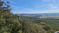
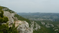
(7) Follow the few guardrails and the ledge path to admire the breathtaking views over the Cirque de l’Infernet, and begin the descent towards Saint-Guilhem.
(8) Turn left onto theGR® red-and-white marked trail (signposted “Route des Fenestrettes”,PR® yellow) to begin a steady, sustained descent (there are some lovely off-trail viewpoints on the left during the descent, but these are not secured).
(9) At the crossroads, by the signpost marked “Roc de la Bissonne”, head towards Saint-Guilhem (signposted 1.5 km away) by taking the hairpin bend to the right.
(10) End of the descent and crossing of the Verdus stream (usually dry): take the road on the right towards the village.
Possible alternatives:
- turn left towards the source of the Verdus (a round trip of about 3 km),
- to walk through the historic centre of the village (take the time to explore the little-known narrow streets).
(11) Optional at the bottom of the village: go down the steps towards the Saint-Guilhem water sports centre to cool off by the river (strongly advised against during periods of high water!).
(E) Arrival at the coach station (option to return to Montpeyroux by coach). See the ‘Practical Information’ section.

 Visorando Member
 Very difficult

 Difficult
