


Refine your search for walks in Montfort-sur-Meu
Montfort-sur-Meu walks


 The Porte de Brocéliande in Montfort-sur-Meu
 Visorando Member
 7.51 mi
 +341 ft
 -358 ft
 3h 45
 Moderate
 Departure from Montfort-sur-Meu (Ille-et-Vilaine)
Montfort-sur-Meu, formerly Montfort La Cane, is a town steeped in history with a remarkable heritage located at the gateway to Brocéliande, with its mythical forest and Arthurian legends:
A medieval town under the Lords of Gaël-Montfort; a fortified town of which the Papegault Tower, the Châtelet and the remains of the ramparts still stand; a religious town with St-Jacques Abbey, the Ursuline Convent and the birthplace of Saint Louis Grignion de Montfort.
Joëlette route in Montfort-Sur-Meu
 7.99 mi
+302 ft
-302 ft
3h 55
Moderate
Departure from Montfort-sur-Meu (Ille-et-Vilaine)
Route created by the JoAilettes35 association to enable disabled people to discover the wooded surroundings of Montfort-Sur-Meu - 22 March 2015
User comment, 1 January 2025:It is impossible to complete the entire route because the Bois du Buisson forest is private property and there are now >no entry signs everywhere.
Route of the manor houses in Saint-Uniac
4.15 mi
+85 ft
-85 ft
2h 00
 Easy
Departure from Saint-Uniac (Ille-et-Vilaine)
A short walk through the countryside around Saint-Uniac, featuring a few grassy paths and partly following the GR®37. No particular difficulty. Don’t miss the church in the village, the Quénétain Manor and the Saint-Uniac Fountain.
From La Chambre au Loup to Boutavent Castle in Brocéliande
 8.15 mi
+262 ft
-269 ft
4h 00
Moderate
Departure from Iffendic (Ille-et-Vilaine)
From Lake Trémelin: start with Les Landiers de Trémelin, then cross the Chambre au Loup valley with its woods and moors, followed by a visit to the ruins of Boutavent Castle, owned by the Lords of Gaël-Montfort in the 13th and 14th centuries, and return via the Putenoë woods to finish along the lake.
A hike from La Tête aux Pieds: nature, history and heritage.
Walk between two ponds in Brocéliande in Iffendic
 9.10 mi
+131 ft
-138 ft
4h 20
Moderate
Departure from Iffendic (Ille-et-Vilaine)
The legendary Brocéliande is undoubtedly the most popular of all, but the natural Brocéliande is just as omnipresent.
It is the latter that you will discover on this hike, with Lake Trémelin, the Bois de la Roche Trébulente and Putenoë woods, and above all the Careil bird sanctuary... don't forget your binoculars!
The balconies of Monterfil
 9.51 mi
+781 ft
-787 ft
5h 05
Moderate
Departure from Monterfil (Ille-et-Vilaine)
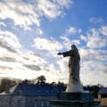
Monterfil is located between Rennes and Plélan-le-Grand, close to the Paimpont forest and the Brocéliande site. Here, visitors will get a taste of the moorland and schist landscapes. They will also have the opportunity to cross deep, steep-sided valleys where small streams flow peacefully.
Chambre au Loup circuit
 6.05 mi
+240 ft
-230 ft
3h 00
Moderate
Departure from Iffendic (Ille-et-Vilaine)
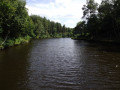
The first part of this hike takes you into deep woods. Then you will discover the archaeological site of the medieval castle of Boutavent. Continue this hike through open areas with beautiful panoramic views and steep ascents and descents to reach the Étang de la Chambre au Loup.The return journey takes you back up a steep, open and rocky climb with breathtaking views.
:!: 9.07.2025: The signposting has been changed from blue to yellow.
Route of the two chapels in Boisgervilly
7.90 mi
+135 ft
-135 ft
3h 45
Moderate
Departure from Boisgervilly (Ille-et-Vilaine)
Walk through the countryside around Boisgervilly. Flat terrain, with no difficulty. A few awkward sections, particularly tall grass, during certain seasons.
Places to see: the two chapels, the Chapel of Saint-Antoine and the Chapel of Notre-Dame de Bon Secours.
Route de Montauban-de-Bretagne
5.80 mi
+174 ft
-177 ft
2h 50
Easy
Departure from Montauban-de-Bretagne (Ille-et-Vilaine)
A green corridor fed by the River Garun, a park, and country paths around the railway line and the station. The end of the route is more residential but nonetheless interesting as you follow the GR®37.
Around Mordelles
 4.65 mi
+56 ft
-56 ft
2h 10
Easy
Departure from Mordelles (Ille-et-Vilaine)
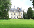
As you explore the outskirts of Mordelles, you will discover the magnificent Château de la Chesnais, the Vaunoise and Meu rivers, the Parc du Pressoir, a beautiful mill, the Étangs de la Biardais ponds and a Gallo-Roman temple.
The Gué Charet and Étunel ponds
2.79 mi
+213 ft
-213 ft
1h 30
Moderate
Departure from Treffendel (Ille-et-Vilaine)
A circular route passing by the communal lake at Treffendel, continuing to Gué Charet, then following the River Serein to the Étang de l’Étunel.
La Motte-Marcillé route
4.28 mi
+105 ft
-131 ft
2h 05
Easy
Departure from Gévezé (Ille-et-Vilaine)
La Motte-Marcillé is the name of a feudal motte. This short walk will introduce you to the village’s architectural and natural heritage. From the church, you’ll head out into the countryside along charming little paths.
The Néal Valley and the Lampouy alignments in Médréac
 8.90 mi
+404 ft
-410 ft
4h 25
Moderate
Departure from Médréac (Ille-et-Vilaine)
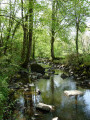
Médréac, a small village in Ille-et-Vilaine, on the border with Côtes d'Armor. The route is particularly attractive: the picturesque Néal valley with the cave of Gabillard, a local Chouan resistance fighter, the megalithic alignments of Lampouy, the railway station, its museum and its rail bike with two routes.
This hike follows theGR® 37 and part of thePR® "Circuit des mégalithes" (Megalith Circuit). The southern part of thisPR® has not been included as it is uninteresting and the paths are poorly maintained.
Route des Molives in Miniac-sous-Bécherel
6.02 mi
+213 ft
-207 ft
2h 55
Easy
Departure from Miniac-sous-Bécherel (Ille-et-Vilaine)
Quite a few quiet roads and sunken lanes (best used in dry weather). Lovely views of the surrounding countryside. Signposting (blue square on a yellow background) is a bit dated, and there are a few signs still indicating the route. I have also included various possible alternatives in the description to avoid unmaintained sunken lanes.
Ermitage route
 7.10 mi
+269 ft
-243 ft
3h 30
Moderate
Departure from Goven (Ille-et-Vilaine)
A beautiful route between the towns of Baulon, Lassy and Goven, surrounded by the legends of the Notre-Dame chapel. Discover the history surrounding the statue of Saint Anne and the nearby fountain.
This route is partially signposted (wooden sign, yellow paint indicating the Hermitage route). Part of it is shared with another very well-signposted route (the Caffort route).