Circular route up to Suhalmendi from Ascain

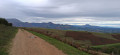
A very beautiful and varied ride suitable for any mountain biker with a minimum level of experience. Breathtaking scenery. The route follows the mountain bike signposts except for the option to climb to the summit of Suhalmendi.

Details

2069474
Creation:
Last update:
Last review:
  • Mountain biking
    Activity: Mountain biking
  • ↔
    Distance: 8.77 mi
  • ◔
    Duration according to the author: 2 hrs 
  • ▲
    Difficulty: Moderate

  • ⚐
    Back to start: Yes
  • ↗
    Ascent: + 1,093 ft
  • ↘
    Descent: - 1,096 ft

  • ▲
    Highest point: 974 ft
  • ▼
    Lowest point: 36 ft
  • ⚐ Country: France
  • ⚐
  • ⚐ City: Ascain (64310)
  • ⚑
    Start/End: N 43.345891° / W 1.618307°
  • ❏
    IGN map(s): Ref. 1245OT

  • ◶
    Type of surface: Not specified
  • ⇧
    Bike carrying: Not specified
  • ▲
    Difficulty: Not specified
  • Hour-by-hour weather

Description of the route

Park in the car park after the pelota court and Sainte-Marie school. Route d’Arraioa

(S/E) From the car park, follow the road towards the Arraioa farm, crossing the Galardiko Erreka bridge.

(1) Take the path that climbs up the left bank of the Arraioko Erreka stream.

(2) Keep to the right of the stream, following the mountain bike signposts. The path is stony.

(3) Follow the tarmac road to the top of thisfirst hill.

(4) Before reaching the main road (D4), turn left onto the middle path which climbs through the forest towards Zuhalmendi.

(5) At this fork, there are two options:
- Follow the track to go round Zuhalmendi.
- Head up to the right and then to the left to the summit (route marked on the map and described below).

(6) The view is magnificent: a 360° panorama stretching from the ocean to the mountains. Head down towards the north, towards the ocean.

(7) Join the track and follow it to the right. Further on, it becomes a tarmac road.

(8) At the Mendiondokoborda junction, take the track on the left heading due north and follow it.

(9) Turn right and follow the track, keeping to the left until you reach a fork in the tracks.

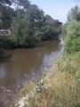
(10) Turn left and then follow the path, which becomes technical along the banks of the Uzkaingo Erreka stream. Stay along this stream. There are a few fords and sections that are best tackled carefully on foot.

(11) Reach Ascain by taking the road to the left, thenthe first left, and follow the mountain bike signposts.

(1) Turn right until you reach the car park (S/E).

Waypoints

  1. S/E : mi 0 - alt. 43 ft - Ste-Marie School car park
  2. 1 : mi 0.25 - alt. 121 ft - Arraioko Erreka stream
  3. 2 : mi 0.4 - alt. 128 ft - To the right of the stream, following the mountain bike signposts
  4. 3 : mi 1.35 - alt. 325 ft - Tarmac road
  5. 4 : mi 1.74 - alt. 525 ft - Junction before the D4
  6. 5 : mi 3.05 - alt. 774 ft - Junction with alternative route
  7. 6 : mi 3.31 - alt. 932 ft - Suhalmendi
  8. 7 : mi 3.66 - alt. 807 ft - Track on the right.
  9. 8 : mi 4.33 - alt. 597 ft - Junction on the left.
  10. 9 : mi 4.92 - alt. 702 ft - Track on the right
  11. 10 : mi 5.58 - alt. 456 ft - Turn left onto the path. Stream.
  12. 11 : mi 7.55 - alt. 89 ft - Road to the left
  13. S/E : mi 8.77 - alt. 39 ft - Ste-Marie School car park.

Reviews and comments

3.7 / 5
Based on 4 reviews

Reliability of the description
3.8 / 5
Ease of following the route
3.8 / 5
Route interest
3.5 / 5
filiplacour
filiplacour

Overall rating : 5 / 5

Date of your route : Dec 15, 2025
Reliability of the description : ★★★★★ Very good
Ease of following the route : ★★★★★ Very good
Route interest : ★★★★★ Very good
Very busy route : Yes

A very pleasant route in this direction, the climb is sheltered, and the final steep section is quite manageable and sunny (on that day). The descent along the track is also very enjoyable as you can take in the view. As usual, we have a small picnic at the summit, where we can enjoy a 360° view through our binoculars and count the vultures overhead, with red kites often making an appearance.

Machine-translated

Jeanchriq
Jeanchriq

Overall rating : 1 / 5

Date of your route : Oct 24, 2024
Reliability of the description : ★☆☆☆☆ Very disappointing
Ease of following the route : ★☆☆☆☆ Very disappointing
Route interest : ★☆☆☆☆ Very disappointing
Very busy route : No

Route completed in October 2024. The first section was extremely technical. It’s not just a stony track when you have to get off your bike every 5 metres! Had to turn back
Rated ‘Moderate’ in terms of difficulty. It’s under-rated. ‘Difficult’ or even ‘technical’ would be more appropriate
Disappointing

Machine-translated

jrc
jrc

Overall rating : 4.3 / 5

Date of your route : Jul 06, 2020
Reliability of the description : ★★★★★ Very good
Ease of following the route : ★★★★★ Very good
Route interest : ★★★☆☆ Average
Very busy route : No

The route description is entirely accurate. However, this route is more of a walking trail than a mountain bike trail. Indeed, the path is covered in huge, slippery stones. You need to be extremely careful, otherwise you’re bound to fall.
Despite this, there is a lovely stretch through the forest and a stunning view from the summit of Suhalmendi, offering a magnificent panorama.

Machine-translated

Eulali
Eulali

Overall rating : 4.3 / 5

Date of your route : Sep 23, 2019
Reliability of the description : ★★★★☆ Good
Ease of following the route : ★★★★☆ Good
Route interest : ★★★★★ Very good

The route follows the description exactly; however, I have a few comments regarding the nature of the terrain, particularly the section running alongside the stream towards the ‘Terminen Muga’ sheepfold. Although this path is flat, it presents numerous difficulties along almost its entire length due to the presence of stones, which cause riders to lose their balance constantly, leading to falls.
I would therefore advise against using clipless pedals on this section. For greater safety, opt instead for flat pedals to minimise the risk of falls (both to yourself and your equipment).
The rest of the route presents no difficulties (including the descents), apart from the climb to the summit of Suhalmendi, which still requires a good effort on the pedals…
Beautiful 360° panoramic view

Machine-translated

For more walks, use our search engine .

The GPS track and description are the property of this route's author. Please do not copy them without permission.