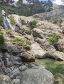
Monte d’Oro

A physically demanding hike where you’ll climb 1,400 metres over the first 5 km. This is a route featuring numerous sections where you’ll need to use your hands, with a few challenging passages.
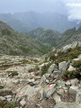
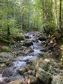
The descent follows a section ofthe GR®20. You’ll have the chance to admire magnificent scenery ranging from moss-covered woodland to high mountain landscapes.

Details

n°35081694
Creation:
Last update:
Last review:
  • Walking
    Activity: Walking
  • ↔
    Distance: 9.81 mi
  • ◔
    Duration according to the author: 8 hrs 
  • ▲
    Difficulty: Very difficult

  • ⚐
    Back to start: Yes
  • ↗
    Ascent: + 4,934 ft
  • ↘
    Descent: - 4,915 ft

  • ▲
    Highest point: 7,825 ft
  • ▼
    Lowest point: 2,986 ft
  • ⚐ Country: France
  • ⚐ City: Vivario (20219)
  • ⚑
    Start/End: N 42.128323° / E 9.133917°
  • ❏
    IGN map(s): Ref. 4251OT, 4251OTR, 4252OT, 4252OTR
  • Hour-by-hour weather

Photos

Description of the walk

(S/E) From Vizzavona station, you’ll easily find the path which starts on theGR®20, as it’s well signposted.

(1) Just after the first footbridge, take the second one on your right, then follow the path heading north, marked with yellow dots. A sign reads: Bergeries de Pozzatelli. You’ll cross the forest track several times on this steeply ascending section. You’ll reach a flat area below the Bocca di Pozzi, where there’s a spring hidden beneath some boulders. It’s marked by a sign and an inscription painted on a rock.

(2) Continue along the path to the Couloir de la Scala.

(3) The climb here is quite steep; at times you’ll need to use your hands. The path winds its way through boulders from which water trickles. Snow may also remain until early summer. You’ll reach a dip below Pratu Scampicciolu.

(4) Continue towards the summit and skirt round it to the south. After crossing some boulders, you’ll reach a grassy ledge on a ridge.

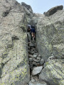
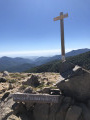
(5) To reach the summit, you must approach the summit bastion from the east, starting from the grassy plateau. The ascent involves climbing over large boulders, including some moves up a chimney. Some boulders are loose, so take care. One final, slightly challenging step and you’ll catch sight of the summit cross!

(6) Descend by downclimbing, then return to the path junction.

(5) The next section takes you through a field of boulders where you’ll need to use your hands a little. You’ll arrive at the small pass known as Bocca di Porco.

(7) View of Lac d’Oro. The path descends to your left over scree. On this section, you’ll need to scramble down a short section. You’ll reach the junction with theGR®20.

(8) Head down to your left. From here on, the path will be much better signposted.

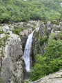
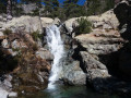
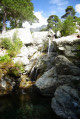
(9) At this point, if you veer off the path to the right, you can see a large waterfall (unnamed?) in a canyon. The path features numerous steps and boulders.

(10) You’ll pass by the Cascade des Anglais, where you can go for a swim if conditions allow. Stay on theGR®20, following the sign for ‘Gare de Vizzavona’.
Carry on to a small inn where you cross the Agnone via a footbridge.

(11) The path splits in two; turn right and you’ll come out onto a track at a hairpin bend.

(12) Take the path on the right to end up on a wide track leading to the first footbridge you crossed at the start of the route.

(1) Follow the path and the road from the start, in the opposite direction, to return to Vizzavona station (S/E).

Waypoints

  1. S/E : mi 0 - alt. 2,986 ft - Gare de Vizzavona
  2. 1 : mi 0.53 - alt. 3,130 ft - Junction of the circular loop
  3. 2 : mi 3.22 - alt. 6,181 ft - Spring
  4. 3 : mi 3.61 - alt. 6,647 ft - La Scala Couloir
  5. 4 : mi 3.75 - alt. 7,133 ft - Pratu Scampicciolu
  6. 5 : mi 4.07 - alt. 7,726 ft - Return journey - Monte d'Oro
  7. 6 : mi 4.14 - alt. 7,815 ft - Monte d'Oro
  8. 7 : mi 4.72 - alt. 7,001 ft - Bocca di Porco
  9. 8 : mi 5.1 - alt. 6,617 ft - Junction of the trail and the GR20
  10. 9 : mi 6.22 - alt. 4,865 ft - View of a waterfall (unnamed?)
  11. 10 : mi 7.68 - alt. 3,793 ft - Cascade des anglais
  12. 11 : mi 8.76 - alt. 3,297 ft - Junction
  13. 12 : mi 8.94 - alt. 3,212 ft - Path/track junction
  14. S/E : mi 9.81 - alt. 2,986 ft - Gare de Vizzavona

Notes

The path is marked with yellow dots; the section on theGR®20is marked with red and white stripes.

You do not need any climbing equipment.
Make sure you wear waterproof walking boots. The route is quite wet and may be snow-covered even in early summer.
Walking poles will come in handy if you have a way of attaching them to your rucksack during the short climbing sections.

You’ll find a spring about a third of the way into the walk.

You won’t have mobile phone coverage for most of the walk.

Check the weather forecast before setting off.

Worth a visit

You can take a short detour at the start of the path, just after the ‘1 ’, to find the ‘Mains d’Or’, which are signposted.

Always be cautious and plan ahead when you're outdoors. Visorando and the author of this route cannot be held responsible for any accidents occurring on this route.

The GR® and PR® markings are the intellectual property of the Fédération Française de Randonnée Pédestre.

Reviews and comments

4 / 5
Based on 2 reviews

Reliability of the description
4.5 / 5
Ease of following the route
3 / 5
Route interest
4.5 / 5
christophe FABRY
christophe FABRY

Overall rating : 4 / 5

Date of your route : Sep 01, 2026
Reliability of the description : ★★★★☆ Good
Ease of following the route : ★★★★☆ Good
Route interest : ★★★★☆ Good
Very busy route : Yes

A challenging hike; you’ll need to be in good physical shape, but the view from Mount Oro is well worth the effort. Make sure you take plenty of water in case of hot weather, though there are opportunities to refill your water bottle along the route near streams. The ascent becomes technical as you approach Mount Oro, but if you take your time, it’s manageable without specialist equipment. The descent via the GR 20 is mainly over rocky terrain, so suitable footwear is essential. The use of walking poles is recommended to make the descent easier.

Machine-translated

Arthur_mdn
Arthur_mdn

Thank you for your constructive feedback!

Machine-translated

Manu LETERRIER
Manu LETERRIER

Overall rating : 4 / 5

Date of your route : Sep 08, 2025
Reliability of the description : ★★★★★ Very good
Ease of following the route : ★★☆☆☆ Disappointing
Route interest : ★★★★★ Very good
Very busy route : No

Hiking experience in Corsica, Mare à Mare Sud three years ago, GR 20 completed in 11 days in 2020; this hike around Monte d'Oro is very difficult, marking the wildest and roughest stages of the GR20 North. The markings are fairly discreet and the cairns left by our predecessors are very useful. Everything is fine once you find the GR20 North 20 trail for the last third of the hike and the return to VZVN. Very few people on this hike, sublime views, to be done with experience, good physical condition (big elevation gain and fairly exposed passages where you have to use your hands), good equipment, food and 2 litres of water per person in sunny early September weather conditions

Machine-translated

Other walks in the area

For more walks, use our search engine .

The GPS track and description are the property of this route's author. Please do not copy them without permission.