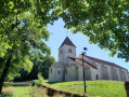
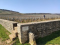
Montagne de Villars as seen from Concœur

A lovely walk around the charming village of Concœur, amongst vineyard plots and the Mantuan Forest. The Montagne de Villars viewpoint offers a stunning view of the Meuzin valley and the Hautes Côtes de Nuits vineyards.

Details

69390545
Creation:
Last update:
Last review:
  • Walking
    Activity: Walking
  • ↔
    Distance: 4.05 mi
  • ◔
    Average duration: 2h 10 
  • ▲
    Difficulty: Moderate

  • ⚐
    Back to start: Yes
  • ↗
    Ascent: + 387 ft
  • ↘
    Descent: - 397 ft

  • ▲
    Highest point: 1,578 ft
  • ▼
    Lowest point: 1,198 ft

Description of the walk

Park in the Concœur cemetery car park.

(S/E) Take the road that climbs up towards the plateau and continue for about 500 m. 

(1) Take the first forest track on the left and follow it straight on; after 1 km, you’ll reach the Plateau de Mantuan walking trail, which you should follow, keeping to the left.

(2) At the junction, go straight on and follow the western flank of Montagne de Villars for about 1 km, until you reach the point where the walking trail descends towards Villars-Fontaine.

(3) Take a small, inconspicuous path on your left which continues to run along the plateau without descending into the valley. The path winds past a few rocks and clearings, offering lovely views over the Meuzin valley and the villages below, before joining the hiking trail that climbs up from Villars-Fontaine. Follow it to the left for just a few metres to reach a small sign pointing to a viewpoint on the right. 

(4) Turn right here and carry on to the viewpoint, which is actually a clearing maintained for paraglider and microlight take-offs.

(5) Head up towards the top of the clearing, where a small track will take you back to the hiking trail you left at the sign. Let a path on the right lead downhill, then turn right onto the hiking trail at the next junction, and carry on straight ahead. 

(6) Turn right, walk on for a few dozen metres, then turn sharply left. About fifty metres further on, turn sharply right and you’ll reach a junction. 

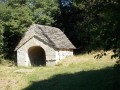
(7) Leave this path, which descends straight down a steep slope towards the bottom of the valley, and turn right at a 90° angle onto another path. Descend steeply for about 500 m, pass over a small reservoir and emerge at the edge of the vineyard. 

(8) Turn sharply left onto the footpath, follow the edge of the woodland, then head down to the right towards the valley floor. Reach the junction with a path that climbs up from the D109 towards the woodland, running alongside a ditch, and turn sharply right at this point. 

(9) Head up to the left to the edge of the forest, follow the path climbing up to the right to join a hiking trail. Follow this trail in the same direction to reach the village of Concœur.

(10) Head straight ahead to reach the main road, turn left to pass in front of the church and continue straight on to reach the cemetery car park (S/E). 

Waypoints

  1. S/E : mi 0 - alt. 1,355 ft - Cemetery car park
  2. 1 : mi 0.22 - alt. 1,509 ft - Junction, turn left
  3. 2 : mi 0.98 - alt. 1,568 ft - Junction, go straight on
  4. 3 : mi 1.53 - alt. 1,522 ft - Start of the path on the left
  5. 4 : mi 1.8 - alt. 1,529 ft - Viewpoint sign
  6. 5 : mi 1.86 - alt. 1,542 ft - Villars Mountain Viewpoint
  7. 6 : mi 2.58 - alt. 1,568 ft - Junction, turn right
  8. 7 : mi 2.77 - alt. 1,457 ft - Right-angle bend to the right
  9. 8 : mi 3.02 - alt. 1,240 ft - Exit onto the vineyard
  10. 9 : mi 3.33 - alt. 1,198 ft - Right-angled junction, turn left
  11. 10 : mi 3.76 - alt. 1,322 ft - Entrance to Concœur
  12. S/E : mi 4.05 - alt. 1,355 ft - Cemetery car park

Worth a visit

Jam and red berries are on sale at the shop in the village.

Reviews and comments

4.3 / 5
Based on 2 reviews

Reliability of the description
4 / 5
Ease of following the route
4 / 5
Route interest
5 / 5
FKNECHT
FKNECHT

Overall rating : 4.7 / 5

Date of your route : Apr 13, 2026
Reliability of the description : ★★★★★ Very good
Ease of following the route : ★★★★☆ Good
Route interest : ★★★★★ Very good
Very busy route : No

A really nice route. We did it with children aged 6 and 11. No particular difficulties. Plenty of shade. There’s a slight deviation from the route near the take-off area, but nothing insurmountable.

Machine-translated

yves 21
yves 21

Hello
Here's my problem
I've had problems with tracking several times. I trace my computer, transfer it to my mobile phone, and it works fine. It follows the paths well, but when I put the tracks in place, it doesn't follow them. I need straight red tracks that have nothing to do with the path.

Machine-translated

brion chantal
brion chantal

Overall rating : 4 / 5

Date of your route : Jun 09, 2025
Reliability of the description : ★★★☆☆ Average
Ease of following the route : ★★★★☆ Good
Route interest : ★★★★★ Very good
Very busy route : No

Lost between numbers 2 and 3. Found the trail again at the viewpoint. Lost again towards the end. We followed part of the trail
followed the path marked with white and green lines. We know the area a little, which helped us find our way back
find our way back. We walked along paths we didn't know.

Machine-translated

Other walks in the area

For more walks, use our search engine .

The GPS track and description are the property of this route's author. Please do not copy them without permission.