


 Country:
 City:


Starting point: Concœur cemetery car park.
(S/E) Head due south along the road that climbs towards the plateau. It turns into a track and, after a 500-metre climb, the first forest path branches off to your left.
(1) Take this path, which, after 1 km, leads you back to a track that you follow to the left. Then, on your right, you’ll see a sign for the Sentier de Vergy.
(2) Take this path to the right. It runs along the western slope of the Montagne de Villars (below you on your right) for about 1 km. Suddenly, the path drops steeply towards Villars Fontaine. Leave it on your right; a small, inconspicuous track continues along the plateau on your left, without descending towards the Meuzin Valley.
(3) Head due south along this inconspicuous path on your left. It runs past a few rocks and clearings offering fine views of the Meuzin Valley and its villages below, and joins the hiking trail leading up from Villars Fontaine. Follow it to the left for just a few metres, then turn right towards the viewpoint.
(4) This viewpoint is a clearing maintained for paraglider and microlight take-offs. Head up towards the top of the clearing where a small path takes you back to the hiking trail, which you’ll follow to the right for about 2 km. Then let a path descend to your right, and, after 300 m, a marked path descends to the right.
This is a tricky section: do not stray from the GPS track!
(5) Take the marked path on the right; after 50 m, turn left, then right; after 200 m, turn right again, then descend steeply for just under 1 km (without heading down towards the valley). At the bottom of the slope, you’ll reach the edge of the vineyard.
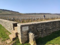
(6) Then turn right and take the path which, emerging from the copse, leads into the middle of the vineyard. There, a path on the left, running perpendicular to the slope, continues the descent through the vines.
(7) Take this straight path, which winds through the vines, until you reach the D109. Cross the road carefully, then, turning right and then left, continue straight ahead along the path that leads back to the top of the western slope of the Combe Pernant.
(8) Turn left onto the small path that heads down towards the top of the Cascade de la Serrée (usually dry), and climb up the other side to Le Bâtier. Follow it, skirting the cliffs of the Combe Pernant (on your right), on the eastern slope. After 500 metres, you’ll reach the Combe Pernant viewpoint. A small spring crosses the path and trickles down the rock face as a waterfall.
(9) Take in the view from the belvedere, admire the spring, then continue along the Sentier Bâtier for 100 metres until you reach a path that climbs to the left, towards the vineyards.
(10) Leave the Sentier Bâtier, climb to the left, then, just before emerging from the woods into the vineyard on the neighbouring plateau, turn left onto the path that leads back into the woods. Continue through the woods for just over 500 metres, and you’ll rejoin the Sentier Bâtier on your left, which leads back to the D109.
(11) Cross the road carefully, then head up the bottom of a small valley to the edge of the woodland, leaving the Sentier Bâtier on your right. A small path at the edge of the woodland climbs to the right.
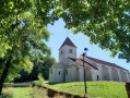
(12) Follow it until you join a hiking trail that leads gently back towards the village of Concœur. Walk through the village and you’ll come to the cemetery (S/E).

 Visorando Member


 Difficult
 Easy

