Country:
 City:


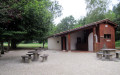
Park at the car-sharing area, Place des Frères Tolot, in front of the Salle des Fêtes.
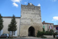
(S/E) Leave the car park and head to the right towards the village centre. Pass Place de la Bascule, then enter the village via the Grande Rue. Pass Place du Puits, then walk past the Town Hall and continue to the Church of Notre-Dame on the right: open to visitors. After the church, carry on to the next street on the left, Rue du Lac.
(1) Walk down this street, then cross the road and continue straight ahead towards Les Glycines: there is a Yellow Cross on the left. Walk past the sewage treatment plant and go round the bottom of it along the grassy path. Pass through the hamlet of Jouanlong and continue along the grassy path opposite until you reach the junction with another path on the right, marked in yellow and orange.
(2) Ignore this path and continue straight ahead along the grassy path. At the end of this path, near the house in the hamlet of Bouzon, carry on along the tarmac road until you reach the junction with the Route de l’Auvignon.
(3) Turn left onto this road. Pass through the hamlet of La Penchade and continue down the road.
(4) Once at the bottom, after the hamlet of La Tuilerie, take the stony path on the right, marked with yellow signs. Carry on for a further 300 m past the house in the hamlet of Mouret.
(5) At the crossroads, follow the path on the right which climbs alongside a hedge, marked with a yellow arrow. Continue along this steep, stony path through the woods for about 500 metres, passing a ruined house and continuing the climb. Leave the buildings at Lougratte on your right, pass through the hamlet of Le Hiteau, and continue straight ahead along the grassy path. Pass an old wash house and arrive at the junction with a path where there is a small menhir opposite.
(6) Turn right, then join a road and turn left towards the village. Leave the road briefly to go round the cemetery, rejoin it and continue to the right to enter the village via the Grande Rue.
(1) Carry on straight ahead to finish crossing the village and reach the car-sharing area (S/E).

 Visorando Member
 Easy