Mont Cima, Cime de l’Eurier and the ancient ruins of Aspremont

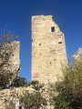
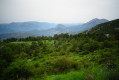
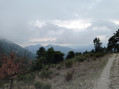
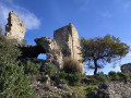
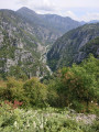
This wild and scenic circular route takes you on a journey of discovery through three iconic sites in the hills around Nice: Mont Cima (878 m), the Cime de l’Eurier (807 m) and the ruins of Vieux Aspremont. With open ridges, Mediterranean forests and breathtaking views over the Baie des Anges and the Nice hinterland, this varied hike offers a complete immersion in nature.

Details

n°69253175
Creation:
Last update:
Last review:
  • Walking
    Activity: Walking
  • ↔
    Distance: 6.84 mi
  • ◔
    Average duration: 4h 50 
  • ▲
    Difficulty: Moderate

  • ⚐
    Back to start: Yes
  • ↗
    Ascent: + 1,906 ft
  • ↘
    Descent: - 1,903 ft

  • ▲
    Highest point: 2,881 ft
  • ▼
    Lowest point: 1,660 ft

Photos

Description of the walk

Park at the Sainte-Claire car park. Access by bus is available via route 19, Sainte-Claire stop. 

(S/E) Join the main road (Avenue Félix Faure) and turn right for 100 m. 

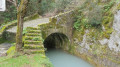
(1) Leave the avenue and take the small road on the right. Cross the stone bridge and follow the path (GR®5) for about 2.5 km, ignoring the offshoots to the right and left. You’ll reach a three-way junction (elevation 522) at marker 300. 

(2) Leave the track you have been following and take the Piste Rocca Partida (GR®5), which climbs to the left. Pass a mobile phone mast and continue until you reach a DFCI water tank with a mushroom graffiti design (elevation 565).

(3) Leave the track and take the path (GR®5) on the right through the woodland. Turn left at the three-way junction to rejoin the track (elevation 609). 

(4) Take the stony path in the middle (GR®5): on the right is a track leading downhill; on the left, a level track. You’ll reach a junction (marker 708). 

(5) Leave the GR®5. Carry on straight ahead, ignoring the path leading down to the left. 

(6) Stay on the stony path, ignoring the one that branches off to the right, and head for Mont Cima (elevation 878).

(7) There is a huge cairn; use the orientation boards to learn more about the mountains. Then carry on in the same direction until you come out onto a track. 

(8) Turn left onto it and walk for about 150 metres. 

(9) Turn off to the right. From this point onwards, there is no longer a proper, maintained path, but rather animal tracks that you can follow. Pass the Cime de l’Eurier and reach the ruins of Vieil Aspremont (816 metres): please respect the site whilst enjoying the exceptional view. 

(10) Turn back and follow the outbound route in the opposite direction to the car park (S/E). 

Waypoints

  1. S/E : mi 0 - alt. 1,683 ft - Car park
  2. 1 : mi 0.09 - alt. 1,673 ft - Junction for both outbound and return routes
  3. 2 : mi 0.75 - alt. 1,719 ft - Rocca Partida track
  4. 3 : mi 1.37 - alt. 1,857 ft - Water reservoir
  5. 4 : mi 1.58 - alt. 1,998 ft - Middle path
  6. 5 : mi 2.05 - alt. 2,320 ft - Junction, go straight on
  7. 6 : mi 2.32 - alt. 2,648 ft - Continue to the left
  8. 7 : mi 2.63 - alt. 2,881 ft - Mont Cima - Mont Cima
  9. 8 : mi 2.89 - alt. 2,461 ft - Track
  10. 9 : mi 3 - alt. 2,415 ft - This route is not maintained
  11. 10 : mi 3.42 - alt. 2,621 ft - Ruins of Aspremont
  12. S/E : mi 6.84 - alt. 1,683 ft - Car park

Notes

There is only one water source: the fountain at Saint-Clair. 

Worth a visit

Castel de Saint-Blaise. 

Always be cautious and plan ahead when you're outdoors. Visorando and the author of this route cannot be held responsible for any accidents occurring on this route.

The GR® and PR® markings are the intellectual property of the Fédération Française de Randonnée Pédestre.

Reviews and comments

4.7 / 5
Based on 1 review

Reliability of the description
5 / 5
Ease of following the route
5 / 5
Route interest
4 / 5
User 9654088

Overall rating : 4.7 / 5

Date of your route : Feb 02, 2026
Reliability of the description : ★★★★★ Very good
Ease of following the route : ★★★★★ Very good
Route interest : ★★★★☆ Good
Very busy route : No

A beautiful winter hike, but I didn't do the round trip to the summit of Eurier. Instead, I continued along the path down to the "ruins of Aspremont" signpost and rejoined the GR5 to make a circular hike and return to the B844.

Machine-translated

Other walks in the area

For more walks, use our search engine .

The GPS track and description are the property of this route's author. Please do not copy them without permission.