Country:

 City:


Leave the N106 at altitude 901 on the IGN map and take the forest track (signposted ‘DFCI reservoir’).
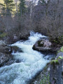
After about 300 m, park after the small bridge (over the Ruisseau Le Lançon) in the clearing at the junction of two tracks.Beyond this junction, vehicle access is prohibited.
(S/E) Turn right onto the main track (heading north), continuing on level ground until you reach a Fork in the road (IGN elevation 900).
(1) Turn left onto the ascending track. Then pass the first forestry track on your left, situated about 400 m further on. Some 1,200 m further on, still climbing, after a right-hand bend and before a left-hand bend, a second forestry track begins, branching off completely to the left (IGN elevation 1,025).
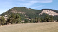
(2) This fairly wide but grassy track, which is rarely used, heads eastwards with a few ascents and descents, roughly 50 to 80 m below the edge of the Causse, offering views towards the valley. After about 1.2 km, the track narrows to a path.
(3) The path, which is sometimes steep for a distance of approximately 2 to 300 metres, then widens as it skirts the northern ridge of the Causse de Sauveterre. After an ascent, it reaches a junction with the path leading down from the plateau. This is also point no. 9 of walkno. 110494415
(4) From this junction (which is also point no. 9 on walk no.110494415), just below a cairn, continue straight on southwards along the path (though it is sometimes just a narrow track due to the vegetation), which generally descends, until you reach a Fork in the road at the bottom of a fairly steep descent, opposite some branches lying across the path (IGN elevation 993).
(5) Turn sharply left here to take, heading north, a faintly marked path (vegetation on the ground), which will lead to a much wider dirt track.
(6) Turn sharply right, heading downhill along this track towards the bottom of the valley, until you reach a junction at a bend in the track.
(7) At this bend, continue to the left, ignoring the track heading uphill to the right – it is blocked a little further on by large tree trunks – which is why you should take the narrow, poorly marked path between points (5) and (6) to reach the car park (S/E).
 Visorando Member

 Association / Club / Walk leader