


Refine your search for walks in Magnan (fleuve)
Magnan (fleuve) walks


 Old Aspremont
 Visorando Member

 2.22 mi
 +1,024 ft
 -1,024 ft
 1h 55
 Moderate
 Departure from Aspremont (Alpes-Maritimes) (Alpes-Maritimes)
Starting from the charming village of Aspremont, this short but challenging round trip hike takes you up to Vieil Aspremont, the ruins of the old village abandoned in 1426.
Short circular loop starting from Aspremont
2.91 mi
+1,079 ft
-1,083 ft
2h 15
Moderate
Departure from Aspremont (Alpes-Maritimes) (Alpes-Maritimes)
This circular route starting from Aspremont is relatively short. During the descent, it offers a beautiful view of the village itself and the Var valley.You can also discover its Mediterranean vegetation.
Tour of the upper Magnan valley via Saint-Pancrace and the hamlet of La Sirole
 4.28 mi
+1,043 ft
-1,033 ft
2h 55
Moderate
Departure from Nice (Alpes-Maritimes)
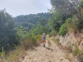
This easy walk, partly through woodland, follows the right bank of the upper Magnan valley via the Pont and the Chemin du Génie to Saint-Pancrace, before crossing to the right bank via the Pont du Pommier. After the Pont du Pommier and having crossed the Route de Sirole, you join the Chemin des Crêtes de Bergiade and the Chemin de Bergiade to descend the right bank of the Vallon de Magnan and reach the Boulevard de la Madeleine, after crossing the Ravin des Vallières. This walk can be combined with an exploration of the hidden valleys of Magnan and the Ravin des Vallières.
The Vallon Obscur du Magnan
 1.29 mi
+180 ft
-157 ft
0h 45
 Easy
Departure from Nice (Alpes-Maritimes)
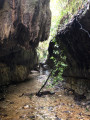
Discover an unusual, damp and narrow natural space, situated in… Nice! A change of scenery is guaranteed as you walk in or alongside the ‘Magnan’ stream.
This spot, frequented by our ‘elders’ many years ago, is little known to the general public. The Vallon de Magnan, carved out of a type of rock known as ‘poudingue’, forms part of an ecosystem known as the ‘vallons obscurs’.
Please read the ‘Practical Information’ section before venturing into the valley.
Levens - Nice
13.55 mi
+2,077 ft
-3,734 ft
8h 00
 Difficult
Departure from Alpes-Maritimes
Étape de la traversée des Alpes de Levens jusqu'à Nice. Randonnée permettant de traverser la bande littorale typiquement méditerranéenne et arriver à la Mer Méditerranée à Nice.
GTA, Great Alpine Crossing via the GR®5 and GR®55. From Lake Geneva to Nice.
 342.76 mi
+99,633 ft
-100,915 ft
21 days
 Very difficult
Departure from Saint-Gingolph (Haute-Savoie)
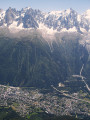
The Grande Traversée des Alpes (GTA) mainly follows the GR®5, with a few possible variations such as the crossing of the Haute Vanoise via the GR®55 and the Via Alpina, which this route takes instead of the GR®5 route via the Col de l’Iseran. It crosses the French Alps from north to south, from Saint-Gingolph to Nice. The guide includes web links to the many accommodation options along the route or nearby: mountain huts, lodges, campsites, cabins and shelters, excluding hotels. Although this guidebook details the GTA as a three-week trek, it can be adapted to suit your own pace, with stages of varying lengths, either completed in one go or in sections over several years. This journey, fuelled by the joy of freedom in unspoilt natural surroundings, will remain a superb and unforgettable experience, offering, moreover, the opportunity to meet many people with whom you can share this same passion for the mountains.
From Utelle to Nice Ville railway station
 21.50 mi
+3,806 ft
-6,385 ft
13h 10
Difficult
Departure from Utelle (Alpes-Maritimes)
This twenty-first stage, once you have crossed the Vésubie, takes place in the Nice Pre-Alps and brings the GTA (Grande Traversée des Alpes) to a close by the sea. From the Place de la Fontaine in Utelle, the GR®5 heads west, then south, crossing a few small valleys to reach the hamlet of Cros d’Utelle. It crosses the Vésubie valley, climbs the opposite slope after the town of Levens, ascends through woodland to Colla Partida, passes beneath Mont Cima and descends to the beautiful circular fortified village of Aspremont. The path climbs the western flank of Mont Chauve d’Aspremont without reaching the summit. It descends the Crête de Graus until it reaches Château Renard and then La Bauma. The path enters a valley, which it follows eastwards, then due south towards La Fontaine Sainte, and crosses the bridge over the Autoroute de la Provençale. It enters the city of Nice, which it crosses from north to south to reach Nice Ville railway station.