The forgotten transport routes around Abainville

A lovely circular route through southern Meuse combining meadows, canals, disused railway lines, pretty villages and fields of wind turbines stretching as far as the eye can see.

Details

1448156
Creation:
Last update:
Last review:
  • Walking
    Activity: Walking
  • ↔
    Distance: 9.21 mi
  • ◔
    Average duration: 4h 35 
  • ▲
    Difficulty: Moderate

  • ⚐
    Back to start: Yes
  • ↗
    Ascent: + 413 ft
  • ↘
    Descent: - 433 ft

  • ▲
    Highest point: 1,273 ft
  • ▼
    Lowest point: 919 ft
  • ⚐ Country: France
  • ⚐ City: Abainville (55130)
  • ⚑
    Start/End: N 48.530685° / E 5.494343°
  • ❏
    IGN map(s): Ref. 3216SB
  • Hour-by-hour weather

Photos

Description of the walk

Park in Abainville, at Place de l’Église or in the car park near the community hall and the cemetery behind the Town Hall.

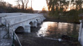
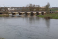
(S/E) To the left of the church, take Rue Saint-Martin to the junction (children’s playground), turn right then left to cross the first bridge, admire the wash house and cross the second bridge to reach the left bank of the Ornain.

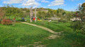
(1) Turn right immediately after the second bridge and follow the path through the meadow until you reach the old railway line (rails still in place).

(2) Follow the railway line until you reach a former gatekeeper’s cottage (No. 17).

(3) Leave the railway track and take the path on the right towards Houdelaincourt. Walk past a farm.

(4) Cross the railway line and, shortly afterwards, turn right to walk past the wash house, follow the river on the left and join the D960. Cross to the right, in turn, over the bridge over the Ornain, the railway line and the D960 (pedestrian crossing).

(5) Turn left onto the footbridge over the intake for the Marne–Rhine Canal.
Just past the silos, turn right onto the path – tarmac-surfaced at the start – which climbs north-eastwards (signposted Delouze-Rosières).

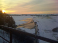
(6) At the telecoms mast, after the 384-metre mark, there is a panoramic view of the region’s wind farms. Continue straight on to the end of the track, at the 378-metre mark.

(7) Turn right and head down into the valley leading to the village of Delouze. Further down, join theGR®703alternative route.

(8) Walk through the village, then head uphill to the right to cross the D960 and take the path opposite leading to the cemetery.
Continue along the path (GR®703variant), passing below an isolated, inhabited property, until you reach a crossroads at an elevation of 323.

(9) Leave the track heading south-south-west, turn left, then immediately right onto the path – which may be somewhat overgrown with grass – following the old railway line, the tracks of which have been removed.
Follow the footpath along the track, cross a bridge and continue until the footpath leaves the track and turns off onto the path running alongside it to the left.
Continue along this track, passing the track on the right that leads to the old gatekeeper’s house (No. 33) at elevation 319, and carry on to the crossroads at elevation 315.

(10) Turn right, then left to rejoin the railway line, cross the viaduct and carry on to the next crossroads (gatekeeper’s house no. 32), at elevation 311.
Turn right onto the tarmac road leading to the village, cross the D966 and head right towards the bakery and patisserie.

(11) Turn left onto the Grande Rue, then, after 150 metres, turn right onto the Rue du Perche, which leads to the village castle at the end on the left.
Turn left, then right onto the path leading to the mill (round trip).
On the way back, carry on straight ahead until you reach the square where the old café used to be. Walk up the Grande Rue on the left to reach the finish at the Place de l’Église (S/E).


Waypoints

  1. S/E : mi 0 - alt. 958 ft - Church Square and Town Hall Square
  2. 1 : mi 0.18 - alt. 942 ft - The bridges over the > - Ornain (rivière)
  3. 2 : mi 0.76 - alt. 938 ft - Arrival on the Bar-le-Duc/Neufchâteau line
  4. 3 : mi 0.99 - alt. 938 ft - Gatekeeper’s house no. 17
  5. 4 : mi 1.76 - alt. 925 ft - Crossing the railway line
  6. 5 : mi 1.99 - alt. 925 ft - Houdelaincourt and the canal harbour
  7. 6 : mi 3.25 - alt. 1,260 ft - Telecoms mast
  8. 7 : mi 4.08 - alt. 1,243 ft - Crossroads for Delouze
  9. 8 : mi 4.81 - alt. 1,079 ft - Delouze
  10. 9 : mi 6.17 - alt. 1,063 ft - Arrival on the Brienne/Sorcy line
  11. 10 : mi 7.44 - alt. 1,037 ft - The Viaduct
  12. 11 : mi 8.38 - alt. 974 ft - Descent into the village
  13. S/E : mi 9.21 - alt. 958 ft - Church Square and Town Hall Square

Notes

Drinking water is available on arrival at the cemetery after Delouze. Except in winter.

Provisions available at the Abainville bakery, patisserie and grocery shop.

Binoculars for counting the wind turbines...

Worth a visit

Abainville: due to the presence of the River Ornain and the iron mines in the surrounding area, the village was once home to major forges which produced some of the parts and rivets used in the Eiffel Tower. This is reportedly indicated on a plaque affixed to the tower’s northern base.
In 1906, the forges gave way to a granite works, which is now modest in scale.
Owing to its location at the junction of major railway lines at the time, the village hosted a large camp for American troops at the end of the First World War.
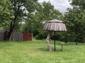
This history is commemorated at the lower end of the village, before the bridges over the river, by information boards and a totem pole.

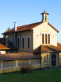
(S/E) The church, which is usually open (if not, ask Jean-Claude in the ochre-coloured house below), is in the Neo-Gothic style and dates from 1880; it bears witness to the village’s past wealth, or at least that of some of its inhabitants.

The village washhouse has recently been restored. Note the roof covered with ‘violin’ tiles.

The meadow, which is remarkably well-preserved, is criss-crossed by the meandering Ornain. To the left of the route, a marshy area is home to a variety of flora and fauna, including numerous amphibians.

The first railway line we follow linked Nançois-Tronville, near Bar-le-Duc, to Neufchâteau via Ligny-en-Barrois. Built between 1975 and 1883, it was closed to passenger traffic in 1969 and to freight in 2014.

(5) In Houdelaincourt, the canal harbour is still used by the agricultural co-operative to load grain and unload fertiliser. However, traffic on the canal is gradually being replaced by road transport.

The region has a particularly high concentration of wind farms, as evidenced by the viewpoint at elevation 384 between Houdelaincourt and Delouze. And further projects are in the pipeline...

(8) Delouze: a pretty little linear village, with several fountains, two wash houses – one at the entrance to the village and the other (Lavoir Saint-Pierre) in the centre – and a few notable houses.

(9) Here, you come to the second railway line, opened in 1892, which linked Brienne-le-Château to Sorcy-Saint-Martin and served a primarily strategic purpose. Note the beautiful cast-iron railings on the bridge. Avoid testing their strength…

(10) Follow the railway line again and cross a viaduct. This was destroyed in 1940 and rebuilt in 1941. It was only in use for a few years afterwards, as the line was decommissioned in 1953...
A lovely view to the west over Abainville, with lots of wind turbines on the horizon.
Warning: the guardrails are not maintained and, in some places, are non-existent. Do not lean on any remaining ones.

Abainville Castle: the present-day structure dates from the late 18th century, likely built on the site of a more heavily fortified castle better suited to protecting its occupants. It is said that underground passages lead from certain houses in the village to the castle, which would lend credence to this theory.

Abainville Mill: A fine, single-block building, stretching from the leat on the left – used for power generation – to the residential section on the right, via the milling area opposite the entrance. The mill ceased operations in the early 1960s.

Always be cautious and plan ahead when you're outdoors. Visorando and the author of this route cannot be held responsible for any accidents occurring on this route.

The GR® and PR® markings are the intellectual property of the Fédération Française de Randonnée Pédestre.

Reviews and comments

4.5 / 5
Based on 2 reviews

Reliability of the description
4.5 / 5
Ease of following the route
4.5 / 5
Route interest
4.5 / 5
philjacque
philjacque

Hello, Sylviane.
Thank you for your feedback.
Could you please indicate a little more precisely on the map where you came across the rubbish tip?
Thank you in advance.

Machine-translated

SYLVIANE16
SYLVIANE16

Overall rating : 4 / 5

Date of your route : Feb 21, 2021
Reliability of the description : ★★★★☆ Good
Ease of following the route : ★★★★☆ Good
Route interest : ★★★★☆ Good
Very busy route : No

It’s worth noting that after the first viaduct, there is a huge illegal tip of tarmac slabs and concrete… which blocks the path for about 50 metres. Some people have walked straight through it, whilst others have climbed over it to find a path further up.
At point 9, it is possible to continue along the GR;

Machine-translated

Jmarchal
Jmarchal

• Bermont Chapel – Leave a review (Click here)
• Notre-Dame-de-Bon-Secours in Châtenois – Give your opinion (Click here)
• The meanders of the River Sarthe - Share your opinion (Click here)
• The forgotten transport routes around Abainville - Share your thoughts (Click here)

These four routes have not yet been explored but will be in 2021.
I am writing to congratulate you on the quality of your work
Kind regards

JM

Machine-translated

philjacque
philjacque

Thank you for this very positive and encouraging comment. If you’re in the area or passing through, do give this walk a go too.

Machine-translated

franchie
franchie

Overall rating : 5 / 5

Date of your route : Feb 13, 2019
Reliability of the description : ★★★★★ Very good
Ease of following the route : ★★★★★ Very good
Route interest : ★★★★★ Very good

A lovely walk that allowed me to discover the hidden treasures of Delouze (washing houses) and other architectural details and scenery, which aren’t spoiled too much by the large number of wind turbines.
Thanks to Philjacque for the valuable practical and tourist information.

Machine-translated

Other walks in the area

For more walks, use our search engine .

The GPS track and description are the property of this route's author. Please do not copy them without permission.