Country:

 City:
City:


Park in the car park on Avenue Nessel (D40).
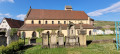
(S/E) From the car park, head towards St Nicholas’s Chapel, cross the Ohmabach stream and turn immediately right to follow the Blue Disc signposting along the stream, then cross it to reach the D40.
(1) Turn left to cross a stream and rejoin the path on the right. At the track, turn right then left.
(2) Follow the Red Ring markings to the four-way junction at the edge of the forest.
(3) Turn left, following the Yellow Disc markings, to Gauchmatt.
(4) Keep left on the D40, following the Blue Triangle markings; pass close to the Romanian cemetery and cross this road, a track and the fitness trail to reach the Langenstein Menhir.
(5) Continue, cross a track and take the path marked with a Blue Ring which climbs up to the Grossfels Rock. Follow it and, once you reach the rock, turn right following the Blue Triangle markings which go round St Lucy’s Chapel.
(6) Leave the road by immediately taking a path on the left marked with the Blue Ring, which leads back to the starting point, turning right at a Fork in the road and then left in front of the chapel (S/E).

 Visorando Member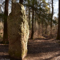
 Moderate
 Tourist office