Around Walscheid, following in the footsteps of Pope Leo IX

A short circular walk around Walscheid featuring points of interest such as the promontory overlooking the village and the site of the original chapel, the present-day Saint-Léon Chapel and the Saint-Léon Cave, the largest underground cavern in the Vosges Mountains.

Details

n°52761910
Creation:
Last update:
Last review:
  • Walking
    Activity: Walking
  • ↔
    Distance: 2.32 mi
  • ◔
    Average duration: 1h 25 
  • ▲
    Difficulty: Easy

  • ⚐
    Back to start: Yes
  • ↗
    Ascent: + 410 ft
  • ↘
    Descent: - 410 ft

  • ▲
    Highest point: 1,509 ft
  • ▼
    Lowest point: 1,089 ft

Photos

Description of the walk

Park at the car park by the Walscheid lake.

(S/E) From the lake, take the Route d’Alsace to the right for about 50 metres.

(1) Turn left into the narrow lane and continue to the main road (D96). Cross the junction with care and head left onto the path running alongside the road, to the right of the drainage channel. After the benches, cross the road again and take the Route Forestière de Saint-Léon opposite.

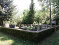
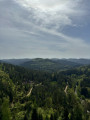
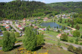
(2) Turn right onto the path marked with a Red Triangle and walk to the promontory, which offers a fine view of Walscheid. Head towards the remaining façade of the original chapel (information panel on the left), and continue to the village, following the Red Triangle markings. At the four-way junction, go straight on, follow the road all the way down, then turn right to rejoin the D96. Follow this road to the right for about forty metres.

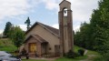
(3) Take the first path on the left and walk past Saint-Léon Chapel. Continue north towards Saint-Léon Grotto. At the fork about a hundred metres further on, turn right, then follow the sign for “Grotte Saint-Léon” to reach the grotto.

(4) Continue downhill until you reach the first houses.

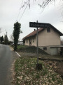
(5) At the first junction, turn right onto Chemin Léon IX and, at the end of the street, turn left onto Chemin de la Vallée. Cross the D96 and take the Route d’Alsace until you reach the original fork in the road.

(1) Go straight on, then turn left to reach the car park (S/E).

Waypoints

  1. S/E : mi 0 - alt. 1,099 ft - Car park - Plan d'eau de Walscheid
  2. 1 : mi 0.06 - alt. 1,102 ft - Junction of the circular loop. Near the - Bièvre (rivière) - Affluent de la Sarre
  3. 2 : mi 0.36 - alt. 1,257 ft - Path on the right, leading uphill
  4. 3 : mi 1.13 - alt. 1,457 ft - Start of the trail - Chapelle Saint-Léon (Saint-Léon)
  5. 4 : mi 1.44 - alt. 1,342 ft - Grotte de Saint Léon
  6. 5 : mi 1.85 - alt. 1,145 ft - Léon IX Path
  7. S/E : mi 2.32 - alt. 1,099 ft - Car park - Plan d'eau de Walscheid

Worth a visit

Walscheid.

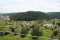
Saint-Léon promontory, panoramic view of Walscheid and the site of the first chapels.
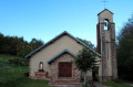
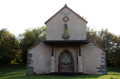
(3) Saint-Léon Chapel, built in 1954.

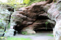
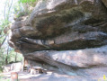
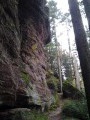
(4) Saint-Léon Cave, the largest underground cavern in the Vosges Mountains.

Reviews and comments

4.3 / 5
Based on 2 reviews

Reliability of the description
4 / 5
Ease of following the route
4 / 5
Route interest
5 / 5
maxjuju
maxjuju

Overall rating : 3.7 / 5

Date of your route : Oct 21, 2024
Reliability of the description : ★★★☆☆ Average
Ease of following the route : ★★★☆☆ Average
Route interest : ★★★★★ Very good
Very busy route : No

The description wasn’t detailed enough – we got lost

Machine-translated

Olive1
Olive1

Overall rating : 5 / 5

Date of your route : Aug 30, 2024
Reliability of the description : ★★★★★ Very good
Ease of following the route : ★★★★★ Very good
Route interest : ★★★★★ Very good
Very busy route : No

There were six of us friends that Monday, and it looked set to be a lovely day… sunny and just the right temperature for this walk… it turned out to be a lovely experience…

Machine-translated

Other walks in the area

For more walks, use our search engine .

The GPS track and description are the property of this route's author. Please do not copy them without permission.