Les alouettes via Estrée-Cauchy

Venez prendre un bol d'air en passant par les villages de Servins, Estrée-Cauchy et Fresnicourt-le-Dolmen.

Details

67266704
Creation:
Last update:
Last review:
  • Walking
    Activity: Walking
  • ↔
    Distance: 6.77 mi
  • ◔
    Average duration: 3h 20 
  • ▲
    Difficulty: Moderate

  • ⚐
    Back to start: Yes
  • ↗
    Ascent: + 226 ft
  • ↘
    Descent: - 223 ft

  • ▲
    Highest point: 561 ft
  • ▼
    Lowest point: 367 ft
  • ⚐ Country: France
  • ⚐ City: Servins (62530)
  • ⚑
    Start/End: N 50.408316° / E 2.634303°
  • ❏
    IGN map(s): Ref. 2405O, 2406O
  • Hour-by-hour weather

Photos

Description of the walk

Start at Place du Jeu de Paume.

(S/E) Leave the car park with the chapel on your left, cross the D57 to take Rue du Four and continue straight on until you reach the Sentier d’Estrée.

(1) Follow it to the right and carry on straight on until you reach a Fork in the road at Le Timbre.

(2) Take the path on the right, then you’ll reach a crossroads at Fossé Sainte-Marie.

(3) Turn left and carry on straight ahead at the bend. Continue to the second junction.

(4) Turn right twice to rejoin the Chaussée Brunehaut (D34) until you reach Rue du Calvaire.

(5) Turn right and carry on until you reach Rue de Alouette.

(6) Take the hairpin bend to the left, then turn left again onto the path between the town hall and the church. Then keep to the right to return to Chaussée Brunehaut.

(7) First turn left then right over a distance of 20 metres and join Chemin de Mingoval. Turn right again onto Rue Annette and continue to a Fork in the road.

(8) Turn right and, at the end of the path, make a quick left-right turn onto Chaussée Brunehaut, then reach a Fork in the road.

(9) Follow the cul-de-sac to the left and continue straight on along a lane.

(10) First turn left then right to take the path from Olhain to Arras and carry on straight ahead.

(11) Turn right; at the end, first turn right then left to take Rue d’en Haut.

(12) Turn left; on the path at the top, take Rue du Dolmen straight ahead.

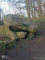
(13) Pass the ‘Dolmen la table des fées’, then carry on straight ahead

(14) turn right and carry on straight ahead to reach the car park.

(S/E) Return to Place du Jeu de Paume.

Waypoints

  1. S/E : mi 0 - alt. 541 ft - Jeu de Paume car park
  2. 1 : mi 0.26 - alt. 522 ft - Estrée footpath
  3. 2 : mi 0.87 - alt. 522 ft - Timbre junction
  4. 3 : mi 1.27 - alt. 538 ft - Fossé Ste-Marie
  5. 4 : mi 1.94 - alt. 525 ft - Crossroads
  6. 5 : mi 2.22 - alt. 509 ft - Rue du Calvaire
  7. 6 : mi 2.62 - alt. 528 ft - Rue de Alouette
  8. 7 : mi 2.83 - alt. 509 ft - Brunehaut Road
  9. 8 : mi 3.23 - alt. 518 ft - Junction
  10. 9 : mi 3.41 - alt. 522 ft - Dead end
  11. 10 : mi 4.12 - alt. 495 ft - first turn right then left
  12. 11 : mi 4.56 - alt. 407 ft - Turn right
  13. 12 : mi 5.09 - alt. 413 ft - Path - Église Notre-Dame (Fresnicourt-le-Dolmen)
  14. 13 : mi 5.38 - alt. 558 ft - La Table aux Fées (Fresnicourt)
  15. 14 : mi 6.25 - alt. 535 ft - Turn right
  16. S/E : mi 6.77 - alt. 541 ft - Jeu de Paume car park

Notes

Pas de point d'eau

Worth a visit

Reviews and comments

souchez rando
souchez rando

Thanks for the feedback – I’ll make the changes

Machine-translated

joorange
joorange

I took the opportunity during a walk in the area to try out the path between points 11 and 12, which I wasn’t familiar with.
And with good reason, as it isn’t a path at all, but a passageway through cultivated fields.
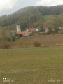
I quite liked it (lovely view of Fresnicourt) but I think it might be confusing for novice walkers. What’s more, as the weather warms up, the crops will start to grow and the path will no doubt become impassable.
I think it would be a good idea to point out that you can head straight into Fresnicourt by turning right at the junction after point 10.
Kind regards

Machine-translated

Other walks in the area

For more walks, use our search engine .

The GPS track and description are the property of this route's author. Please do not copy them without permission.