Les Ruelles from La Motte-Chalancon

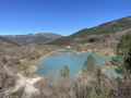
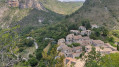
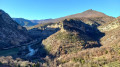
This long walk starting from La Motte-Chalancon offers a magnificent panoramic view of the village and the Oule valley. You’ll come across lavender fields, springs and streams, lambs, and more...

Details

13175920
Creation:
Last update:
Last review:
  • Walking
    Activity: Walking
  • ↔
    Distance: 10.08 mi
  • ◔
    Average duration: 7h 05 
  • ▲
    Difficulty: Difficult

  • ⚐
    Back to start: Yes
  • ↗
    Ascent: + 2,779 ft
  • ↘
    Descent: - 2,759 ft

  • ▲
    Highest point: 4,567 ft
  • ▼
    Lowest point: 1,808 ft

Description of the walk

Start from the Place de la Mairie or Place des Écoles.

(S/E) With your back to the car park, take the street on the right and, at Place de Aires, follow the D135 to the right.

(1) At the junction with a wayside cross, continue to the right onto the D614, towards Altiport.

(2) At the hamlet of Saint-Antoine, take the track suitable for vehicles, heading towards Altiport, and climb until you reach a fork on the plateau behind the Montagne de Motte Vieille.

(3) Ignore the path continuing to the left towards the altiport and carry on to the right. Follow the fields, then a hillside water reservoir, until you reach a cross-track.

(4) Turn right.

(5) A few metres after the left-hand bend and a platform, turn right onto the small path that climbs steeply up the slope to reach the Col de la Maure.

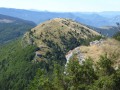
(6) Take in the view, then head down to the left into the oak forest and follow the ridge of the Montagne des Ruelles.

(7) When the ridge curves to the left, take the small grassy path that starts on the shoulder to the right and then veers left. The very overgrown path quickly turns into a track for vehicles. Continue to the junction with the track at the edge of the woodland.

(8) Turn sharply left towards Pas de Pousterlou. Pass it and, after thethird hairpin bend, you’ll reach a fork.

(9) Carry on straight ahead downhill.

(10) Carry on along the track, leaving the path on your right.

(11) At the road, turn left and head down the D614a. You’ll reach La Motte Chalencon and the Place de la Mairie (S/E).


Waypoints

  1. S/E : mi 0 - alt. 1,808 ft - Place de la Mairie or Place des Écoles
  2. 1 : mi 0.25 - alt. 1,827 ft - D614 road – towards Altiport
  3. 2 : mi 1.36 - alt. 2,218 ft - Saint-Antoine, towards Altiport
  4. 3 : mi 2 - alt. 2,657 ft - Arrival on the plateau
  5. 4 : mi 2.85 - alt. 3,094 ft - Altiport Trail
  6. 5 : mi 3.04 - alt. 3,222 ft - Path on the right
  7. 6 : mi 3.53 - alt. 3,806 ft - Col de la Maure
  8. 7 : mi 4.21 - alt. 4,537 ft - Crête des Ruelles
  9. 8 : mi 5.16 - alt. 4,058 ft - Path on the right
  10. 9 : mi 6.28 - alt. 3,655 ft - Forest track
  11. 10 : mi 7.34 - alt. 3,045 ft - Junction
  12. 11 : mi 8.45 - alt. 2,388 ft - D614a road
  13. S/E : mi 10.08 - alt. 1,808 ft - Place de la Mairie or Place des Écoles

Notes

(S/E) Plenty of car parks, a bakery and a convenience shop nearby for last-minute shopping.

(7) Alternative route:
You can continue along the ridge towards the Pas de Pousterlou (approx. –30 mins).

There are plenty of springs in Drôme Provençale, but it can get very hot and the elevation gain is significant, so be sure to bring extra water on top of your usual intake.
No special equipment required, though walking poles are very useful on the ridge.

Worth a visit

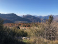
Beautiful views over the valley, with the little village of La Motte-Chalencon nestled around its church.

Reviews and comments

4.5 / 5
Based on 2 reviews

Reliability of the description
4 / 5
Ease of following the route
4.5 / 5
Route interest
5 / 5
Lau Deotto
Lau Deotto

Overall rating : 5 / 5

Date of your route : May 09, 2026
Reliability of the description : Not used / Not applicable
Ease of following the route : ★★★★★ Very good
Route interest : ★★★★★ Very good
Very busy route : No

A lovely hike – quite a challenge on the way up, and the final stretch along the ridges is simply stunning.
The first part of the descent to the Pas du Pousterlou is very pleasant; the rest (track and road) is more monotonous but allows for a quick descent.
A wonderful discovery! Thank you

Machine-translated

JODIDO
JODIDO
• Edited:

Overall rating : 4.3 / 5

Date of your route : Feb 02, 2025
Reliability of the description : ★★★★☆ Good
Ease of following the route : ★★★★☆ Good
Route interest : ★★★★★ Very good
Very busy route : No

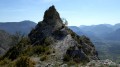
I really enjoyed this walk, which offered magnificent views of several peaks in the Dévoluy range (La Grande Tête de l’Obiou, the Grand Ferrand, the Roc and the Tête de Garnesier) from the Crête de la Montagne des Ruelles.
I encountered two issues with the route description. I took the direction signposted ‘altiport’ and followed a track. At one point, a sign pointed to the left, rather than to the right as mentioned in the directions.
I tried to work out why the altiport was actually on my right and not on my left as stated in the route description.
I’d probably got it wrong at point 3, as I headed towards the altiport instead of continuing to the right. And sure enough, I found myself a bit higher up than the route description suggested.
But this didn’t prove to be a problem, as by staying on this track I was able to climb up to the Col de la Maure via a small path branching off to the right. It was a fairly steep climb for a good half an hour!
I followed the ridges, but at one point I found myself walking on fresh snow with no footprints or tracks. And quite quickly, I also lost sight of the yellow markings, which were rather sparse anyway.
I really had no idea which way to go when I spotted a fairly large cairn. Despite the snow, I could tell the path was just beyond it because there was no vegetation on a sort of white strip. So I headed in that direction and soon found myself on a track with less and less snow. When I reached the junction where I could see a sheepfold on the right, I was reassured to know that I was indeed on the right route. I soon reached the Pas de Pousterlou and arrived at the fork (8 and 9). You mustn’t carry on straight ahead if you want to head back down via the Combe Bernard, but take the path on the right despite the Red Cross on a tree. If you carry on straight ahead, you’ll rejoin the route taken on the way up to point 4. Once at the Combe Bernard, you’ll soon reach the road and it’s another 3 kilometres to the village.
I was back at my car less than 6 hours after setting off on the walk, having taken a good half-hour’s break. 16 km and 850 metres of elevation gain.
The ‘difficult’ rating seems a bit of an exaggeration to me; ‘moderate’ would probably be more accurate...

Machine-translated

Other walks in the area

For more walks, use our search engine .

The GPS track and description are the property of this route's author. Please do not copy them without permission.