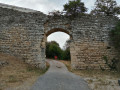
The four villages of Saint-Marcellin, Faucon, Entrechaux and Saint-Romain

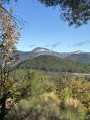
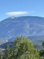
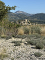
Winding through valleys and ravines, sometimes on the heights of Saint-Marcellin-lès-Vaison, sometimes deep within the forest, narrow paths will lead you to discover the beauty of this northern Provençal region, with magnificent views of Mont Ventoux.

Details

n°66633059
Creation:
Last update:
Last review:
  • Walking
    Activity: Walking
  • ↔
    Distance: 5.48 mi
  • ◔
    Average duration: 3h 35 
  • ▲
    Difficulty: Moderate

  • ⚐
    Back to start: Yes
  • ↗
    Ascent: + 1,207 ft
  • ↘
    Descent: - 1,220 ft

  • ▲
    Highest point: 1,460 ft
  • ▼
    Lowest point: 850 ft

Photos

Description of the walk

Park in the car park at the Salle des Fêtes in Saint-Romain-en-Viennois.

(S/E) Walk downhill, heading due south, keeping the football pitch on your right. Leave the tarmac and continue to the first junction.

(1) Take the path that climbs slightly to the right. Follow this narrow, stony path uphill.

(2) At the crossroads, take care: take the path leading uphill, straight ahead, keeping in the same direction. The climb is short but very steep.

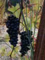
(3) As you emerge from the woodland, rejoin the forest track and follow the disused vineyard, keeping it on your right.

(4) Just before entering the forest, turn right. Continue alongside the vineyard, then head up into the woods via the path on the left. You’ll reach a junction of forest tracks.

(5) Stay on the narrow path on the left which runs alongside the forest track. Join the track further on and follow it.

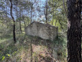
(6) Just before the cistern, leave the forest track and take the path on your left, then walk gently uphill to Darbousset.

(7) Turn left. Continue along the path, then onto a slightly wider track, until you reach the Chemin du Dévés.

(3) Turn right and stay on this wide track. Ignore two turnings on the left, then take a sharp right-hand bend.

(8) Look out for the path on the left, which you’ll take on the way back, and carry on straight ahead until you reach the Chemin d’Entrechaux.

(9) Cross this path to follow the wide track opposite.

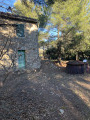
(10) 200 metres before the house, take the small path on the right, which climbs quite steeply through the forest, until you reach the olive grove at the edge of the woodland; go round it on the left until you reach the wide forest track. Carry on until you reach the junction with the Chemin d’Entrechaux.

(11) Head back down this small tarmac road to the right.

(9) Join the Chemin du Devès on the left.

(8) Turn right to head down past the vineyard on your left. Go round it on the left to find a small path under the trees. Follow this path until you reach the Y-junction at the start.

(1) Then turn right towards the Salle des Fêtes to return to the car park (S/E).

Waypoints

  1. S/E : mi 0 - alt. 863 ft - Car park at the community hall
  2. 1 : mi 0.28 - alt. 948 ft - Junction with the circular loop
  3. 2 : mi 0.61 - alt. 1,194 ft - Junction, go straight on
  4. 3 : mi 1.01 - alt. 1,404 ft - Forest track
  5. 4 : mi 1.19 - alt. 1,440 ft - Junction with the circular Darbousset loop
  6. 5 : mi 1.49 - alt. 1,293 ft - Crossing of forest tracks
  7. 6 : mi 1.89 - alt. 1,115 ft - Fire cistern
  8. 7 : mi 2.29 - alt. 1,371 ft - Le Darbousset, return via the left
  9. 8 : mi 3.49 - alt. 1,066 ft - Start of the trail / Return
  10. 9 : mi 3.64 - alt. 1,083 ft - Chemin d’Entrechaux
  11. 10 : mi 3.98 - alt. 1,217 ft - Provençal farmhouse
  12. 11 : mi 4.57 - alt. 1,181 ft - Chemin d’Entrechaux
  13. S/E : mi 5.48 - alt. 850 ft - Car park at the community hall

Notes

A very easy walk with no major risks. Can be done in trainers.

Worth a visit

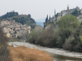
Lovely views of Mont Ventoux and the town of Vaison.

Reviews and comments

3.8 / 5
Based on 2 reviews

Reliability of the description
4 / 5
Ease of following the route
4 / 5
Route interest
3.5 / 5
Jacky Anx
Jacky Anx

Thank you for your feedback
I reckon the suitcases are made of clay 😂. It’s a shame about the little mistake
Kind regards

Machine-translated

Rando84
Rando84

Overall rating : 3.3 / 5

Date of your route : Jan 16, 2025
Reliability of the description : ★★★☆☆ Average
Ease of following the route : ★★★☆☆ Average
Route interest : ★★★★☆ Good
Very busy route : No

It got a bit messy towards the end; we had to turn back and eventually go back again, but rejoin the route via a different path. There was a lot of mud and grit stuck to our shoes the day we did it, so I wouldn’t recommend it in wet weather...

Machine-translated

Jacky Anx
Jacky Anx

Thank you for your feedback. Kind regards

Machine-translated

Rembotte
Rembotte

Overall rating : 4.3 / 5

Date of your route : Dec 02, 2024
Reliability of the description : ★★★★★ Very good
Ease of following the route : ★★★★★ Very good
Route interest : ★★★☆☆ Average
Very busy route : Yes

A very lovely route with some lovely views. But there’s a lot of undergrowth.
Nevertheless, I’d recommend this walk.
Well done, Gg

Machine-translated

Other walks in the area

For more walks, use our search engine .

The GPS track and description are the property of this route's author. Please do not copy them without permission.