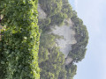
Between Saint-Romain and Puymeras

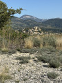
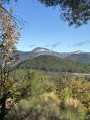
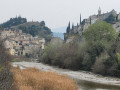
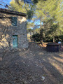
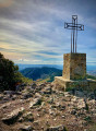
An easy walk beneath pine and holm oak trees, along very pleasant paths. A beautiful view of Puymeras and Mont Ventoux.

Details

65896562
Creation:
Last update:
Last review:
  • Walking
    Activity: Walking
  • ↔
    Distance: 4.23 mi
  • ◔
    Average duration: 2h 25 
  • ▲
    Difficulty: Easy

  • ⚐
    Back to start: Yes
  • ↗
    Ascent: + 584 ft
  • ↘
    Descent: - 584 ft

  • ▲
    Highest point: 1,378 ft
  • ▼
    Lowest point: 856 ft

Photos

Description of the walk

Park in the car park at the village hall in Saint-Romain-en-Viennois.

(S/E) Leave the tennis court on your right and head due south along the tarmac road. Take the narrow path on your left and continue until you reach the vineyard.

(1) Cross the vineyard and head up to the right until you reach Chemin du Dévés. Turn left onto this concrete road until you reach Chemin d’Entrechaux; cross it and take the wide path directly opposite.

(2) Take the narrow path on your right, just before the private property. Walk uphill along the edge of the forest, skirting the vineyard plots. Join the forest track and continue to the left.

(3) Take the path on the left and stay on it.

(4) Take the small path on your left. You’ll come to a small tarmac road.

(5) Follow it to the left and, at the end, carry on in the same direction along the track.

(6) Further on, you’ll come to a road; follow it straight ahead. Leave it at the entrance to Saint-Romain and take the forest path on your left. Join the path you took on the way there, at the vineyard plot.

(1) Follow the route back in the opposite direction to the car park at the village hall (S/E).

Waypoints

  1. S/E : mi 0 - alt. 856 ft - Village hall
  2. 1 : mi 0.42 - alt. 994 ft - Junction of the circular loop
  3. 2 : mi 1.11 - alt. 1,237 ft - Before the private property
  4. 3 : mi 1.47 - alt. 1,329 ft - A lovely path to the left
  5. 4 : mi 2.21 - alt. 1,306 ft - Path beneath the pine trees
  6. 5 : mi 2.86 - alt. 951 ft - Route
  7. 6 : mi 3.38 - alt. 965 ft - Route
  8. S/E : mi 4.23 - alt. 856 ft - Village hall

Notes

Easy walk suitable for all ages, IPB: 25

Worth a visit

Panoramic views of Mont Ventoux and the Drôme Provençale.

Reviews and comments

3.3 / 5
Based on 7 reviews

Reliability of the description
3.3 / 5
Ease of following the route
3.2 / 5
Route interest
3.4 / 5
User 29687558

Overall rating : 3.5 / 5

Date of your route : Jun 15, 2026
Reliability of the description : ★★★☆☆ Average
Ease of following the route : Not used / Not applicable
Route interest : ★★★★☆ Good
Very busy route : No

After 300 metres, turn back to look for the paths marked on the map. After an hour, head back to the starting point, as the route is very poorly described in the guide.

Machine-translated

User 28470987

Overall rating : 2 / 5

Date of your route : Feb 06, 2026
Reliability of the description : ★★☆☆☆ Disappointing
Ease of following the route : ★★☆☆☆ Disappointing
Route interest : ★★☆☆☆ Disappointing
Very busy route : No

I can confirm that before the private property (small sign), two dogs, including an aggressive Patou, are waiting for you!
After that, it's the "total zone", the tracks are ruined by forestry work, impassable, impossible to find your way without GPS! First and last hike for me with Visorando.

Machine-translated

User 22952885

Overall rating : 2.7 / 5

Date of your route : Oct 29, 2025
Reliability of the description : ★★☆☆☆ Disappointing
Ease of following the route : ★★★★☆ Good
Route interest : ★★☆☆☆ Disappointing
Very busy route : No

I do not recommend this route in its current state:
- just before point 1: you pass below a house where a wolfdog (German Shepherd type) barks loudly and is NOT tied up or locked up; the dog is hostile. However, it is normal for this dog not to be tied up as it is "at home" and defending its territory. Nevertheless, this is frightening and this point alone is enough to avoid this route in its current state;
- Stage 2: arrival at a plot of land marked as private (photo available on request). In accordance with this, the route ends here.
Nice scenery, but disappointing.

Machine-translated

Much
Much

Overall rating : 3.3 / 5

Date of your route : Aug 30, 2025
Reliability of the description : ★★★☆☆ Average
Ease of following the route : ★★☆☆☆ Disappointing
Route interest : ★★★★★ Very good
Very busy route : No

Lovely walk in the forest.
The route map lacks precision. The description at each point is (in my opinion) not precise enough. The GPS track lacks precision, which is a shame.
The walk in the woods is very pleasant, but be careful in autumn as it is a hunting ground.

Machine-translated

sassoi
sassoi

Overall rating : 4.3 / 5

Date of your route : Jun 28, 2025
Reliability of the description : ★★★★★ Very good
Ease of following the route : ★★★★☆ Good
Route interest : ★★★★☆ Good
Very busy route : No

A pleasant walk with beautiful views of the surrounding area and a magnificent view of Mont Ventoux. A peaceful route through woods, paths and vineyards.

Machine-translated

elise.pasquier@sfr
elise.pasquier@sfr

Overall rating : 4.3 / 5

Date of your route : May 05, 2025
Reliability of the description : ★★★★★ Very good
Ease of following the route : ★★★★☆ Good
Route interest : ★★★★☆ Good
Very busy route : No

It’s a lovely walk to start with, but then you come to a stretch of burnt land. Otherwise, it’s quite shady.

Machine-translated

astro64
astro64

Overall rating : 3 / 5

Date of your route : Jan 10, 2025
Reliability of the description : ★★★☆☆ Average
Ease of following the route : ★★★☆☆ Average
Route interest : ★★★☆☆ Average
Very busy route : No

Between points 1 and 2: “until you reach the Chemin d’Entrechaux, cross it and take the wide path directly opposite”
We couldn’t see anything opposite, so we went back down and retraced our steps along the route in the opposite direction. On the way back, we realised we had to walk 50 metres back up the road to take the path on the left. The route is mostly through pine forest with few views.

Machine-translated

Other walks in the area

For more walks, use our search engine .

The GPS track and description are the property of this route's author. Please do not copy them without permission.