Les Ordons and the Bourignon hut

A short but attractive walk on the Ordons plateau with lovely views of the Alps and the Swiss and Alsatian Jura.

Details

28413858
Creation:
Last update:
Last review:
  • Walking
    Activity: Walking
  • ↔
    Distance: 5.05 mi
  • ◔
    Average duration: 3h 00 
  • ▲
    Difficulty: Easy

  • ⚐
    Back to start: Yes
  • ↗
    Ascent: + 781 ft
  • ↘
    Descent: - 758 ft

  • ▲
    Highest point: 3,255 ft
  • ▼
    Lowest point: 2,795 ft

Photos

Description of the walk

Two kilometres past the village of Bourrignon, heading towards Develier, take the track on the right opposite the Ferme de la Ventelière (bus shelter). Park in the small car park on the left.

(S/E) Take the tarmac path on the left and continue to the Ferme des Côtes.

(1) Walk past this farm on the left and continue along the track, heading towards the mast.

(2) At the Y-junction, take the path on the left and head for the Col des Rangiers (farm and restaurant).

(3) Turn right onto the path that runs between the buildings and climbs towards the houses higher up. Then take the path on the right that climbs to the Cabane des Ordons, skirt the forest on the right and then enter it via the hikers’ access point. Follow the path to the Suisse Romande television and radio mast at Les Ordons (995 m).

(4) Go round it on the right using the footpath for walkers and continue along the signposted path to reach the Cabane des Cerneux: a shelter with tables and benches, open all year round.

(5) Continue up the path to rejoin the tarmac access road to Les Ordons, which you follow to the left, in the opposite direction to your outward journey.

(2) Carry on straight ahead, pass the Ferme des Côtes once more and return to the car park (S/E).

.

Waypoints

  1. S/E : mi 0 - alt. 2,808 ft - La Ventolière car park
  2. 1 : mi 0.96 - alt. 2,940 ft - Les Côtes
  3. 2 : mi 1.21 - alt. 2,992 ft - Y-junction
  4. 3 : mi 2.26 - alt. 2,795 ft - Col des Rangiers (856m)
  5. 4 : mi 3.04 - alt. 3,245 ft - Les Ordons, Suisse Romande TV and radio transmission mast
  6. 5 : mi 3.49 - alt. 2,972 ft - Cerneux hut
  7. S/E : mi 5.05 - alt. 2,812 ft - La Ventolière car park

Worth a visit

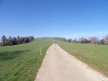
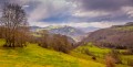
There are lovely views of the Swiss Jura and the Alps in good weather between the car park and the farm on the left.
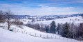
From the Cerneux hut, there are views of the village of Bourrignon and the Jura ridges of the Sundgau. The hut is open to passing walkers; please ensure it is left tidy before leaving.

Reviews and comments

4.3 / 5
Based on 2 reviews

Reliability of the description
4.5 / 5
Ease of following the route
4.5 / 5
Route interest
4 / 5
User 27132752

Overall rating : 4 / 5

Date of your route : Aug 25, 2025
Reliability of the description : ★★★★☆ Good
Ease of following the route : ★★★★☆ Good
Route interest : ★★★★☆ Good
Very busy route : Yes

A beautiful walk through forests and plains.
Some beautiful spots and a superb refuge where you can stop for a picnic in peace.

Hiking in Switzerland is really the best and a step above what you find in France (signposting, welcome, safety)

Machine-translated

phil.pseudo
phil.pseudo

Overall rating : 4.7 / 5

Date of your route : Feb 10, 2025
Reliability of the description : ★★★★★ Very good
Ease of following the route : ★★★★★ Very good
Route interest : ★★★★☆ Good
Very busy route : No

A very enjoyable and varied walk. Not particularly difficult, though there is a steep but short climb to reach the Ordons transmission mast from Rangiers.
Beautiful views all along the walk.

Machine-translated

Other walks in the area

For more walks, use our search engine .

The GPS track and description are the property of this route's author. Please do not copy them without permission.