The Monts d’Aubrac from Saint-Gêniez-d’Olt

ThisPR® route starts from Saint-Gêniez-d’Olt; it has one foot in the Lot and its head in the sky, as it climbs all the way to the Croix de la Rode, 1,000 metres higher up. La Croix de la Rode is both the highest point and a junction, allowing you either to descend via Aurelle or to take theGR® de Pays du Tour des Monts d’Aubrac. It is also possible to continue along the Way of St James, to reach the Refuge des Rajas or the village of Aubrac.

Details

n°462022
Creation:
Last update:
Last review:
  • Walking
    Activity: Walking
  • ↔
    Distance: 11.61 mi
  • ◔
    Average duration: 8h 20 
  • ▲
    Difficulty: Difficult

  • ⚐
    Back to start: No
  • ↗
    Ascent: + 3,442 ft
  • ↘
    Descent: - 312 ft

  • ▲
    Highest point: 4,610 ft
  • ▼
    Lowest point: 1,375 ft

Photos

Description of the walk

Park near the Tourist Office, in the Place de la Mairie car park.

(S) On leaving the cloister, turn left onto Rue de l’Hôtel de Ville and cross the Lot via the old bridge.

(1) Turn right and follow the D503 to the Chapelle des Buis; below this, take the D95, pass Boralde Saint-Pierre and continue to the hairpin bend.

(2) Take the dirt track opposite until you rejoin the D95, then leave it.

(3) Turn left onto the track leading to Vigne Neuve. Leave this track on the left and take the one heading towards Minié Haut. Carry on until you reach Bénézèches.

(4) Turn left onto the track that runs alongside the Boralde, then veers eastwards and becomes steep; continue on to Les Rescostes.

(5) Turn left and head uphill towards Le Cros, heading west; in the middle of the hamlet, turn right and continue to Naves-d’Aubrac.

(6) Walk through the old village; on leaving, take the track on the left and continue to the junction with the D95, passing beneath the summit of the Puech de Bouissou.

(7) Turn left towards the north as far as Les Cats.

(8) Take the path opposite and begin the ascent until you meet theGR®6.

(9) Turn left onto theGR® and continue climbing northwards on theGR®6. Carry on until you cross theGR®60, which is shared with theGRP® Tour des Monts d’Aubrac. Continue along theGR®6to quickly reach the Croix de Rode (E).

Waypoints

  1. S : mi 0 - alt. 1,407 ft - Car park at Place de la Mairie
  2. 1 : mi 0.14 - alt. 1,375 ft - Old bridge
  3. 2 : mi 1.2 - alt. 1,463 ft - Take the dirt track opposite
  4. 3 : mi 1.79 - alt. 1,818 ft - Turn left
  5. 4 : mi 3.17 - alt. 1,900 ft - Turn left
  6. 5 : mi 4.34 - alt. 2,421 ft - At Les Rescotes, take the small path to the left
  7. 6 : mi 5.27 - alt. 3,189 ft - The village of Naves
  8. 7 : mi 6.45 - alt. 3,458 ft - Junction with the departmental road, head north
  9. 8 : mi 8.03 - alt. 3,711 ft - At Les Cats, head straight ahead
  10. 9 : mi 9.72 - alt. 4,419 ft - Continue left towards the north.
  11. E : mi 11.61 - alt. 4,508 ft - Croix de Rode, or return via Aurelle

Notes

Make sure you have enough drinking water for the entire duration of the hike.
A good waterproof jacket and a warm jumper, plus a hat in summer.
Good walking boots.
A walking stick and provisions.
You’ll find shelters at Naves, Les Cats and the Rajas Refuge.
FFRP signposting.

Note: To complete this as a day trip, you’ll need to plan your return journey, for example by leaving a second car at La Croix de Rode.
However, if you’re doing a two-day trip, you can stay overnight at the Refuge des Rajas and return the following day via the route: From the Monts d’Aubrac to the Lot via Aurelle

Worth a visit

The old village of Naves (in Aubrac) is very typical of the villages of the Haut Rouergue and is well preserved. Restoration work on the former nuns’ convent – one of the village’s centrepieces – is still to be completed. At the foot of the village, a house with the air of a country manor adds a striking and unexpected touch. Four kilometres further on, you’ll pass the hamlet of Les Cats, consisting of two large farms where the Aubrac breed is reared.
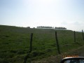
Here begins a 3-kilometre climb, and as you go, the panorama widens from east to west until it becomes absolutely sublime. We are now in the land of high pastures and wind. The ‘montagnes’ are the names given to the vast grassy expanses. In days gone by, the burons were in use; this was the land of the buronniers and shepherds.
Naturally, the abundance of wildflowers in May, June and July is dazzling; it’s impossible not to spot the star of the show here: the Aubrac cow with its eyes lined with kohl. The path levels out almost completely; we pass through a Scots pine forest and finally come upon a vast horizon and the Croix de la Rode. Erected in 1377, it marks the boundaries of the Barony of Aurelle, between the lands of the Dom d’Aubrac and the Marquis de Canilhac. Of particular note on one of its sides is a very expressive Virgin and Child...

Always be cautious and plan ahead when you're outdoors. Visorando and the author of this route cannot be held responsible for any accidents occurring on this route.

The GR® and PR® markings are the intellectual property of the Fédération Française de Randonnée Pédestre.

Reviews and comments

4.7 / 5
Based on 1 review

Reliability of the description
5 / 5
Ease of following the route
4 / 5
Route interest
5 / 5
brousse
brousse

I’m glad you enjoyed this PR… It reinforces my commitment to my role as a trail marker and also reaffirms my belief in the value and potential of this region for hiking. Thank you.
Pierre

Machine-translated

benoit123
benoit123

Overall rating : 4.7 / 5

Date of your route : May 22, 2017
Reliability of the description : ★★★★★ Very good
Ease of following the route : ★★★★☆ Good
Route interest : ★★★★★ Very good

There are some lovely walks to enjoy in this area.
The routes are usually very well marked.

Machine-translated

Other walks in the area

For more walks, use our search engine .

The GPS track and description are the property of this route's author. Please do not copy them without permission.