Le Puech del Rey

This is an educational walk organised by two classes and their teachers, with the involvement of the Aveyron Departmental Hiking Committee and local authorities. It is also suitable for families.
Private property (3); see the notice dated 1 September 2023 for an alternative route

Details

465163
Creation:
Last update:
Last review:
  • Walking
    Activity: Walking
  • ↔
    Distance: 3.35 mi
  • ◔
    Average duration: 2h 10 
  • ▲
    Difficulty: Easy

  • ⚐
    Back to start: Yes
  • ↗
    Ascent: + 692 ft
  • ↘
    Descent: - 699 ft

  • ▲
    Highest point: 2,087 ft
  • ▼
    Lowest point: 1,375 ft

Description of the walk

Starting point: Tourist Office – Car park: Place de l’Hôtel de Ville.

(S/E) On leaving the cloister, turn left into Rue de l’Hôtel de Ville and cross the River Lot via the Old Bridge.

(1) Turn right, then left onto Rue de la Poujade. Walk past the Saint-Antoine Chapel.

(2) Just after the chapel, take the path leading uphill to the left. Cross the small road and continue straight ahead along the path. The path runs alongside old vineyards or strawberry fields before entering the woodland.

(3) At a bend just before the hamlet of Le Batut, leave the wide path and take the path on the left (15° gradient). Follow the path overlooking Saint-Geniez as it winds round the Pic du Roy hill. Walk through the forest of oak and chestnut trees.

(4) Leave the path and take the wide track to the left. Continue along this track as it winds its way down to the Ruisseau du Barribès.

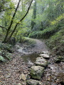
(5) Cross the stream via the small wooden bridge (be careful, it’s slippery). Follow the path to the left which runs alongside the stream.

(6) Cross the stream via the second bridge and carry on to cross a third bridge. Continue to the first houses and head down Rue du Barribès, which runs alongside the stream. As you leave the neighbourhood, turn left, passing the parish church.

(1) Cross the Lot again via the Vieux Pont and walk up Rue de l’Hôtel de Ville to the cloister (S/E).


Waypoints

  1. S/E : mi 0 - alt. 1,407 ft - Town Hall Square
  2. 1 : mi 0.12 - alt. 1,391 ft - Vieux Pont
  3. 2 : mi 0.44 - alt. 1,486 ft - Path leading uphill to the left
  4. 3 : mi 1.3 - alt. 2,018 ft - Take care, turn left
  5. 4 : mi 1.8 - alt. 1,870 ft - Wide path on the left
  6. 5 : mi 2.07 - alt. 1,614 ft - Bridge over the Ruisseau du Barribès
  7. 6 : mi 2.6 - alt. 1,509 ft - Second bridge
  8. S/E : mi 3.35 - alt. 1,407 ft - Town Hall Square

Notes

- Take some water with you.
- Make sure you wear suitable footwear.
- Avoid this walk during periods of heavy rain, as the footbridges over the Barribés will be slippery.
- Signposting: FFRP.

The Year 7 and Year 8 pupils on the creative hiking module at Denys Puech Secondary School, together with their teachers, would like to thank everyone who contributed to the success of this project, in particular the members of the Aveyron Departmental Hiking Committee and the Rand’Olt association, the team at Denys Puech Secondary School, the municipality of Saint-Gêniez, and all the financial partners.

Worth a visit

- the Talabot Monument
- Saint-Antoine Chapel
- The Augustinian Chapel and Cloister
- The old Barribès quarter
- The parish church of Saint-Gêniez

Further information available from the Tourist Office
Le Cloître, 12130 Saint-Gêniez-d’Olt-et-d’Aubrac

Reviews and comments

3.3 / 5
Based on 7 reviews

Reliability of the description
3.1 / 5
Ease of following the route
2.5 / 5
Route interest
4.2 / 5
ANDYLAYEN
ANDYLAYEN
• Edited:

A family walk with a baby, a three-and-a-half-year-old and two teenagers. It is indeed a bit steep at the start, but the route is lovely and offers some beautiful views. The path is shaded and there’s no more fallen timber on the route – just a few stones on the climb after the chapel. As for parking, there’s a car park just before the bridge further down, which is easier to use, though that doesn’t stop you from taking a stroll across the bridge just above it and then continuing the walk.

Machine-translated

ALICE MARIE
ALICE MARIE

Overall rating : 3.7 / 5

Date of your route : Apr 17, 2024
Reliability of the description : ★★★★☆ Good
Ease of following the route : ★★★☆☆ Average
Route interest : ★★★★☆ Good
Very busy route : No

A very lovely route, though unfortunately badly damaged by tree-felling machinery at the start of the descent. The path is damaged and debris from shredded branches makes progress difficult on this very steep section.
Not recommended for families, the elderly or those with no hiking experience.

Machine-translated

DELION Alain
DELION Alain

Overall rating : 2.7 / 5

Date of your route : Sep 01, 2023
Reliability of the description : ★★☆☆☆ Disappointing
Ease of following the route : ★★☆☆☆ Disappointing
Route interest : ★★★★☆ Good
Very busy route : No

Please note: at point 3, it is a private road. You must therefore take the path on the left at Castagnal d’Albin.

Machine-translated

jeanmarie.chopin
jeanmarie.chopin

Overall rating : 1 / 5

Date of your route : Oct 24, 2020
Reliability of the description : ★☆☆☆☆ Very disappointing
Ease of following the route : Not used / Not applicable
Route interest : Not used / Not applicable
Very busy route : No

It needs to be made much clearer that the “little bridge” (at point 5) consists of a narrow plank sloping at an angle of at least 20° (which becomes very slippery as soon as there are traces of damp – we are in the woods, after all!!!).
Having set out on this walk with children – who are, mind you, well used to walking – crossing the bridge proved far too dangerous.
The ‘Easy’ rating for this route is certainly inappropriate and could easily lead to confusion!
Fortunately, having set off in the opposite direction to that described (deliberately, as I was worried about this difficulty at point 5 and didn’t want to find myself stuck with the children at the bottom of the descent at point 5), I was very pleased to continue our walk – albeit a shorter one – along the Barribès fitness trail.

Machine-translated

henri57
henri57 ★

Hello,

Thank you for taking the time to give your feedback.

For your information, ‘Route on map’ refers to assessing whether the route as shown on the map corresponds to the actual terrain.

Did the route cause any problems?
Did you follow the route using a GPS device or a GPS app?
Did you find any discrepancies with the route of the walk?

Kind regards

Machine-translated

voyageur1243
voyageur1243

Overall rating : 4 / 5

Date of your route : Dec 16, 2019
Reliability of the description : ★★★★★ Very good
Ease of following the route : ★★★☆☆ Average
Route interest : ★★★★☆ Good

A route of moderate difficulty; take care on the footbridges if they are wet:

Machine-translated

gazok54
gazok54 ★

Thank you, Brousse, for your reply.
Gite&Xavier: Visorando has adopted a policy of avoiding references to signposted routes as much as possible. To achieve this, we provide route descriptions accompanied by a GPX track, which allows you to hike without getting lost. This approach enables you to venture off the beaten track.
Marked trails, on the other hand, are listed in guidebooks which you’ll find at tourist information centres.
In the meantime, thank you for your suggestions

Machine-translated

brousse
brousse

I am the “mapper” and “digitiser” for this walk on Visorando; the problem is that on the IGN map, as on the cadastral map, the correct path does not appear. Using a GPS app, we’d need to take on-site measurements from the marker signposted “Chemin du Puech du Roy” and merge them with the existing route, removing the incorrect one…
I don’t have a GPS app, so I’m asking for the help of a Visorando user who has such an app to assist me with this task. The FFRP-style signposting, which I updated last winter, is, I believe, correct…
However, I remain at your disposal…

Please note that 180 km of walking routes are open, maintained and signposted by the FFRD in Saint-Gêniez-d’Olt and Aubrac…

Brousse

Machine-translated

Gite&Xavier
Gite&Xavier

Overall rating : 3.3 / 5

Date of your route : Oct 01, 2017
Reliability of the description : ★★★☆☆ Average
Ease of following the route : ★★★☆☆ Average
Route interest : ★★★★☆ Good

Hello
There are several discrepancies between the route description and the route shown on the map:
At point 3: the description states: “At a bend just before the place known as Le Batut”. “Just before” isn’t precise enough; moreover, if it’s before, how are we supposed to know? Before reaching Le Batut. There is indeed a path which turns left, with a sign indicating “Le Puech del Rey”, and heading towards Le Batut, it is signposted “Chapelle d’Aurelle”.
If in doubt, carry on to Le Batut (600m) and then turn back to rejoin this path which climbs, then continues along a ledge, before climbing again at the end.
At point 4: OK, you do take a path on the left, but it should be made clear that there’s one that goes to the right and one that continues straight on. From the description, one might have thought there was only one path to the left, especially as shortly afterwards, on the descent (200 m), there is also a wide path that turns left and goes downhill but leads nowhere… (we checked). If in doubt, it might be worth specifying that you should follow the yellow markings, which are indicated at this junction.
Despite these possible errors, they do not have a serious impact on the duration of the walk; even if you take a wrong turn, it’s barely 15 minutes longer.
It’s worth noting that this path is well signposted, so why not provide directions based on the signposting? There’s a yellow trail, a mountain bike trail and signposts.
Enjoy your hike!!

Machine-translated

Bru-bru
Bru-bru

No, no other issues.
With this information, you can choose your route:
- either the one shown on the map, avoiding the first path on the left signposted for the Pic du Roy
- or by taking that first path and going round the peak to the south (a slightly longer route)

Machine-translated

bibi
bibi ★

Thank you for clarifying that. Have you encountered any other issues regarding the description or the route on the map?
Kind regards

Machine-translated

Bru-bru
Bru-bru

Overall rating : 3.3 / 5

Date of your route : Jun 20, 2017
Reliability of the description : ★★★☆☆ Average
Ease of following the route : ★★★☆☆ Average
Route interest : ★★★★☆ Good

Please note: before you reach the hamlet of “Le Batut” shown on the map, there are two paths on the left.
If you wish to follow the route shown on the map, do not take the first one (it is not marked on the map).
There is, however, a lovely little sign pointing towards the Pic du Roy.
This path skirts the summit to the south; fortunately, it eventually rejoins the route at point 631.

Machine-translated

1pantoufle
1pantoufle

Hello
So we’ll need to amend the route on the map as people are getting it wrong
Kind regards

Machine-translated

bibi
bibi ★

Thank you for your message, but actually I don’t think this is necessarily the ‘official’ route around the Puech del Rey; however, the suggested route does indeed take you all the way round it...
Kind regards

Machine-translated

1pantoufle
1pantoufle

Hello, point 3 isn’t in the right place on the map. To go round the Puech, you shouldn’t go up to the Batut
but take the path further down, which is near the Castagnal d’Albin. The description is correct, but the route on the map isn’t (the route on the map doesn’t go round the Puech and doesn’t overlook St Geniez).
Kind regards

Machine-translated

Other walks in the area

For more walks, use our search engine .

The GPS track and description are the property of this route's author. Please do not copy them without permission.